2
Using the map view
1
2
8
9
10
11
12
13
14
15
16
6
4
3
7
5
1
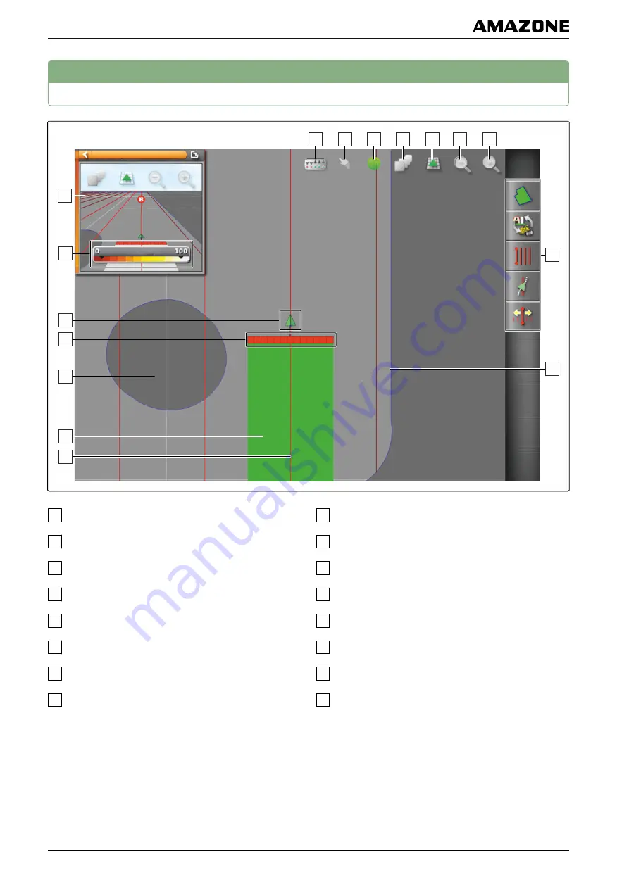
Miniature view of the map view
2
Configure coverage map
3
Vehicle symbol
4
Implement symbol
5
Exclusion area (dark grey)
6
Worked area (coverage), (green)
7
Track line (red)
8
Display virtual section switch
9
Confirm selection
10
Vehicle focus
11
Configure map layers
12
changing the perspective
13
Reduce map section
14
Enlarge map section
15
Job menu
16
Boundary line (blue)
In the map view, all of the data that is required for
working a field is created and saved through the job
menu. A symbol for the vehicle and a symbol for the
connected implement are shown on the map in the map
view.
002422
G | Using the operating menu | Using the map view
MG5574-
EN
-II | B.1 | 25.10.2016
102


