EFD1000 E5 Dual Electronic Flight Instrument (EFI) Install Manual
DOCUMENT # 900-00041-001
PAGE 155-226
REVISION D
© Copyright 2019 Aspen Avionics Inc.
Obtaining Vertical Component (Z) for your location
The first step will require navigating to the NOAA website and entering the
geographical location of the aircraft. Enter the following link in your Internet browser:
http://www.ngdc.noaa.gov/geomag-web/#igrfwmm
Either enter your Zip code and click on “Get Location” or select a country and city from
the drop down menus. Your known Lat/Long may also be entered. Once your closest
geographical area is found the Lat/Long will pre-fill to the right. Leave the date fields
as pre-filled (today’s date) and then click on “Compute Magnetic Field Values” near the
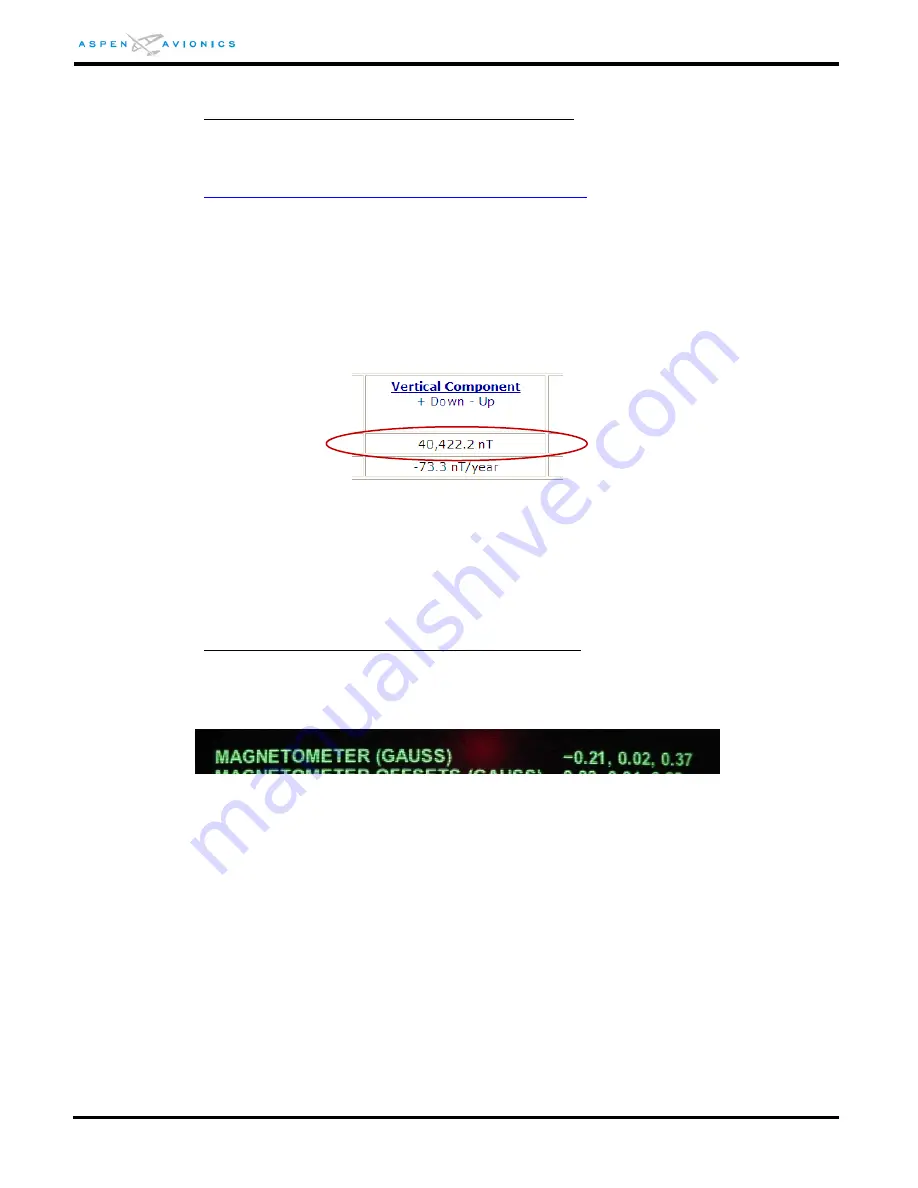
bottom center of the screen. Under the column “Vertical Component” copy this value
in nT (nanotesla) to the top box of Table 10-3.
Figure 10-8: nT Example
This value must be converted by moving the decimal point over 5 places to the left.
For example a value of 40,422.2nT will become .40 after the decimal is moved five
places to the left and the 0.004222 is discarded. This value (Z1) will be compared to
the Vertical Component on the EFD1000 E5 Diagnostic Page in the installation menu.
Obtaining Vertical Component (Z) from EFD1000 E5
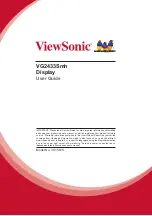
Enter the EFD1000 E5 installation menu and navigate to the last menu page. On the
Diagnostic Page locate the MAGNETOMETER (GAUSS) row and note the third value in
the row. Copy this value to the Z2 box in Table 10-3 (example value is .37).
Figure 10-9: EFD1000 Diagnostic Page Magnetometer Row Example
If the pitch angle of the RSM to the horizon (with aircraft sitting on the landing gear) is
less than 5 degrees then the “Z” value can be read directly and compared to the NOAA
number above. If the RSM is tilted more than 5 degrees to the horizon then the
averaging of two values to come up with a “Z” for comparison will be required. To
average two readings the aircraft should be positioned facing north (±20 degrees) and
a Z value recorded and then with the aircraft positioned exactly 180 degrees from the
northern heading the Z value is recorded. Add these two numbers together and then
divide by 2 to get the average “Z” value. Enter this value in the Z2 box of Table 10-3.
Now add and subtract 0.1 from Z1 to come up with a Z3 and Z4 range limit.
If Z2 falls between the Z3 and Z4 limits then the RSM location and magnetic signature
is acceptable for your geographic location and a RSM Calibration can proceed.


