background image

F

268

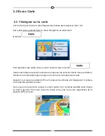
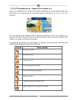
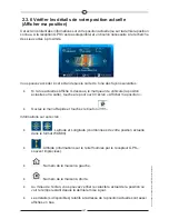
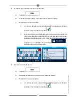
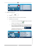
Vous pouvez aussi accomplir quelques actions sur cet écran :

Touchez 

 pour enregistrer la position actuelle comme destination 

favorite.

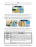
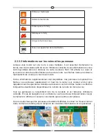
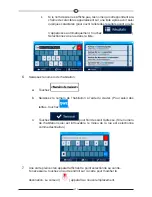
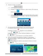
Vous  pouvez  également  rechercher  une  assistance  près  de  votre  position  actuelle. 

Touchez 

  pour  ouvrir  un  nouvel  écran  afin  d’effectuer  une 

recherche rapide :


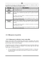
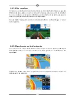
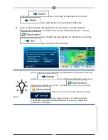
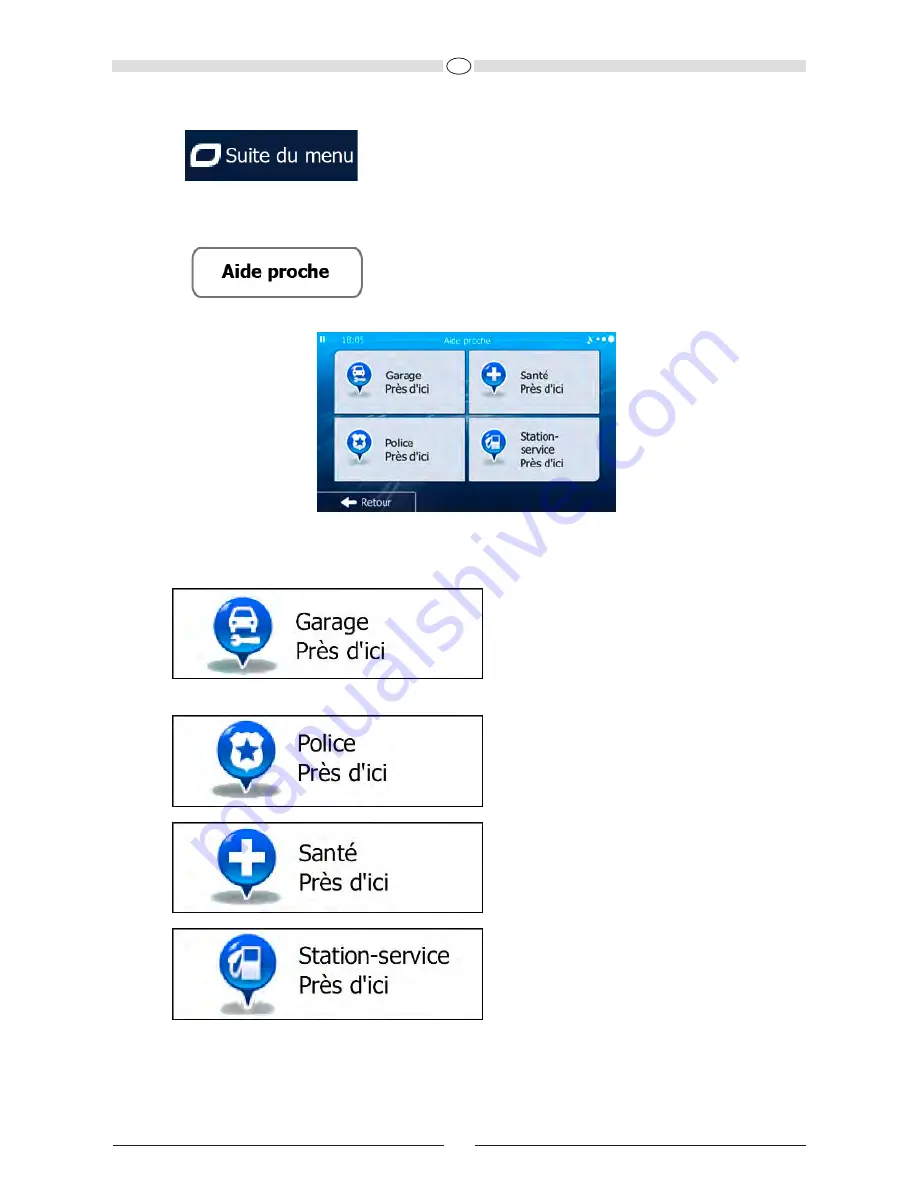
Vous pouvez rechercher les services suivants près de votre position actuelle ou près de 

la dernière position connue :

• 

 : Garage et services d’assistance   


routière

• 

 : Commissariat de police

• 

 : Services d’urgence et médicaux

• 

 : Station-service

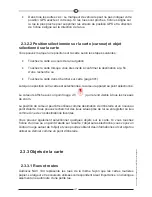
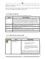
Touchez l’un des boutons, sélectionnez un lieu à partir de la liste et naviguez 

vers ce dernier.

Summary of Contents for NAV 104

Page 1: ...NAV 104 Bedienungsanleitung...

Page 2: ...x NAV 104 sofort in Betrieb nehmen Dieses Dokument enth lt eine ausf hrliche Beschreibung der Navigationssoftware Obwohl Sie sich mit dem NAV 104 leicht w hrend des Gebrauchs vertraut machen k nnen em...

Page 3: ...igungsvorschau und n chste Stra e 17 2 3 3 3 Spurdaten und Verkehrsschilder 18 2 3 3 4 Kreuzungs bersicht 19 2 3 3 5 Tankstellen und Rastst tten bei Autobahnabfahrten 19 2 3 3 6 Arten von 3D Objekten...

Page 4: ...en 68 3 3 Die Routenparameter berpr fen und auf routenbezogene Funktionen zugreifen 68 3 4 Die Route ndern 70 3 4 1 Neues Ziel bei vorhandener Route w hlen neue Route Wegpunkt 70 oder endg ltiges Ziel...

Page 5: ...f r den Ladezustand und die Qualit t der GPS Position 99 5 1 9 Verkehrsinformationen bei der Routenplanung 100 5 1 9 1 Fr here Verkehrsdaten 100 5 2 Men Mehr 101 5 3 Einstellungsmen 102 5 3 1 Audio u...

Page 6: ...Wenn Sie Ihre Meinung sp ter ndern k nnen Sie die Protokollspeicherung jederzeit in den Einstellungen Seite 118 aktivieren bzw deaktivieren Bitte schauen Sie nur dann auf das Display wenn es die Verke...

Page 7: ...artet Gehen Sie wie folgt vor 1 W hlen Sie die gew nschte Sprache f r die Benutzeroberfl che Diese Auswahl k nnen Sie sp ter in den regionalen Einstellungen Seite 117 ndern 2 Lesen Sie den Endbenutzer...

Page 8: ...swahl k nnen Sie sp ter unter Audio und Warnungen Seite 117 ndern 6 ndern Sie gegebenenfalls das Zeitformat und die verwendeten Einheiten Diese Auswahl k nnen Sie sp ter in den regionalen Einstellunge...

Page 9: ...Dar ber hinaus k nnen Sie routenbezogene Aktionen durchf hren z B Ihre Route bearbeiten oder l schen einen Ausgangspunkt festlegen eine alternative Route w hlen bestimmte Routenabschnitte ausschlie e...

Page 10: ...nur best tigen wenn die Anwendung neu gestartet oder eine umfangreiche Neukonfiguration durchgef hrt werden muss Eine Best tigung ist auch erforderlich bevor Daten oder Einstellungen von Ihnen gel sch...

Page 11: ...en verwenden Sie m ssen Buchstaben und Zahlen nur eingeben wenn es unbedingt erforderlich ist Sie k nnen mit Ihren Fingern auf den Vollbildtastaturen tippen und zwischen verschiedenen Tastaturlayouts...

Page 12: ...ntippen des Bildschirms Normalerweise m ssen Sie den Touchscreen immer nur einmal ber hren Einige n tzliche Funktionen k nnen allerdings nur mit einer Kombination von Fingerbewegungen aufgerufen werde...

Page 13: ...diese Miniaturkarte zu vergr ern und die Kartenanzeige zu ffnen Auf dieser Karte sind die aktuelle Position der Pkw Zeiger standardm ig ein roter Pfeil die empfohlene Route eine orangefarbene Linie un...

Page 14: ...nur ein Datenfeld angezeigt Tippen Sie auf dieses Feld um alle Routendatenfelder zu sehen Tippen Sie auf ein Datenfeld um die anderen auszublenden und nur das gew hlte Feld anzuzeigen Diese Datenfeld...

Page 15: ...ndern Die genaue Position des Pkw Zeigers h ngt vom bei der Routenberechnung verwendeten Fahrzeugtyp und dem Navigationsmodus ab Beide k nnen in den Routeneinstellungen Seite 107 festgelegt werden Be...

Page 16: ...igt der bei jedem Ma stab gut sichtbar ist Sie k nnen die Cursorposition als Routenziel oder neuen Warnpunkt verwenden nach Sonderzielen in der N he suchen oder sie in den Favoriten speichern Auch ein...

Page 17: ...e gedruckte Stra enkarten aus Aus ihrer Farbe und Breite k nnen Sie schlie en wie wichtig die Stra e ist Dadurch k nnen Sie ganz leicht eine Autobahn von einer kleineren Stra e unterscheiden 2 3 3 2 A...

Page 18: ...en empfangen werden 18 Im Kreisverkehr links abbiegen 3 Ausfahrt Auf die Autobahn auffahren Die Autobahn verlassen Auf die F hre auffahren Von der F hre abfahren Ein Wegpunkt naht Ihr Ziel naht 2 3 3...

Page 19: ...vorhanden werden unter Umst nden auch Verkehrsschilder angezeigt Um die derzeit angezeigte Kreuzung auszublenden und zur Kartenanzeige zur ckzukehren tippen Sie einfach auf das Bild 2 3 3 5 Tankstell...

Page 20: ...n Sonderzielen bei Autobahnabfahrten sehen m chten k nnen Sie die Symbole in den Einstellungen f r die visuellen Anweisungen Seite 115 ndern 2 3 3 6 Arten von 3D Objekten Audiovox NAV 104 unterst tzt...

Page 21: ...on an einer beliebigen Stelle in die Karte um sie genauer zu betrachten Die Karte folgt dann nicht mehr Ihrer aktuellen Position d h der Pkw Zeiger standardm ig ein roter Pfeil ist nicht mehr auf dem...

Page 22: ...n Sie dann erneut darauf um die Karte wieder in die vorige Richtung zu drehen Kompass im 3D Kartenmodus Der Kompass zeigt immer Norden an Tippen Sie auf die Schaltfl che um zur Nordausrichtung zu wech...

Page 23: ...n Inaktivit t bzw durch Antippen von geschlossen Das Men wird auch geschlossen wenn Sie einfache Steuerelemente wie etwa die Stummschaltung bet tigen In allen anderen F llen wird beimAntippen einer Sc...

Page 24: ...D 24 63 Seite 107 114 Seite 75 Seite 69 Seite 115 Seite 102...

Page 25: ...etzten bekannten Position wenn es keinen GPS Empfang gibt sowie eine Schaltfl che um nach hilfreichen Orten in Ihrer N he zu suchen Sie k nnen wie folgt von der Karte aus auf diese Seite zugreifen Wen...

Page 26: ...von Ihnen Hausnummer rechts von Ihnen In der Bildschirmmitte sehen Sie ob es sich um Ihre aktuelle Position handelt bzw wann die Position das letzte Mal aktualisiert wurde Die Adresse sofern verf gba...

Page 27: ...en berechnet die Software Ihre Route auf Basis des Stra ennetzes das in den mitgelieferten hochwertigen Vektorkarten gespeichert ist Sie k nnen Ihre Route auf verschiedene Arten erstellen Wenn Sie ein...

Page 28: ...Ihr Ziel zu w hlen Eine Adresse oder einen Teil davon eingeben zum Beispiel einen Stra ennamen ohne Hausnummer oder die Namen zweier sich kreuzender Stra en Seite 29 Eine Adresse ber eine Postleitzahl...

Page 29: ...bigen Angaben egal welche wenn Sie zuerst nach der Postleitzahl suchen Seite 39 3 1 1 1 Eine Adresse eingeben Gehen Sie wie folgt vor um eine Adresse als Ihr Ziel einzugeben 1 Tippen Sie in der Karten...

Page 30: ...enn es sich dabei nicht um den gew nschten Namen handelt werden die auf die Zeichenfolge zutreffenden Namen in einer Liste angezeigt nachdem Sie einige Buchstaben eingegeben haben tippen Sie auf um di...

Page 31: ...f b Geben Sie die Hausnummer ber die Tastatur ein Zur Eingabe von Buchstaben tippen Sie bitte auf Geben Sie die Hausnummer ber die Tastatur ein Zur Eingabe von c Tippen Sie auf um die Eingabe der Adre...

Page 32: ...Sie die Navigation mit 3 1 1 2 Den Mittelpunkt einer Stra e als Ziel w hlen Wenn keine Hausnummer verf gbar ist k nnen Sie zum Mittelpunkt einer Stra e navigieren 1 Tippen Sie in der Kartenanzeige au...

Page 33: ...chten Namen handelt werden die auf die Zeichenfolge zutreffenden Namen in einer Liste angezeigt nachdem Sie einige Buchstaben eingegeben haben tippen Sie auf um die Ergebnisliste aufzurufen bevor sie...

Page 34: ...berechnet Tippen Sie auf um Routenparameter zu ndern oder starten Sie die Navigation mit 3 1 1 3 Eine Kreuzung als Ziel w hlen Gehen Sie wie folgt vor um eine Adresse als Ihr Ziel einzugeben 1 Tippen...

Page 35: ...Namen in einer Liste angezeigt nachdem Sie einige Buchstaben eingegeben haben tippen Sie auf um die Ergebnisliste aufzurufen bevor sie automatisch angezeigt wird W hlen Sie die Stra e aus der Liste 5...

Page 36: ...in die Karte um Ihr Ziel zu ndern Der Cursor wird an der neuen Stelle angezeigt Tippen Sie auf um das Ziel zu best tigen bzw auf um ein anderes Ziel zu w hlen 8 Nach einer Kurz bersicht ber die Route...

Page 37: ...tionsmen auf folgende Schaltfl chen 3 ndern Sie ggf das Land wie zuvor Seite 29 beschrieben 4 W hlen Sie die Zielstadt bzw den Zielort a Tippen Sie auf b Beginnen Sie den Namen der Stadt des Ortes ber...

Page 38: ...ner anderen Stelle in die Karte um Ihr Ziel zu ndern Der Cursor Tippen Sie ggf an einer anderen Stelle in die Karte um Ihr Ziel zu wird an der neuen Stelle angezeigt Tippen Sie auf um das Ziel zu best...

Page 39: ...ppen Sie im Navigationsmen auf folgende Schaltfl chen 3 ndern Sie ggf das Land wie zuvor Seite 29 beschrieben 4 W hlen Sie eine neue Stadt einen neuen Ort anhand der Postleitzahl a Tippen Sie auf b Ti...

Page 40: ...ie Zeichenfolge zutreffenden Namen in einer Liste angezeigt nachdem Sie einige Buchstaben eingegeben haben tippen Sie auf um die Ergebnisliste aufzurufen bevor sie automatisch angezeigt wird W hlen Si...

Page 41: ...berechnet Tippen Sie auf um Routenparameter zu ndern oder starten Sie die Navigation mit 3 1 1 6 Tipps f r die schnelle Eingabe von Adressen Wenn Sie den Namen einer Stadt eines Ortes oder einer Stra...

Page 42: ...alle Wiener Gassen und Wiener Stra en Dar ber hinaus k nnen Sie auch innerhalb von Postleitzahlen suchen Da Postleitzahlen nur aus wenigen Zeichen bestehen ist diese Methode blicherweise schneller als...

Page 43: ...bt oder rund um Ihren aktuellen Standort wenn kein Ziel festgelegt wurde 1 So rufen Sie die Schnellsuche auf Wenn die Kartenanzeige ge ffnet ist tippen Sie auf und dann auf Wenn das Navigationsmen ge...

Page 44: ...ls sind oben auf dem Bildschirm zu sehen 6 optional Tippen Sie auf um Einzelheiten zum gew hlten Sonderziel anzuzeigen Tippen Sie auf um zur Karte zur ckzukehren 7 Tippen Sie ggf an einer anderen Stel...

Page 45: ...auf um zum Navigationsmen zur ckzukehren 2 Tippen Sie im Navigationsmen auf folgende Schaltfl chen 3 Die voreingestellten Suchkategorien werden angezeigt Wenn es eine aktive Route gibt wird entlang de...

Page 46: ...staurants gesucht Gibt es keine aktive Route es wurde kein Ziel ausgew hlt so wird in der N he Ihrer aktuellen Position gesucht Wenn Ihre aktuelle Position ebenfalls nicht verf gbar ist kein GPS Signa...

Page 47: ...dkarte mit dem ausgew hlten Punkt in der Mitte wird aufgerufen Der Name und die Adresse des Sonderziels sind oben auf dem Bildschirm zu sehen 7 optional Tippen Sie auf um Einzelheiten zum gew hlten So...

Page 48: ...er Kartenanzeige auf um zum Navigationsmen zur ckzukehren 2 Tippen Sie im Navigationsmen auf folgende Schaltfl chen 3 Tippen Sie auf 4 W hlen Sie das Gebiet in dem nach dem Sonderziel gesucht werden s...

Page 49: ...ie Ergebnisliste wird nach der Entfernung der Orte von Ihrem Ziel geordnet Tippen Sie auf um entlang der aktiven Route und nicht rund um einen bestimmten Punkt zu suchen Diese Funktion ist n tzlich we...

Page 50: ...mit Sonderzielen z B Hotel Motel oder tippen Sie auf um alle Sonderziele in der gew hlten Hauptkategorie rund um den markierten Punkt oder entlang der Route anzuzeigen 8 Manchmal wird eine Liste der...

Page 51: ...e die Liste ggf durch und tippen Sie auf einen der Eintr ge Eine Vollbildkarte mit dem ausgew hlten Punkt in der Mitte wird aufgerufen Der Name und die Adresse des Sonderziels sind oben auf dem Bildsc...

Page 52: ...suchen Sie k nnen in der N he verschiedener Orte entlang Ihrer Route in der gesamten Sonderzieldatenbank oder nur in einer Sonderzielkategorie bzw Sonderzielunterkategorie suchen 1 Tippen Sie in der...

Page 53: ...das Ziel der aktiven Route nach einem Sonderziel suchen Die Ergebnisliste wird nach der Entfernung der Orte von Ihrem Ziel geordnet Tippen Sie auf um entlang der aktiven Route und nicht rund um einen...

Page 54: ...erden soll oder tippen Sie auf um alle Sonderziele zu durchsuchen 7 W hlen Sie eine der Sonderzielunterkategorien z B Hotel Motel die durchsucht werden soll oder tippen Sie auf um die gew hlte Sonderz...

Page 55: ...len bzw der letzten bekannten Position von der gew hlten Stadt bzw dem gew hlten Ort vom Ziel oder je nach notwendiger Abweichung von der Route geordnet Tippen Sie auf um die Liste neu zu ordnen 12 Se...

Page 56: ...in anderes Ziel zu w hlen 15 Nach einer Kurz bersicht ber die Routenparameter erscheint eine Karte mit der gesamten Route Die Route wird automatisch berechnet Tippen Sie auf um Routenparameter zu nder...

Page 57: ...rd immer rund um Ihren aktuellen Standort gesucht bzw rund um die letzte bekannte Position wenn Ihre aktuelle Position nicht verf gbar ist Werkst tten und Pannenhilfe rzte und Notfallversorgung Polize...

Page 58: ...des Sonderziels sind oben auf dem Bildschirm zu sehen 7 optional Tippen Sie auf um Einzelheiten zum gew hlten Sonderziel anzuzeigen Tippen Sie auf um zur Karte zur ckzukehren 8 Tippen Sie ggf an einer...

Page 59: ...haltfl chen 3 Machen Sie Ihr Ziel auf der Karte ausfindig Verschieben vergr ern und verkleinern Sie die Karte je nach Bedarf 4 Tippen Sie auf den Ort den Sie als Ihr Ziel ausw hlen m chten Der Cursor...

Page 60: ...voriten aufnehmen k nnen 1 ffnen Sie die Liste der Favoriten Wenn die Kartenanzeige zu sehen ist tippen Sie auf um das Men Schnellzugriff aufzurufen Wenn Sie sich im Navigationsmen befinden tippen Sie...

Page 61: ...er erscheint eine Karte mit der gesamten Route Die Route wird automatisch berechnet Tippen Sie auf um Routenparameter zu ndern oder starten Sie die Navigation mit 3 1 5 Eines der wahrscheinlichsten Zi...

Page 62: ...f an einer anderen Stelle in die Karte um Ihr Ziel zu ndern Der Cursor Tippen Sie ggf an einer anderen Stelle in die Karte um Ihr Ziel zu wird an der neuen Stelle angezeigt Tippen Sie auf um das Ziel...

Page 63: ...Ihnen der intelligente Verlauf auf der ersten Seite drei Ziele vor die wahrscheinlichsten Ziele Die restlichen Ziele sind nach dem Zeitpunkt zu dem sie das letzte Mal ausgew hlt wurden gereiht Bewegen...

Page 64: ...auf um Routenparameter zu ndern oder starten Sie die Navigation mit 3 1 7 Die Koordinaten des Ziels eingeben Sie k nnen Ihr Ziel auch durch Eingabe seiner Koordinaten w hlen Gehen Sie wie folgt vor 1...

Page 65: ...uf und geben Sie die Koordinaten im UTM Format ein 6 Sobald Sie damit fertig sind tippen Sie auf 7 Eine Vollbildkarte mit dem ausgew hlten Punkt in der Mitte wird aufgerufen Tippen Sie ggf an einer an...

Page 66: ...Routenparameter zu ndern oder starten Sie die Navigation mit 3 1 8 Eine Route aus der Liste der Ziele aufbauen Route erstellen Im Men Meine Route k nnen Sie eine Route auch erstellen indem Sie die Zi...

Page 67: ...Sie auf um Ihr Ziel auszuw hlen 6 Das Zielmen wird ge ffnet und Sie k nnen das Routenziel genauso wie in den vorigen Abschnitten beschrieben ausw hlen 7 Nach der Auswahl des neuen Ziels wird wieder d...

Page 68: ...n Sie im Navigationsmen auf 3 Tippen Sie auf Die aktive Route wird in voller L nge gemeinsam mit zus tzlichen Informationen und Steuerelementen auf der Karte angezeigt 3 3 Die Routenparameter berpr fe...

Page 69: ...echnung verwendeten Fahrzeugtyps Routenplanungsmethode z B Schnell 4 Auf dieser Seite haben Sie folgende Optionen eine ausf hrliche Beschreibung finden Sie im n chsten Kapitel Tippen Sie auf um die Ro...

Page 70: ...eits gestartet haben gibt es verschiedene M glichkeiten wie Sie die aktive Route ndern k nnen In den folgenden Abschnitten werden einige dieser Optionen beschrieben 3 4 1 Neues Ziel bei vorhandener Ro...

Page 71: ...n Die anderen Ziele auf Ihrer Route werden beibehalten Hinweis Der neue Wegpunkt wird an jener Stelle in die Liste der Ziele eingef gt die die bestm gliche Route ergibt ber die Funktion Route ndern k...

Page 72: ...raufhin k nnen Sie einen anderen Ausgangspunkt f r die Route als Ihre aktuelle GPS Position w hlen 1 Tippen Sie in der Kartenanzeige auf um zum Navigationsmen zur ckzukehren 2 Tippen Sie im Navigation...

Page 73: ...pen Sie auf nachdem Sie Ihren neuen Ausgangspunkt festgelegt haben 7 Die Karte wird mit einem durchsichtigen Pkw Zeiger wieder ge ffnet dies zeigt an dass es keinen GPS Empfang gibt Wenn es zuvor bere...

Page 74: ...Tippen Sie in der Kartenanzeige auf um zum Navigationsmen zur ckzukehren 2 Tippen Sie im Navigationsmen auf 3 Tippen Sie auf 4 Sie haben folgende Optionen Tippen Sie auf um ein neues Ziel hinzuzuf ge...

Page 75: ...len Standort wieder aus 3 4 5 Die aktive Route l schen W hlen Sie eine der folgenden Optionen um die navigierte Route zu l schen Wenn die Kartenanzeige ge ffnet ist tippen Sie auf und dann auf Wenn es...

Page 76: ...ern Gehen Sie wie folgt vor 1 W hlen Sie wie zuvor beschrieben ein Ziel und fahren Sie fort bis die Seite zum Best tigen der Route ge ffnet wird 2 Tippen Sie auf 3 Tippen Sie auf 4 Sie sehen die grund...

Page 77: ...e Route neu Die orangefarbene Linie zeigt nun die empfohlene neue Route an 3 4 7 Alternative Routen f r eine bestehende Route berpr fen Sie k nnen die Routeneinstellungen ndern um die aktive Route mit...

Page 78: ...rnativen Routen die mit der gew hlten Routenplanungsmethode berechnet wurden Tippen Sie auf eine beliebige Route um sie auf der Karte anzuzeigen 6 Wenn Sie keine geeignete Alternative finden k nnen Si...

Page 79: ...oute neu Die orangefarbene Linie zeigt nun die empfohlene neue Route an 3 4 8 Das f r die Routenplanung verwendete Fahrzeug ndern Gehen Sie wie folgt vor um die aktive Route f r ein anderes Fahrzeug n...

Page 80: ...chalten 3 4 9 Die bei der Routenplanung verwendeten Stra enarten ndern Gehen Sie wie folgt vor um die aktive Route mit anderen Einstellungen f r die verwendeten Stra enarten neu zu berechnen Diese nde...

Page 81: ...utenplanung mit einbezogen Wenn Sie Mautstra en deaktivieren plant Audiovox NAV 104 die beste geb hrenfreie Route f r Sie Audiovox NAV 104 schlie t F hren bei der Routenplanung standardm ig mit ein Ei...

Page 82: ...ben ein Ziel Dabei kann es sich etwa um eine Adresse ein Sonderziel einen beliebigen Ort auf der Karte oder ein Ziel aus den letzten Zielen handeln 2 Tippen Sie auf wenn die Vollbildkarte mit dem ausg...

Page 83: ...uf und dann auf Wenn das Navigationsmen ge ffnet ist tippen Sie auf und dann auf 2 Die Liste Ihrer Favoriten wird angezeigt 3 Tippen Sie auf den Favoriten den Sie bearbeiten m chten Bewegen Sie die Li...

Page 84: ...w hlen Sie einen Punkt aus Der rote Cursor erscheint an dieser Stelle 2 Tippen Sie auf 3 Bewegen Sie die Liste nach unten und tippen Sie auf 4 W hlen Sie auf der nun ge ffneten Seite die Art des Warn...

Page 85: ...und w hlen Sie den zu bearbeitenden Warnpunkt aus Der Warnpunkt wird mit einem roten Kreis markiert 2 Tippen Sie auf 3 Bewegen Sie die Liste nach unten und tippen Sie auf 4 ndern Sie auf der nun ge ff...

Page 86: ...or 1 Tippen Sie in der Kartenanzeige auf um zum Navigationsmen zur ckzukehren 2 Tippen Sie im Navigationsmen auf 3 Tippen Sie auf 4 Bewegen Sie die Liste nach unten und tippen Sie auf Die Simulation b...

Page 87: ...ie k nnen sie durch Antippen der Karte erneut aufrufen Zum n chsten Ereignis auf der Route Fahrman ver springen Die Simulation anhalten Zum vorigen Ereignis auf der Route Fahrman ver springen Tippen S...

Page 88: ...erf gbar sind beispielsweise k nnen Sie den Reiseplan nicht ffnen da es keine Fahrman ver gibt sondern nur geradlinig verbundene Wegpunkte 4 1 Das Ziel der Route w hlen Das Festlegen des Ausgangspunkt...

Page 89: ...t Das Feld Abzweigungsvorschau2 oben links zeigt einen Kompass mit Ihrer Bewegungsrichtung sowie die Entfernung des n chsten Ziels an Wenn Sie einen Wegpunkt erreichen zeigt die orangefarbene Linie di...

Page 90: ...nd Sie fahren ohne dass es eine aktive Route gibt Smart Zoom vergr ert die Karte wenn Sie langsam fahren und verkleinert sie wenn Sie schnell fahren 5 1 2 Farbdesigns bei Tag und Nacht Audiovox NAV 10...

Page 91: ...und neuberechnung Audiovox NAV 104 berechnet die Route anhand der von Ihnen gew hlten Einstellungen Routenplanungsmethoden Ergibt eine schnelle Route wenn Sie auf allen Stra en fast die erlaubte H ch...

Page 92: ...euen Fahrzeugprofils m ssen Sie einen der nachfolgenden Fahrzeugtypen w hlen Abgesehen von den unten angef hrten Bedingungen k nnen bei der Routenplanung auch die Abmessungen das Gewicht und etwaige B...

Page 93: ...en nur Stra en verwendet die f r Fahrr der bzw Fu g nger zug nglich sind Stra en mit Zugangsbeschr nkungen sind von den Routen ausgeschlossen Privatstra en werden nur verwendet wenn Ihr Ziel in dieser...

Page 94: ...rwendet auf denen Taxis fahren d rfen Privat und Anrainerstra en sowie Fu wege sind von den Routen ausgeschlossen Bei der Routenplanung werden verbotene Fahrman ver sowie Fahrtrichtungen ber cksichtig...

Page 95: ...tellungen k nnen Sie die Parameter des ausgew hlten Fahrzeugs bearbeiten Geben Sie die Werte f r den Kraftstoffverbrauch und den Kraftstoffpreis ein Sie haben au erdem die M glichkeit den Unterschied...

Page 96: ...thode gew hlt wurde Wenn eine andere Routenplanungsmethode als Gr n gew hlt wurde und die Anzeige der umweltfreundlichen Alternative aktiviert ist wird die Differenz hinsichtlich Kosten Kraftstoffverb...

Page 97: ...uell konfigurieren Seite 104 Folgende Arten von Warnmeldungen sind verf gbar Akustische Warnung W hrend Sie auf einen dieser Punkte zufahren k nnen Piept ne bei Auswahl einer echten Stimme als Profil...

Page 98: ...der Karte stimmen F r diese Warnung wird auch die im Fahrzeugprofil festgelegte H chstgeschwindigkeit herangezogen Audiovox NAV 104 warnt Sie wenn Sie den voreingestellten Wert berschreiten selbst wen...

Page 99: ...r ten mit integriertem GPS Empf nger besteht eine permanente Verbindung Auf solchen Ger ten scheint dieses Symbol unter normalen Umst nden nicht auf Audiovox NAV 104 ist mit dem GPS Empf nger verbunde...

Page 100: ...je nach Verkehrsdichte im gew hlten Zeitraum verschiedenfarbig dargestellt sind Wenn Sie die Karte ffnen sind zun chst die aktuellen Informationen zu sehen ndern Sie den Wochentag und die Uhrzeit um...

Page 101: ...digkeit Fl che Druck usw umzurechnen Hier finden Sie n tzliche Anwendungen f r unterwegs Der Kleidergr enumrechner hilft Ihnen dabei zwischen verschiedenen internationalen Gr en f r Damen und Herrenbe...

Page 102: ...ein Land aus der Liste w hlen und n tzliche Informationen zum Stra enverkehr in diesem Land anzeigen Dazu z hlen Geschwindigkeitsbeschr nkungen auf verschiedenen Stra en die Promillegrenze sowie etwa...

Page 103: ...aus und verwalten Sie die POI Anzeigeeinstellungen welche POIs auf der Karte angezeigt werden sollen Hier k nnen Sie einstellen wie Ihnen die Software mit diversen routenbezogenen Informationen in de...

Page 104: ...unktionsumfang Echte Stimme Diese im Voraus aufgenommenen Meldungen k nnen Ihnen nur einfache Informationen zu Abzweigungen und Entfernungen geben TTS Stimme Diese Computerstimmen k nnen komplexe Situ...

Page 105: ...en Sie dies hier einstellen Diese Funktion kann Sie warnen wenn Sie sich einer Verkehrs berwachungskamera oder anderen Warnpunkten wie einem Schulgebiet oder Bahn bergang n hern Es liegt in Ihrer Vera...

Page 106: ...en bzw dessen Lautst rke ndern Diese Regler ndern die Lautst rke der nonverbalen Warnt ne Piept ne Diese Regler ndern die Lautst rke der Hintergrundmusik Tastent ne sind akustische Signale die beim Be...

Page 107: ...Informationen Wenn eine andere Routenberechnungsmethode als Gr n gew hlt wurde k nnen Sie beim Best tigen der Route die vorgeschlagene Route mit der besten umweltfreundlichen Alternative vergleichen W...

Page 108: ...ng standardm ig mit ein Eine Landkarte enth lt allerdings nicht unbedingt Informationen ber die Verf gbarkeit von saisonalen F hren Dar ber hinaus sind F hren eventuell geb hrenpflichtig Audiovox NAV...

Page 109: ...der Autobahn ein Die Einheit f r den Kraftstoffverbrauch wird in den regionalen Einstellungen festgelegt W hlen Sie den Motor und Kraftstofftyp Ihres Fahrzeugs Dies hilft bei der Sch tzung des CO2 Au...

Page 110: ...d rfen Privat und Anrainerstra en werden nur in die Route aufgenommen wenn Ihr Ziel auf anderem Weg nicht erreichbar ist Fu wege sind von den Routen ausgeschlossen Bei der Routenplanung werden keine v...

Page 111: ...ungen ber cksichtigt Zur Berechnung der gesch tzten Ankunftszeit wird eine durchschnittliche Radfahrgeschwindigkeit herangezogen Auf Kreuzungen sind alle Fahrman ver m glich Fahrtrichtungsbeschr nkung...

Page 112: ...sind von den Routen ausgeschlossen Bei der Routenplanung werden verbotene Fahrman ver sowie Fahrtrichtungen ber cksichtigt Es werden nur Stra en verwendet auf denen Lastkraftwagen fahren d rfen Priva...

Page 113: ...Berechnung nicht ber cksichtigt werden Bei Fahrzeugarten f r die keine umweltfreundlichen Routen verf gbar sind vereint diese Methode die Vorteile von Schnell und Kurz Audiovox NAV 104 berechnet die...

Page 114: ...s f r Tag und Nacht aus der Liste ndern Sie den roten Pfeil in ein 3D Pkw Modell blenden Sie 3D Geb ude ein bzw aus schalten Sie die Routenaufzeichnungen ein bzw aus und verwalten Sie die POI Anzeigee...

Page 115: ...mationen in der Kartenanzeige bei der Navigation helfen soll Die Datenfelder in der Ecke der Kartenanzeige k nnen individuell konfiguriert werden Tippen Sie auf diese Schaltfl che und w hlen Sie die g...

Page 116: ...leuchtung des Displays anpassen 96 Tippen Sie auf eine davon um sie auf der Karte anzuzeigen und ggf als Wegpunkt in Ihre Route aufzunehmen W hlen Sie welche Arten von Dienstleistungen bei Autobahnaus...

Page 117: ...ie diese Einstellung ndern wird die Anwendung neu gestartet Zuvor m ssen Sie dies best tigen Hier k nnen Sie die von der Anwendung verwendeten Ma einheiten f r Entfernungen festlegen Bei manchen Sprac...

Page 118: ...n Sie k nnen sp ter auf der Karte angezeigt werden Sie k nnen die Anwendung so konfigurieren dass die Routenaufzeichnung beim Speichern einer Fahrt ebenfalls gespeichert wird 5 3 10 Einstellungen f r...

Page 119: ...l schen Ihr Ziel erreichen oder Audiovox NAV 104 beenden Siehe auch Route Stadtmitte Das Stadt Ortszentrum ist nicht der geographische Mittelpunkt einer Stadt eines Ortes sondern ein von den Entwickl...

Page 120: ...er hinaus auch 3D Orientierungspunkte und 3D Geb ude angezeigt Sie k nnen digitale Karten interaktiv verwenden Sie k nnen die Karten vergr ern und verkleinern den Zoom bzw Ma stab ndern nach oben und...

Page 121: ...zte bekannte Position Wenn Sie eine zuk nftige Route ansehen m chten k nnen Sie den Ausgangspunkt durch einen beliebigen anderen Punkt ersetzen Karte in Fahrtrichtung Im Modus In Fahrtrichtung wird Ih...

Page 122: ...Fotokopien und Aufnahmen weitergegeben werden 2012 Audiovox Audio Produkte GmbH Datenquelle 2006 2010 Tele Atlas Alle Rechte vorbehalten Diese Materialien sind durch Urheberrechte Datenbankrechte und...

Page 123: ...NAV 104 User Manual...

Page 124: ...r Start using Audiovox NAV 104 right away This document is the detailed description of the navigation software You can easily discover the NAV 104 while you are using it however we still recommend tha...

Page 125: ...144 2 3 4 Manipulating the map 144 2 3 5 Quick menu 146 2 3 6 Checking the details of the current position Where Am I 149 3 On road navigation 151 3 1 Selecting the destination of a route 151 3 1 1 En...

Page 126: ...195 3 4 5 Cancelling the active route 195 3 4 6 Checking route alternatives when planning the route 195 3 4 7 Checking route alternatives for an existing route 197 3 4 8 Changing the vehicle used in...

Page 127: ...3 Settings menu 219 5 3 1 Sound and Warnings 221 5 3 2 Customise Quick menu 223 5 3 3 Route settings 224 5 3 4 User profiles 229 5 3 5 Map settings 230 5 3 6 Visual guidance settings 232 5 3 7 Display...

Page 128: ...ation If you change your mind later you can enable or disable the log collection in Settings page 235 It is important that you look at the display only when it is safe to do so If you are the driver o...

Page 129: ...ollows 1 Select the written language of the application interface Later you can change it in Regional settings page 234 2 Read the End User Licence Agreement Tap to continue 3 You are now asked whethe...

Page 130: ...settings Later you can change them in Regional settings page 234 7 If needed modify the default route planning options Later you can change them in Route settings page 224 8 The initial setup is now...

Page 131: ...ncelling your route setting a start point for the route picking route alternatives avoiding parts of the route simulating navigation or adding the destination to your Favourites Tap to customise the w...

Page 132: ...meter Tap it once Button with value Some buttons display the current value of a field or setting Tap the button to change the value After the change the new value is shown on the button Tap it once Ic...

Page 133: ...the value Drag the handle to move the slider to its new position Tap the slider where you want the handle to appear the thumb jumps there V i r t u a l keyboard Alphabetic and alphanumeric keyboards...

Page 134: ...input string Entering a space for example between a first name and a family name or in multi word street names Tap the button at the bottom centre of the screen Entering upper and lower case letters W...

Page 135: ...and hold any of the and buttons on the Map screen you can rotate tilt or scale the map continuously Tap and hold on keyboard screens you can delete several characters quickly Tap and hold or in long...

Page 136: ...pen the Map screen tap This map shows the current position the Vehimarker a blue arrow by default the recommended route an orange line and the surrounding map area When there is no GPS position the Ve...

Page 137: ...ently used functions You can change the available functions in Settings By default only one data field is displayed in the bottom right corner Tap this field to see all route data fields Tap any of th...

Page 138: ...value Field Description Shows the distance you need to travel on the route before reaching your final destination Shows the time needed to reach the final destination of the route based on information...

Page 139: ...d the direction of the icon is aligned to the direction of the road 2 3 2 2 Selected map location Cursor and selected map object You can mark a map location in the following ways Tap the map when navi...

Page 140: ...view and Next street When navigating a route the top section of the Map screen shows information about the next route event manoeuvre and the next street or the next city town There is a field in the...

Page 141: ...cription Turn left Turn right Turn back Bear right Turn sharp left Keep left Continue straight in the intersection Go left on the roundabout 3rd exit Enter motorway Exit motorway Board ferry Leave fer...

Page 142: ...the available destinations and the number of the road the lane leads to All signposts look similar when cruising when there is no recommended route When navigating a route only the signpost that poin...

Page 143: ...ttings page 232 2 3 3 6 3D object types Audiovox NAV 104 supports the following 3D object types Type Description 3D terrain 3D terrain map data shows changes in terrain elevations or depressions in th...

Page 144: ...stination of the route before reaching the final destination Destination end point The final destination of the route Route colour The route always stands out with its colour on the map both in daytim...

Page 145: ...ify it continuously and smoothly Tilting up and down Changes the vertical view angle of the map in 3D mode Tap the button once to modify the view in large steps or tap and hold the button to modify it...

Page 146: ...automatically calculated 2 3 5 Quick menu The Quick menu is a selection of controls and functions that are frequently needed during navigation It can be opened directly from the Map screen by tapping...

Page 147: ...select one of your previous destinations Find History page 185 This button opens the route editing function My Route Edit Route This button opens the route related settings More Settings Route Setting...

Page 148: ...e With this function you can search for Places of Interest in various different ways Find Find Places page 168 This button opens the Map screen and starts simulating the active route My Route More Sim...

Page 149: ...t is displayed below the Vehimarker the current position on the map tap it to open the Where Am I screen Open the Quick menu and tap the button Information on this screen Latitude and Longitude coordi...

Page 150: ...ce near your current position Tap to open a new screen for the Quick search The following services can be searched around the current position or the last known position Car repair and roadside assist...

Page 151: ...irst destination Then select a second destination and add it to your route to create a multi point route You can add as many destinations to your route as you like You can also use Audiovox NAV 104 fo...

Page 152: ...ion the midpoint of a street any of the above starting the search with the postal code page 162 3 1 1 1 Entering an address To enter an address as the destination do as follows 1 If you are on the Map...

Page 153: ...t field To accept it tap If the desired name does not show up the names that match the string appear in a list after entering a couple of characters to open the list of results before it appears autom...

Page 154: ...the street from the list 6 Enter the house number a Tap b Enter the house number on the keyboard To enter letters tap c Tap to finish entering the address If the entered house number cannot be found...

Page 155: ...the entire route The route is automatically calculated Tap to modify route parameters or tap and start your journey Tip If you know that you will use this destination frequently before tapping to conf...

Page 156: ...cessary modify the country and city town as described earlier page 152 4 Enter the street name a Tap b Start entering the street name on the keyboard c Find the street you need The most likely street...

Page 157: ...ted point in the middle If necessary tap the map somewhere else to modify the destination The Cursor appears at the new location Tap to confirm the destination or tap to select a different destination...

Page 158: ...country and city town as described earlier page 152 4 Enter the street name a Tap b Start entering the street name on the keyboard c Find the street you need The most likely street name is always show...

Page 159: ...e name of the intersecting street on the keyboard As soon as the street names that match the entered string can be shown on one screen their list appears automatically Select from the list 6 A full sc...

Page 160: ...he city town but an arbitrary point the map creators have chosen In towns and villages it is usually the most important intersection in larger cities it is one of the important intersections 1 If you...

Page 161: ...the list of results before it appears automatically tap Select the city town from the list 5 Instead of entering the street name tap This way the centre of the displayed city town becomes the destinat...

Page 162: ...rching possibilities can be performed with entering the postal code instead of the city town name Find below an example with a full address 1 If you are on the Map screen tap to return to the Navigati...

Page 163: ...e from the list 5 Enter the street name a Tap b Start entering the street name on the keyboard c Find the street you need The most likely street name is always shown in the input field To accept it ta...

Page 164: ...ion 7 A full screen map appears with the selected point in the middle If necessary tap the map somewhere else to modify the destination The Cursor appears at the new location Tap to confirm the destin...

Page 165: ...ets is shorter search for that one first You can then find the second one faster You can search for both the type and the name of a road If the same word appears in several names for example in the na...

Page 166: ...ere Am I screen 3 1 2 1 Quick search for a Place of Interest The Quick search feature lets you quickly find a Place by its name The search is always carried out along the recommended route if it exist...

Page 167: ...n no destination is given If you need to reorder the list tap 5 Browse the list if necessary and tap one of the list items A full screen map appears with the selected point in the middle The name and...

Page 168: ...p to modify route parameters or tap and start your journey 3 1 2 2 Searching for a Place of Interest using preset categories The Preset search feature lets you quickly find the most frequently selecte...

Page 169: ...ctive route exists parking lots are searched around the destination of the route If there is no active route destination is not selected they are searched around the current position If the current po...

Page 170: ...dered by their distance from the current or last known position from the destination or by the length of the necessary detour If you need to reorder the list tap 6 Browse the list if necessary and tap...

Page 171: ...eir categories and subcategories 1 If you are on the Map screen tap to return to the Navigation menu 2 In the Navigation menu tap the following buttons 3 Tap 4 Select the area around which the Place s...

Page 172: ...is useful when you search for a later stopover that results in a minimal detour only such as searching for upcoming petrol stations or restaurants The result list will be ordered by the length of the...

Page 173: ...nds in the selected Place subcategory appears Select one brand or tap to list all Places in the selected subcategory around the selected location or along the route 9 Finally the results appear in a l...

Page 174: ...the details of the selected Place Tap to return to the map 13 If necessary tap the map somewhere else to modify the destination The Cursor appears at the new location Tap to confirm the destination or...

Page 175: ...t position or if it is not available around the last know position The result list will be ordered by the distance from this position Tap to search for a place within a selected city town The result l...

Page 176: ...city town to search in 6 Select one of the main Place categories e g Accommodation to search in or tap to search among all Places 7 Select one of the Place subcategories e g Hotel or Motel to search i...

Page 177: ...errors excepted 8 Tap if you have not done it before 9 Using the keyboard start entering the name of the Place 10 After entering a few letters tap to open the list of Places with names containing the...

Page 178: ...point in the middle The name and address of the Place is displayed at the top of the screen 13 optional Tap to see the details of the selected Place Tap to return to the map 14 If necessary tap the m...

Page 179: ...assistance from the Where Am I screen 1 On the Map screen tap to open the Quick menu 2 Tap and then 3 Preset search categories appear all for searching around the current position or around the last...

Page 180: ...sary detour If you need to reorder the list tap 6 Browse the list if necessary and tap one of the list items A full screen map appears with the selected point in the middle The name and address of the...

Page 181: ...odify route parameters or tap and start your journey 3 1 3 Selecting a map location as the destination 1 If you are on the Map screen tap to return to the Navigation menu 2 In the Navigation menu tap...

Page 182: ...tart your journey 3 1 4 Selecting the destination from your Favourites You can select a location that you have already saved as a Favourite to be your destination Adding a location to the list of Favo...

Page 183: ...stination 5 After a short summary of the route parameters the map appears showing the entire route The route is automatically calculated Tap to modify route parameters or tap and start your journey 3...

Page 184: ...elected point in the middle If necessary tap the map somewhere else to modify the destination The Cursor appears at the new location Tap to confirm the destination or tap to select a different destina...

Page 185: ...likely destinations The rest of the destinations are ordered by time they were last selected If necessary scroll the list to see earlier destinations 3 Select a destination from the list 4 A full scr...

Page 186: ...screen tap to return to the Navigation menu 2 In the Navigation menu tap 3 Open the menu and tap 4 You can enter the latitude and longitude values in any of the following formats decimal degrees degr...

Page 187: ...lect a different destination 8 After a short summary of the route parameters the map appears showing the entire route The route is automatically calculated Tap to modify route parameters or tap and st...

Page 188: ...p to select the destination 6 The Destination menu appears and you can select the destination of the route the same way as described in the previous sections 7 When the new destination is selected the...

Page 189: ...e map together with additional information and controls 3 3 Checking route parameters and accessing route related functions You can check different parameters of the route recommended by Audiovox NAV...

Page 190: ...ter Tap to edit the route to add or remove destinations or change their sequence You can also set a route start point other than your current location This can be useful to plan and save a future trip...

Page 191: ...ew waypoint intermediate destination to the route or append the newly selected destination at the end of the current route Tap to plan a new route to the newly selected location The previous destinati...

Page 192: ...turn off the GPS receiver Then you can set the starting point of the route to a different location than the current GPS position 1 If you are on the Map screen tap to return to the Navigation menu 2...

Page 193: ...t of the route the same way you select a destination 6 When the new start point is set tap 7 The map returns with a transparent Vehimarker showing that there is no GPS reception If an active route alr...

Page 194: ...position or reorder the list 1 If you are on the Map screen tap to return to the Navigation menu 2 In the Navigation menu tap 3 Tap 4 You have the following options Tap to add a new destination Tap to...

Page 195: ...If you are on the Map screen tap and then tap If you have a route with waypoints you need to tap until all waypoints are deleted In the Navigation menu tap and then tap The active route is deleted wit...

Page 196: ...Tap any of them to see it on the map 5 Or if you cannot find a good alternative tap and scroll down for routes with different routing methods 6 Select one of the route alternatives and tap to return...

Page 197: ...e route with a different route planning method you can modify the Route settings page 224 There is another way to do this and to compare different route alternatives with the same route planning metho...

Page 198: ...rent routing methods 7 Select one of the route alternatives then tap and hold for a few seconds to return to the Map screen Audiovox NAV 104 recalculates the route The orange line now shows the new re...

Page 199: ...alculates the route optimised for the new vehicle type The orange line now shows the new recommended route Note If you select and you forget to change it back to a vehicle later the software warns you...

Page 200: ...icle Charge roads are pay roads where you can purchase a pass or vignette to use the road for a longer period of time They can be enabled or disabled separately from toll roads Audiovox NAV 104 includ...

Page 201: ...stinations Planning a route to one of the Favourite destinations is described on page 182 1 Select a destination as described before It can be an address a Place any location on the map a previously u...

Page 202: ...een tap and then tap If you are in the Navigation menu tap and then tap 2 The list of Favourite destinations is displayed 3 Tap the Favourite that you want to edit If necessary browse down to see more...

Page 203: ...peed camera or a railway crossing 1 Browse the map and select a location The red Cursor appears there 2 Tap 3 Scroll down the list and tap 4 On the newly opened screen select the type of the alert poi...

Page 204: ...Browse the map and select the alert point to edit The red circle appears around the alert point 2 Tap 3 Scroll down the list and tap 4 On the newly opened screen modify the type of the alert point the...

Page 205: ...n that demonstrates the active route Do as follows If you are on the Map screen tap to return to the Navigation menu 1 In the Navigation menu tap 2 Tap 3 Scroll down the list and tap The simulation st...

Page 206: ...a few seconds but you can open them again if you tap the map Jump to the next route event manoeuvre Pause the simulation Jump to the previous route event manoeuvre Tap to increase the speed of the si...

Page 207: ...for example you cannot open the itinerary as you have no manoeuvres just route points and straight lines between them 4 1 Selecting the destination of the route Selecting the start point or a destina...

Page 208: ...Preview field in the top left corner shows a compass with your bearing and the distance of the next destination When you reach a waypoint the orange line will show the direction to the next destinatio...

Page 209: ...driving without an active route Smart Zoom will zoom in if you drive slowly and zoom out when you drive at high speed 5 1 2 Daytime and night colour themes Audiovox NAV 104 uses different colour them...

Page 210: ...ulation and recalculation Audiovox NAV 104 calculates the route based on your preferences Route planning methods Gives a quick route if you can travel at or near the speed limit on all roads Usually t...

Page 211: ...ditions dimension weight and freight hazard restrictions can also be taken into account when planning a route Manoeuvre restrictions and directional constraints are taken into account when planning a...

Page 212: ...oute calculation and an average cycling speed is used when calculating the estimated time of arrival All manoeuvres are available in intersections Directional constraints are taken into account the wa...

Page 213: ...t only roads and walkways are excluded from routes Manoeuvre restrictions and directional constraints are taken into account when planning a route Roads are used only if access for lorries is allowed...

Page 214: ...e selected vehicle Enter the fuel consumption values and the price of the fuel You can also select whether you want to see the difference between your route and the green route even if the selected ro...

Page 215: ...ded You can also add your own alert points or edit the preloaded or uploaded points See page 203 for details The application can warn you when you approach road safety cameras like speed cameras or da...

Page 216: ...udiovox NAV 104 is able to warn you if you exceed the current limit This information may not be available for your region ask your local dealer or may not be fully correct for all roads in the map The...

Page 217: ...le but elevation altitude cannot be calculated GPS navigation is possible but the position error may be significant Altitude information is available the position is a 3D position GPS navigation is po...

Page 218: ...e the map and select this option from the More menu 5 2 More menu The More menu provides you with various options and additional applications Tap the following buttons Button Description You can confi...

Page 219: ...all waypoints and the final destination If you save your trip logs when you arrive at some of your destinations or let the application automatically save the trip logs for you those logs are all list...

Page 220: ...rrow to a 3D car model show or suppress 3D buildings turn track logging on or off and manage you Place visibility sets which Places to show on the map Adjust how the software helps you navigate with d...

Page 221: ...nces TTS Voice These computed voices can tell you complex instructions they can tell you the street names or read out the system messages for you Tap this button to adjust the enhanced TTS features Th...

Page 222: ...ol zones or railroad crossings You must ensure on your own liability that using this feature is legal in the country where you intend to use it You can set the alert for the different alert point cate...

Page 223: ...nds beeps Key sounds provide audible confirmation of either pressing hardware buttons or tapping the touch screen These controls affect key sounds Controls for each sound type Button Description Volum...

Page 224: ...method See below for details If the selected routing method is not Green you can have your route compared to the best green alternative on the screen when confirming the route If this alternative is...

Page 225: ...does not necessarily contain information about the accessibility of temporary ferries You might also need to pay a fare on ferries Audiovox NAV 104 excludes unpaved roads by default unpaved roads can...

Page 226: ...ge fuel price for travel cost calculation The currency can be set in Regional Settings Set the maximum speed you travel with the vehicle Check this box to enable more settings for the below parameters...

Page 227: ...ontrolled access roads are excluded from routes A private road is used only if the destination is there Speed limits are not used in route calculation and an average walking speed is used when calcula...

Page 228: ...e used only if access for buses is allowed Private roads resident only roads and walkways are excluded from routes Manoeuvre restrictions and directional constraints are taken into account when planni...

Page 229: ...estimations only They cannot take elevations curves and traffic conditions into account For vehicle types where Green routing is not available this method combines the benefits of Fast and Short Audi...

Page 230: ...able colour themes from the list for both daytime and night use change the blue arrow to a 3D car model show or hide 3D buildings turn track logging on or off and manage you Place visibility sets whic...

Page 231: ...e icons can be used for car pedestrian and the other vehicles Show or suppress 3D landmarks 3D artistic or block representations of prominent or well known objects Show or suppress 3D city models 3D a...

Page 232: ...u are approaching a motorway exit or a complex intersection and the needed information exists the map is replaced with a 3D view of the junction You can turn this feature on or let the map be displaye...

Page 233: ...d modify the route accordingly If you leave the recommended route and suddenly exit the motorway the application offers different alternatives near the exit like petrol stations or restaurants Also if...

Page 234: ...to display different values in the application By default time zone is taken from the map information and adjusted by your current location Here you can set time zone and daylight saving manually 5 3...

Page 235: ...nonymously no one will be able to track any personal information Here you can enable or disable collecting these logs Anonymous statistical information on using the navigation software is collected fo...

Page 236: ...until you delete it reach your destination or you quit Audiovox NAV 104 See also Route City Centre The city town centre is not the geometric centre of the city town but an arbitrary point the map cre...

Page 237: ...also displayed You can use digital maps interactively you can zoom in and out increase or decrease the scale you can tilt them up and down and rotate them left and right In GPS supported navigation di...

Page 238: ...ven point Track up map orientation In Track up mode the map is rotated so its top always points in the current driving direction This is the default orientation in 3D map view mode Vehimarker The curr...

Page 239: ...ding without the express written consent of Audiovox NAV 104 2012 Audiovox Audio Produkte GmbH Data Source 2006 2010 Tele Atlas All rights reserved This material is proprietary and the subject of copy...

Page 240: ......

Page 241: ...NAV 104 Manuel de l utilisateur...

Page 242: ...encez utiliser Audiovox NAV 104 Ce document est la description d taill e du logiciel de navigation Vous pouvez ais ment d couvrir le NAV 104 tout en l utilisant Nous vous conseillons toutefois de lire...

Page 243: ...rvices de sortie d autoroute 260 2 3 3 6 Types d objet 3D 261 2 3 3 7 l ments de l itin raire actif 261 2 3 4 Utiliser la carte 262 2 3 5 Menu Rapide 264 2 3 6 V rifier les d tails de votre position a...

Page 244: ...estination finale 3 4 2 D terminer un nouveau point de d part de l itin raire 312 3 4 3 diter la liste des destinations Modifier itin raire 314 3 4 4 Arr t de l itin raire actif 315 3 4 5 Supprimer l...

Page 245: ...la circulation dans la planification d itin raire 339 5 1 9 1 Circulation historique 339 5 2 Menu Plus 340 5 3 Menu R glages 341 5 3 1 Sons et Avertissements 343 5 3 2 Personnaliser le menu Rapide 34...

Page 246: ...vis ult rieurement vous pouvez activer ou d sactiver la collecte des journaux dans R glages page 357 Veillez ne regarder l cran que si cela est absolument sans danger Si vous tes le conducteur du v hi...

Page 247: ...suit 1 S lectionnez la langue crite de l interface de l application Vous pourrez la modifier ult rieurement dans Param tres r gionaux page 357 2 Lisez le contrat de licence utilisateur final Touchez...

Page 248: ...rieurement dans Param tres r gionaux page 357 7 Modifiez au besoin les options de planification d itin raire par d faut Vous pourrez les modifier ult rieurement dans Param trage de l itin raire page...

Page 249: ...e d finir un point de d part choisir des types d itin raire viter une partie de l itin raire simuler la navigation ou ajouter la destination vos favoris Touchez pour personnaliser le mode de fonctionn...

Page 250: ...ion ouvrir un nouvel cran ou d finir un param tre Touchez ce bouton Bouton avec valeur Certains boutons affichent la valeur actuelle d un champ ou d un param tre Touchez le bouton pour modifier la val...

Page 251: ...activ e Touchez cet interrupteur pour l activer ou le d sactiver Curseur Quand une fonctionnalit peut tre r gl e sur des valeurs diff rentes dans une gamme Audiovox NAV 104 affiche un indicateur sur...

Page 252: ...par exemple entre un nom et un pr nom ou entre les mots qui composent un nom de rue Touchez le bouton au centre inf rieur de l cran Saisir les lettres minuscules et majuscules Lorsque vous saisissez u...

Page 253: ...ran Carte vous pourrez ainsi faire pivoter la carte l incliner ou en modifier l chelle tout moment Touchez sans rel cher sur les crans du clavier vous pourrez ainsi supprimer plusieurs caract res rapi...

Page 254: ...ette carte indique la position actuelle le marqueur de v hicule fl che bleu par d faut l itin raire recommand ligne orange et la zone environnante de la carte Quand il n y a aucune position GPS le mar...

Page 255: ...ont diff rents quand vous naviguez sur un itin raire actif et quand vous n avez aucune destination sp cifi e ligne orange n est pas affich Les champs de donn es par d faut quand vous roulez sans desti...

Page 256: ...disponibles pour les segments restants de l itin raire Le calcul ne peut pas prendre en compte les bouchons et les autres ralentissements ventuels Les donn es historiques de trafic peuvent galement tr...

Page 257: ...tionn e le curseur appara t au point s lectionn Le curseur s affiche avec un point rouge vif qui le rend visible tous les niveaux de zoom La position du curseur peut tre utilis e comme destination de...

Page 258: ...a man uvre suivante Le type d v nement virage rond point sortie d autoroute etc ainsi que sa distance par rapport la position actuelle sont affich s La plupart de ces ic nes sont tr s intuitives Le ta...

Page 259: ...nce repr sentent les voies que vous devez suivre Si des informations suppl mentaires sont disponibles des panneaux remplacent les fl ches Les panneaux apparaissent en haut de la carte Leur couleur et...

Page 260: ...ussi tre pr sents si des informations sont disponibles Si vous d sirez masquer le carrefour actuellement affich touchez l image et l cran Carte reviendra 2 3 3 5 Services de sortie d autoroute Vous po...

Page 261: ...2D Routes sur lev es Les intersections complexes et les routes verticales isol es telles que les ponts autoroutiers ou les ponts apparaissent en mode 3D Rep res 3D les rep res sont des repr sentations...

Page 262: ...viter l itin raire les inclut et les signale d une couleur diff rente de celle de l itin raire 2 3 4 Utiliser la carte Touchez la carte n importe o pour la parcourir au cours de la navigation La carte...

Page 263: ...carte en mode 3D Touchez le bouton une fois pour modifier la vue par tapes ou touchez sans rel cher le bouton pour le modifier tout moment et progressivement Pivotement vers la gauche et vers la droi...

Page 264: ...st calcul automatiquement 2 3 5 Menu Rapide Le menu Rapide consiste en une s lection de commandes et de fonctions n cessaires lors de la navigation Vous pouvez l ouvrir directement partir de l cran Ca...

Page 265: ...une de vos destinations pr c dentes Rechercher Historique page 305 Ce bouton affiche la fonction de modification de l itin raire Itin raire Modifier itin raire Ce bouton affiche les param tres li s l...

Page 266: ...e fonction vous pouvez remplacer l itin raire actif par un itin raire pr c demment enregistr Itin raire Plus Charger l itin raire l aide de cette fonction vous pouvez rechercher des lieux en proc dant...

Page 267: ...ci dessous le marqueur de v hicule la positon actuelle sur la carte touchez le pour ouvrir l cran Afficher ma position Ouvrez le menu Rapide et touchez le bouton Informations sur cet cran Latitude et...

Page 268: ...on actuelle Touchez pour ouvrir un nouvel cran afin d effectuer une recherche rapide Vous pouvez rechercher les services suivants pr s de votre position actuelle ou pr s de la derni re position connue...

Page 269: ...ez une seconde destination et ajoutez la votre itin raire pour cr er un itin raire multipoint Vous pouvez ajouter autant de destinations votre itin raire que vous le d sirez Vous pouvez aussi utiliser...

Page 270: ...e rue n importe quelle option ci dessus en commen ant par le code postal page 280 3 1 1 1 Saisir une adresse Pour saisir une adresse en tant que destination proc dez comme suit 1 Si vous tes sur l cra...

Page 271: ...uchez Si le nom d sir ne s affiche pas les noms qui correspondent la cha ne de caract res apparaissent sur une liste apr s avoir saisi quelques caract res pour ouvrir la liste des r sultats avant qu e...

Page 272: ...6 Saisissez le num ro de l habitation a Touchez b Saisissez le num ro de l habitation l aide du clavier Pour saisir des lettres touchez c Touchez pour finir de saisir l adresse Si le num ro de l habit...

Page 273: ...ul automatiquement Touchez pour modifier les param tres de l itin raire ou touchez pour commencer votre trajet Astuce Si vous savez que vous utiliserez cette destination fr quemment avant de toucher p...

Page 274: ...cela est expliqu plus haut page 270 4 Saisissez le nom de la rue a Touchez b Saisissez le d but du nom de la rue l aide du clavier c Recherchez la rue souhait e Le nom de la rue le plus probable s aff...

Page 275: ...ssaire touchez un autre endroit sur la carte pour modifier la destination Le curseur appara t au nouvel emplacement Touchez pour confirmer la destination ou touchez pour s lectionner une destination d...

Page 276: ...liqu plus haut page 270 4 Saisissez le nom de la rue a Touchez b Saisissez le d but du nom de la rue l aide du clavier c Recherchez la rue souhait e Le nom de la rue le plus probable s affiche toujour...

Page 277: ...l cran une liste appara t automatiquement S lectionnez une rue dans la liste 6 Une carte plein cran appara t affichant le point s lectionn au centre Si n cessaire touchez un autre endroit sur la cart...

Page 278: ...tion 2 Dans le menu Navigation touchez les boutons suivants 3 Si n cessaire modifiez le pays comme d crit plus haut page 270 4 S lectionnez la ville a Touchez b Commencez par saisir le nom de la ville...

Page 279: ...ntre Si n cessaire touchez un autre endroit sur la carte pour modifier la destination Le curseur appara t au nouvel emplacement Touchez pour confirmer la destination ou touchez pour s lectionner une d...

Page 280: ...n 2 Dans le menu Navigation touchez les boutons suivants 3 Si n cessaire modifiez le pays comme d crit plus haut page 270 4 Saisissez une nouvelle ville l aide du code postal a Touchez b Touchez pour...

Page 281: ...ait e Le nom de la rue le plus probable s affiche toujours sur la ligne d entr e Pour l accepter touchez Si le nom d sir ne s affiche pas les noms qui correspondent la cha ne de caract res apparaissen...

Page 282: ...n cran appara t affichant le point s lectionn au centre Si n cessaire touchez un autre endroit sur la carte pour modifier la destination Le curseur appara t au nouvel emplacement Touchez pour confirme...

Page 283: ...recherchant une intersection Recherchez d abord une rue dont le nom est moins ordinaire Peu de lettres suffisent trouver cette rue Si l une des rues est plus courte recherchez d abord cette rue Vous...

Page 284: ...t quelques pressions d cran vous pouvez rechercher un lieu par sa cat gorie vous pouvez rechercher un lieu par son nom En outre vous pouvez rechercher des services sp ciaux partir de l cran Afficher m...

Page 285: ...ur de d tour n cessaire lorsque vous naviguez en suivant l itin raire ou en fonction de la distance par rapport la position actuelle quand aucune destination n est donn e Si vous voulez r organiser no...

Page 286: ...tres de l itin raire la carte appara t affichant tout l itin raire L itin raire est calcul automatiquement Touchez pour modifier les param tres de l itin raire ou touchez pour commencer votre trajet 3...

Page 287: ...ctif destination n est pas s lectionn e elles sont cherch es aux alentours de la position actuelle Si la position actuelle n est pas disponible non plus pas de signal GPS elles sont cherch es aux alen...

Page 288: ...t pas disponible non plus pas de signal GPS elles sont cherch es aux alentours de la derni re position connue Si un itin raire actif existe les h bergements sont recherch s aux alentours de la destina...

Page 289: ...hant le point s lectionn au centre Le nom et l adresse du lieu s affichent au dessus de l cran 7 facultatif Touchez pour voir les d tails du lieu s lectionn Touchez pour revenir sur la carte 8 Si n ce...

Page 290: ...istance par rapport votre position Touchez pour rechercher un lieu dans une ville s lectionn e La liste de r sultats sera affich e en fonction de la distance par rapport au centre de la ville s lectio...

Page 291: ...5 facultatif Si vous avez s lectionn s lectionnez la ville qui sera le lieu de recherche 6 S lectionnez l une des cat gories de lieu principal ex h bergement ou touchez pour r pertorier tous les lieu...

Page 292: ...lectionnez une marque ou touchez pour r pertorier tous les lieux contenus dans la sous cat gorie s lectionn e pr s du lieu s lectionn ou sur l itin raire 9 Enfin les r sultats s affichent dans la lis...

Page 293: ...du lieu s lectionn Touchez pour revenir sur la carte 13 Si n cessaire touchez un autre endroit sur la carte pour modifier la destination Le curseur appara t au nouvel emplacement Touchez pour confirme...

Page 294: ...i re position connue La liste de r sultats sera affich e en fonction de la distance par rapport votre position Touchez pour rechercher un lieu dans une ville s lectionn e La liste de r sultats sera af...

Page 295: ...s 5 facultatif Si vous avez s lectionn s lectionnez la ville qui sera le lieu de recherche 6 S lectionnez l une des cat gories du lieu principal ex h bergement qui fera l objet de la recherche ou touc...

Page 296: ...cat gories de lieux ex H tel ou motel qui fera l objet de la recherche ou touchez pour effectuer la recherche dans la cat gorie de lieu s lectionn 8 Touchez si vous ne l avez pas encore fait 9 l aide...

Page 297: ...e la longueur de d tour n cessaire Si vous voulez r organiser nouveau la liste touchez 12 Parcourez la liste si n cessaire et touchez l un des l ments r pertori s Une carte plein cran appara t afficha...

Page 298: ...ement Touchez pour modifier les param tres de l itin raire ou touchez pour commencer votre trajet 3 1 2 5 S lectionner une assistance proximit depuis l option Afficher ma position Vous pouvez rapideme...

Page 299: ...ssistance routi re Services d urgence et m dicaux Commissariat de police Station service 4 Touchez l un des boutons de recherche rapide pour obtenir une liste instantan e de ce type de Lieux 5 faculta...

Page 300: ...ez pour revenir sur la carte 8 Si n cessaire touchez un autre endroit sur la carte pour modifier la destination Le curseur appara t au nouvel emplacement Touchez pour confirmer la destination ou touch...

Page 301: ...re destination sur la carte d placez et modifiez l chelle de la carte si n cessaire 4 Touchez la position que vous voulez s lectionner comme destination Le curseur appara t 5 Touchez pour s lectionner...

Page 302: ...le menu Navigation touchez 2 Touchez La liste des destinations favorites s affiche 3 Touchez le favori que vous voulez d finir comme destination Si n cessaire naviguez vers le bas pour voir davantage...

Page 303: ...stinations que vous avez pr alablement d finies apparaissent dans la liste Historique Deux de ces destinations r centes sont illustr es dans le menu de Destination pour un acc s facile L Historique in...

Page 304: ...odifier la destination Le curseur appara t au nouvel emplacement Touchez pour confirmer la destination ou touchez pour s lectionner une destination diff rente 5 Apr s un bref r sum des param tres de l...

Page 305: ...premi re page trois destinations en tenant compte de vos itin raires pr c dents destinations les plus probables Les autres destinations sont organis es selon l heure laquelle elles ont t s lectionn e...

Page 306: ...les coordonn es de la destination Vous pouvez galement s lectionner une destination en saisissant ses coordonn es Proc dez comme suit 1 Si vous tes sur l cran Carte touchez pour revenir au menu Navig...

Page 307: ...cessaire touchez un autre endroit sur la carte pour modifier la destination Le curseur appara t au nouvel emplacement Touchez pour confirmer la destination ou touchez pour s lectionner une destinatio...

Page 308: ...z pour revenir au menu Navigation 2 Dans le Menu de Navigation touchez 3 Touchez 4 Il n y a qu une ligne dans la liste de points d itin raire le point de d part de l itin raire normalement la position...

Page 309: ...la liste et r p tez la proc dure ci dessus 3 2 Visualisation de l int gralit de l itin raire sur la carte Il est facile d obtenir une vue d ensemble de la carte de l itin raire actif Proc dez comme s...

Page 310: ...non pav es et les p ages prendre La dur e totale de l itin raire La longueur totale de l itin raire Le retard estim calcul partir des v nements trafic sur votre itin raire Le symbole du type de v hicu...

Page 311: ...4 Modifier l itin raire Quand la navigation est d j d marr e il y a plusieurs fa ons de modifier l itin raire actif Les sections suivantes indiquent certaines de ces options 3 4 1 S lectionner une no...

Page 312: ...la fin de l itin raire Les autres destinations de l itin raire restent intactes La destination finale pr c dente est pr sent la derni re tape 3 4 2 D terminer un nouveau point de d part de l itin rai...

Page 313: ...de l itin raire qui repr sente normalement la position GPS actuelle Touchez pour confirmer votre action apr s le message d avertissement 5 Le menu de destination appara t et vous pouvez s lectionner l...

Page 314: ...cul partir de l emplacement s lectionn 8 Pour retourner la navigation normale touchez 3 4 3 diter la liste des destinations Modifier itin raire Vous pouvez diter l itin raire en modifiant la liste des...

Page 315: ...de l itin raire actif Vous n avez pas besoin d arr ter l itin raire actif lorsque vous recommencez conduire Audiovox NAV 104 red marre les instructions vocales partir de votre position 3 4 5 Supprime...

Page 316: ...l itin raire apr s avoir s lectionn une nouvelle destination Proc dez comme suit 1 S lectionnez une destination selon l explication pr c dente et allez l cran de confirmation de l itin raire 2 Touche...

Page 317: ...nge affiche le nouvel itin raire recommand 3 4 7 V rification des autres itin raires pour un itin raire existant Pour recalculer l itin raire actif gr ce un mode de calcul de l itin raire diff rent vo...

Page 318: ...mode de calcul de l itin raire s lectionn Touchez en un pour l afficher sur la carte 6 Si en revanche vous ne trouvez pas une bonne alternative touchez et d filez vers le bas pour trouver des itin rai...

Page 319: ...gne orange affiche le nouvel itin raire recommand 3 4 8 Modifier le v hicule utilis dans la planification d itin raire Pour recalculer l itin raire actif d un v hicule diff rent proc dez comme suit Ce...

Page 320: ...s la planification d itin raire Pour recalculer l itin raire actif avec d autres pr f rences pour le type de route proc dez comme suit Ces modifications peuvent galement tre faites dans R glages page...

Page 321: ...Il se peut galement que le passage soit payant Audiovox NAV 104 exclut les routes non pav es par d faut les routes non pav es sont parfois en mauvais tat et ne permettent pas d atteindre une vitesse n...

Page 322: ...Touchez 4 facultatif Vous pouvez modifier le nom propos pour le favori l aide du clavier Touchez pour entrer des num ros ou des symboles 5 Touchez pour enregistrer un emplacement comme nouvelle desti...

Page 323: ...ous tes sur l cran Carte touchez puis touchez Si vous tes dans le menu Navigation touchez puis touchez 2 La liste des destinations favorites s affiche 3 Touchez le favori que vous voulez diter Si n ce...

Page 324: ...courez la carte et s lectionnez un emplacement Le curseur rouge appara t cet endroit 2 Touchez 3 Parcourez la liste vers le bas et touchez 4 Sur le nouvel cran s lectionnez le type de point d alerte l...

Page 325: ...rez la carte et s lectionnez le point d alerte diter Le cercle rouge appara t pr s du point d alerte 2 Touchez 3 Parcourez la liste vers le bas et touchez 4 Sur le nouvel cran ouvert modifiez le type...

Page 326: ...Proc dez comme suit 1 Si vous tes sur l cran Carte touchez pour revenir au menu Navigation 2 Dans le Menu de Navigation touchez 3 Touchez 4 Parcourez la liste vers le bas et touchez La simulation com...

Page 327: ...ques secondes mais vous pouvez les rouvrir en touchant la carte sauter l v nement de l itin raire suivant manoeuvre arr ter la simulation sauter l v nement de l itin raire pr c dent manoeuvre touchez...

Page 328: ...r l itin raire car vous n avez aucune manoeuvre juste des points d itin raire et des lignes droites entre eux 4 1 S lection de la destination de l itin raire S lectionner le point de d part ou une des...

Page 329: ...Pr sentation du virage dans l angle en haut gauche indique un compas avec votre position et la distance de la destination suivante Quand vous atteindrez une tape ligne orange indiquera la direction ve...

Page 330: ...zoom intelligent effectue un zoom avant si vous roulez doucement et un zoom arri re si vous roulez vite 5 1 2 Th mes de couleurs diurnes et nocturnes Audiovox NAV 104 utilise diff rents th mes de coul...

Page 331: ...iovox NAV 104 calcule l itin raire en fonction de vos pr f rences Modes de calcul de l itin raire Indique un itin raire rapide si vous pouvez circuler en respectant au mieux la limitation de vitesse s...

Page 332: ...essous Outre les conditions mentionn es ci dessous les restrictions de dimension de poids et celles li es au danger du chargement sont galement prises en compte lors de la planification d un itin rair...

Page 333: ...ns y ont acc s Les routes d acc s restreint sont exclues des itin raires Une route priv e n est utilis e que si elle m ne destination Les limites de vitesse ne sont pas utilis es dans le calcul de l i...

Page 334: ...tes r serv es uniquement aux r sidents et les chemins p destres sont exclus des itin raires Des restrictions de manoeuvre et des contraintes directionnelles sont prises en compte lors de la planificat...

Page 335: ...ayant un effet n gligeable sur l environnement Dans Param trage de l itin raire vous pouvez diter les param tres du v hicule s lectionn Saisissez les valeurs de consommation de carburant et le prix du...

Page 336: ...utres points d alerte de proximit Il existe un avertissement de proximit sp cial pour les radars tel que la vitesse ou les radars feu tricolore et d autres points d alerte de proximit tels que des col...

Page 337: ...hez l un de ces points d alerte Afin d attirer votre attention l alerte peut tre diff rente si vous d passez la limite de vitesse Remarque L avertisseur de radars est d sactiv lorsque vous vous trouve...

Page 338: ...it l ic ne repr sentant la qualit de la r ception GPS affiche la pr cision des informations sur la position Ic ne Description Audiovox NAV 104 n est pas connect au r cepteur GPS la navigation GPS n es...

Page 339: ...de route color s en fonction de la densit de trafic durant la p riode donn e Les informations actuelles s affichent lorsque vous ouvrez l cran Modifiez le jour de la semaine et l heure de la journ e...

Page 340: ...vous aide convertir entre diverses unit s internationales pour les types de v tements et les chaussures d hommes et de femmes Le calculateur scientifique vous aide pour tous vos besoins de calcul Tou...

Page 341: ...Ces informations peuvent inclure les limites de vitesse sur les diff rents types de route le taux maximum d alcool dans le sang et tout quipement obligatoire dont vous avez besoin quand vous tes arr t...

Page 342: ...timents en 3D activez ou d sactivez le suivi des journaux et g rez la visibilit des lieux quels lieux afficher sur la carte R glez la fa on dont le logiciel vous aide naviguer avec diff rentes sortes...

Page 343: ...ocale Il vous suffit de toucher quand vous avez s lectionn la nouvelle langue parl e Diff rents profils de voix sont associ s diff rents niveaux de service Voix naturelle Ces sons pr enregistr s ne pe...

Page 344: ...e soit pas disponible pour votre r gion demandez votre distributeur local ou qu elle ne soit pas compl tement correcte pour toutes les routes de la carte La vitesse maximale d finie dans le profil de...

Page 345: ...esse correspondante apparaissent sur l cran carte pendant que vous approchez de l un de ces radars S agissant de certains points d alerte la limite de vitesse obligatoire ou pr vue est disponible Pour...

Page 346: ...firmation audible des pressions sur les boutons physiques ou sur l cran tactile Ces commandes affectent les sons des touches Commandes pour chaque type de son Bouton Description Curseur de volume R gl...

Page 347: ...pouvez rapidement passer en mode Vert Pour que l itin raire corresponde vos besoins vous avez aussi la possibilit de d finir les types de routes prendre en consid ration ou exclure de l itin raire dan...

Page 348: ...essous Touchez ce bouton pour cr er le profil de votre propre v hicule Touchez ce bouton pour r tablir tous les profils de v hicule selon leurs r glages par d faut Lors de la cr ation du profil d un n...

Page 349: ...hicule R glez s il y a une remorque attach e au v hicule R glez le poids maximum autoris du v hicule R glez le poids r el du v hicule S lectionnez un ou plusieurs types de dangers si le v hicule tran...

Page 350: ...s es dans le calcul de l itin raire et la vitesse moyenne de marche pied est utilis e lors du calcul de l heure d arriv e pr vue Les restrictions de manoeuvre et les contraintes directionnelles si ell...

Page 351: ...exclus des itin raires Des restrictions de manoeuvre et des contraintes directionnelles sont prises en compte lors de la planification d un itin raire Les routes sont uniquement utilis es si les taxi...

Page 352: ...ief les virages et les conditions de trafic Pour des types de v hicules o le calcul de l itin raire vert n est pas disponible ce mode associe les avantages li s la rapidit et la distance Audiovox NAV...

Page 353: ...e et les niveaux d inclinaison selon vos besoins Trois niveaux sont disponibles Quand ils sont s lectionn es la carte effectue un zoom arri re pour montrer une vue d ensemble des alentours si l v neme...

Page 354: ...es Touchez pour enregistrer la visibilit du lieu actuel ou pour en charger une enregistr e auparavant Vous pouvez galement revenir ici aux r glages de visibilit par d faut 5 3 6 R glages Guidage Visue...

Page 355: ...possible que vous vous trouviez dans un embouteillage Audiovox NAV 104 vous propose donc un d tour en utilisant la sortie suivante Le message indique la distance qui vous s pare de la sortie et la di...

Page 356: ...du r tro clairage 5 3 8 Param tres r gionaux Ces param tres vous permettent de personnaliser l application en fonction de votre langue des unit s de mesure des formats et param tres de la date et de...

Page 357: ...ent tre enregistr s ensemble avec les journaux de trajet Ils peuvent ult rieurement tre affich s sur la carte Vous pouvez laisser l application enregistrer le journal du suivi chaque fois qu il enregi...

Page 358: ...on arriv e destination ou sortie de Audiovox NAV 104 Voir aussi Itin raire Centre ville Le centre ville n est pas le centre g om trique de la ville mais un point arbitraire d fini par les cr ateurs de...

Page 359: ...nt aussi dans les villes s lectionn es Vous pouvez utiliser les cartes num riques de mani re interactive en effectuant des zooms avant ou arri re augmenter ou r duire l chelle en les inclinant vers le...

Page 360: ...un itin raire qui sera emprunt ult rieurement le point de d part peut tre remplac par tout autre point donn Orientation de la carte Voie en haut En mode Voie en haut la carte pivote pour que la parti...

Page 361: ...ompris sans l autorisation crite expresse de Audiovox NAV 104 2012 Audiovox Audio Produkte GmbH Data Source 2006 2010 Tele Atlas Tous droits r serv s Ce mat riel est brevet et prot g par les droits d...

Page 362: ...Audiovox Audio Produkte GmbH Lise Meitner Str 9 D 50259 Pulheim Germany Tel 49 0 2234 807 0 Fax 49 0 2234 807 399 www audiovox de...

Reviews: