Chapter: Building a Survey Quality Surface
Lesson: Building Surfaces from Survey Data
161
5.1.1 Creating a Point Group to Be Used As Surface Data
Before you create the surface you need to create a
Point Group
that will be used to select only the points that
you want to use for the surface data. Points that should not be included in the surface should not be included
in the point group. Points for utility potholes or points that are part of the project for horizontal control and do
not have accurate surface elevations are examples of points that should not be included in this group.
1. Continue working in the drawing
Design.dwg
.
This drawing contains the
Points, Alignment, Parcels
, and
Surface
from the previous chapters. Currently only
the parcel lines and labels are displayed.
2. On the
Prospector
tab of the
Toolspace
,
right-click on
Point Groups
and select
⇒
New
.
3. Enter
Topo
for the
Name
.
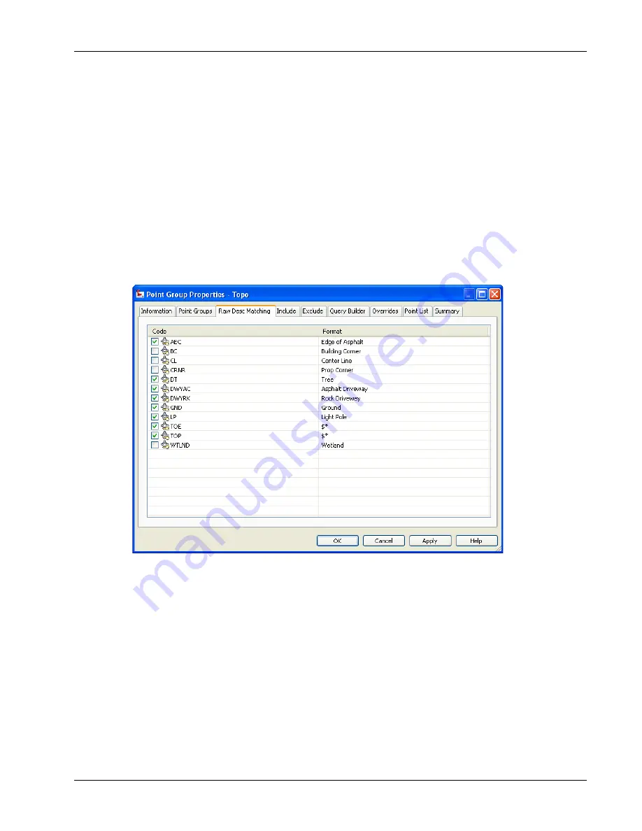
4. Select the
Raw Desc Matching
tab in the
Point Group Properties
dialog box
.
5. Select the description keys
AEC, DT, DWYRK, DWYAC, GND, LP, TOE,
and
TOP.
6. Click
<<OK>>
to create the
Point Group
.


