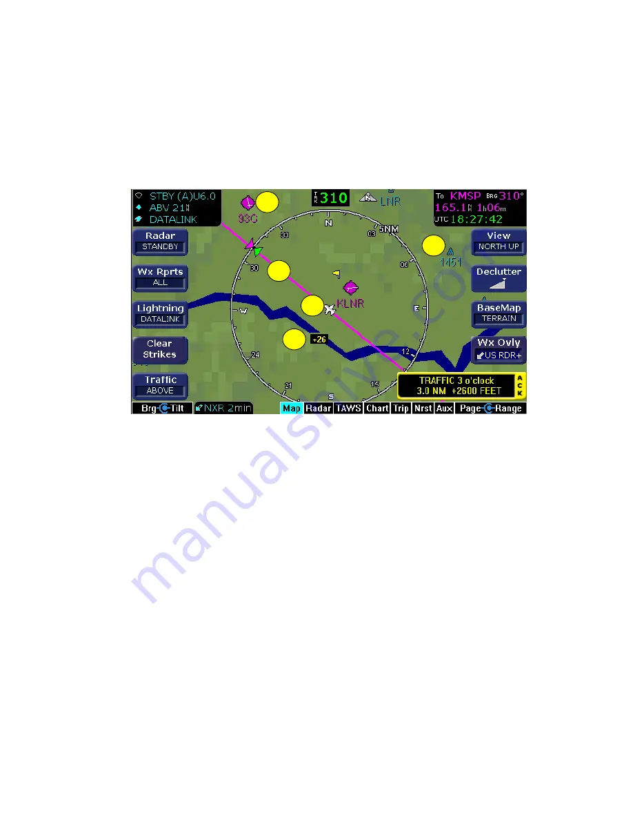
Map Page Symbols - Runways and Flight Plan
600-00078-001 Rev 05
-23-
Avidyne EX500/EX600 MFD
2.4 Map Page Symbols - Runways and Flight
Plan
When you look at the Map page at lower ranges, you can see details,
such as runway diagrams that are not available at longer ranges (see
Figure 2.4).
Figure 2.7 Map Page—Runways and Flight Plan Symbology
1) Airport Runway Diagrams
- When the Map page is set to under
20NM, the EX500/EX600 displays runway layouts of the
destination airport and nearby airports.
2) Flight Plan
- Displays the active flight plan from the selected
GPS on the map. The current leg is displayed in
magenta
and all
other legs are shown in white. When an approach procedure is
selected on a GPS that supports the GAMA graphics interface,
the EX500/EX600 shows all approach segments including the
following: holds, DME arcs, and procedure turns.
3) Ownship Symbol
- Shows the position of your aircraft in relation
to the moving map and the selected view.
4) Traffic Indications
- Displays traffic symbols relative to the
present position of the aircraft and includes relative altitude
(when available) with respect to aircraft. See the Traffic Sensor
User’s Manual for further details.
2
3
1
5
4
Summary of Contents for FlightMax EX500
Page 1: ...600 00078 001 Rev 05 Multi Function Display Pilot s Guide Software Release 4 or Later ...
Page 2: ......
Page 38: ...Map Page Avidyne EX500 EX600 MFD 26 600 00078 001 Rev 05 THIS PAGE INTENTIONALLY LEFT BLANK ...
Page 90: ...Trip Page Avidyne EX500 EX600 MFD 78 600 00078 001 Rev 05 THIS PAGE INTENTIONALLY LEFT BLANK ...
Page 183: ......


