FlightMax EX5000
-10-
600-00105-000 Rev 01
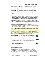
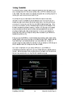
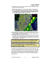
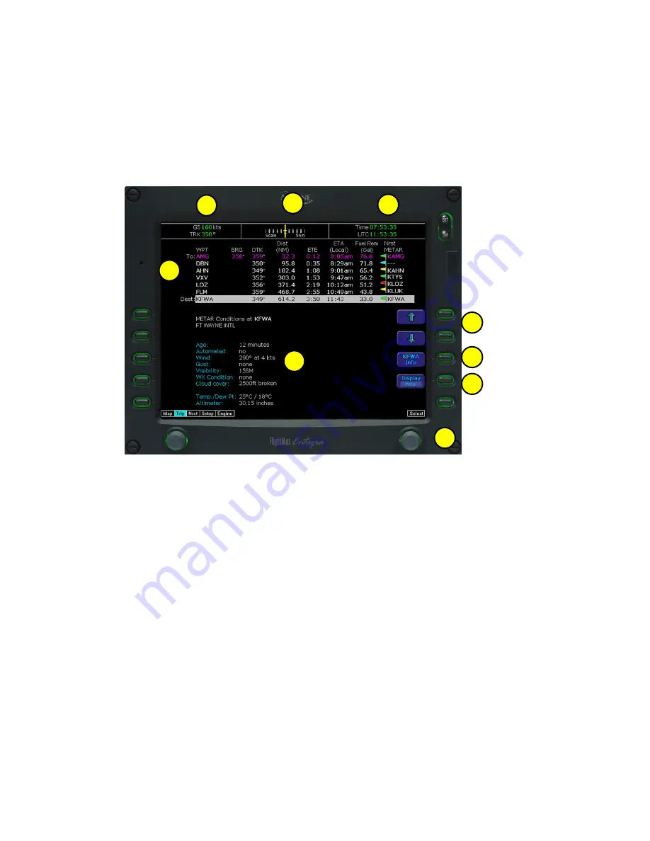
Trip Page
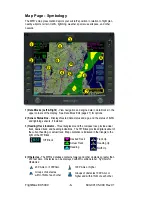
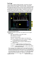
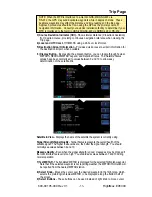
The Trip Page is continuously updated during flight. The distance and the time
values are updated with each new positive fix from the GPS. The route legs
advance with each waypoint message. Turning the left knob one detent to the right
from the Map page brings up the Trip Page, which shows the remaining legs in the
current flight plan and other data being received by the MFD from the GPS. If the
flight plan doesn’t fit on the screen, an ellipse (...) is shown in the next to last line.
The destination is always displayed, on the last line. A “No Flightplan Available”
message is displayed if there is no flight plan entered or if the GPS has failed.
1
2
3
4
5
6
8
9
7
1) Current ground speed and track
2) Flight Plan
information from your GPS. Active waypoint is shown in magenta.
Displayed data:
WPT - Waypoint identifier as received from the GPS
BRG - Bearing to current waypoint
DTK - Desired track to waypoint
DIST (NM) - Cumulative great circle distance of each flight plan leg
ETE - Cumulative estimated time en route to waypoint in H:MM format
for each flight plan leg at current ground speed.
ETA - Estimated time of arrival to waypoint in HH:MM formatted for
airplane local time.
Fuel Remaining - Available with Engine and Fuel Monitor function.
Displays remaining fuel at each waypoint in gallons.
Nrst METAR - Available with Datalink enabled. Displays Graphical METAR
and reporting point identifier.
When conducting a Direct To flight plan, the MFD will supply METAR information for
several intermediate reporting stations along your route. These will be shown as
blank lines on the flight plan list, with "Wx" in the first column, and the METAR flag in
its normal position in the right column. Selecting one of the intermediate points will
display the text METAR on the lower half of the screen. The intermediate METAR
stations will be removed from the list as you pass them during your flight.

