


FlightMax EX5000
-36-
600-00105-000 Rev 01
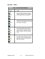
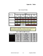
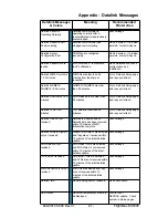
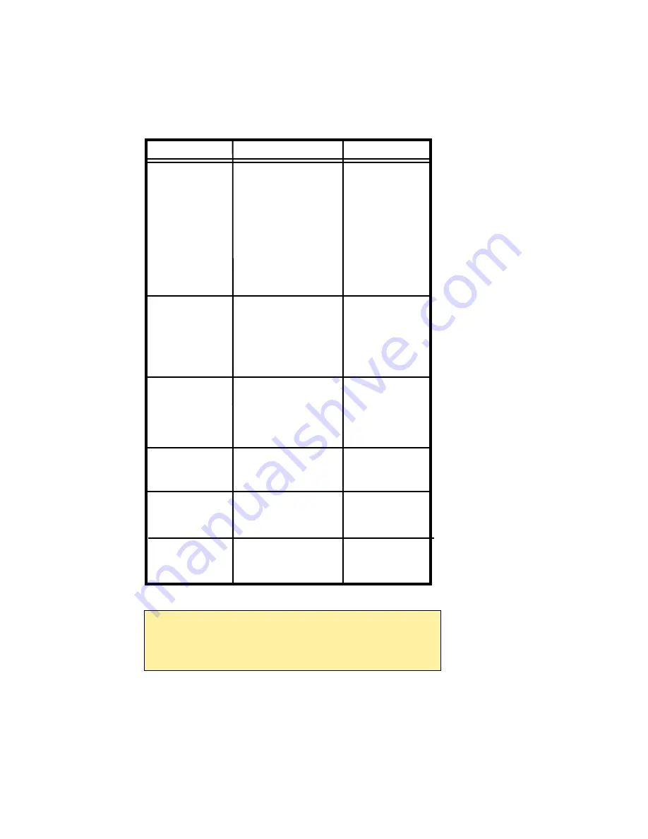
Name
Descriptions
Range
TO WPT
Name of, bearing and
5 characters
distance to the “To”
(Name)
waypoint in the active
1 to 360 degrees
flight plan. Note that the
bearing is from your
0.0 to unlimited NM.
present position directly
to the fix. If you are off
course, it will differ from
your planned course.
Also displays ETE
(Estimated Time En route).
NEXT WPT
Name of, bearing and
5 characters
distance to the “To”
(Name)
waypoint in the active
1 to 360 degrees
flight plan.
0.0 to unlimited NM.
Also displays ETE
(Estimated Time En route).
H:MM:SS
DEST WPT
Name of and distance to
5 characters
final destination waypoint
in system distance units.
Distance is measured
0.0 to unlimited NM.
along planned route.
NRST ARPT
Identifier of, bearing and
5 characters
distance to the nearest
(Name)
airport.
LAT/LON
Current lattitude and
N/S 0 to 90
o
0’
longitude in degrees and
E/W 0 to 180
o
0’
decimal minutes.
BARO ALT
Barometric Altitude
Based on data
from FMS or
GPS (see Note)
Appendix - Tables
Table 7: Data Block Information
NOTE:
The Baro Altitude is received from the FMS or GPS (via 429). The
FMS/GPS calculates the altitude based on the barometric pressure entered
into the FMS by the pilot. This display is used to verify what has been put
into the FMS/GPS. Do not rely on this display for terrain separation.