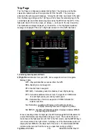
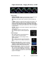
200’ AGL to <1000’AGL
1000’ AGL or higher
Groups of obstacles
within 1NM of each other
Groups of obstacles 1000’ AGL or
higher and within 1NM of each other.
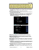
FlightMax EX5000
-6-
600-00105-000 Rev 01
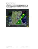
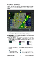
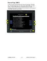
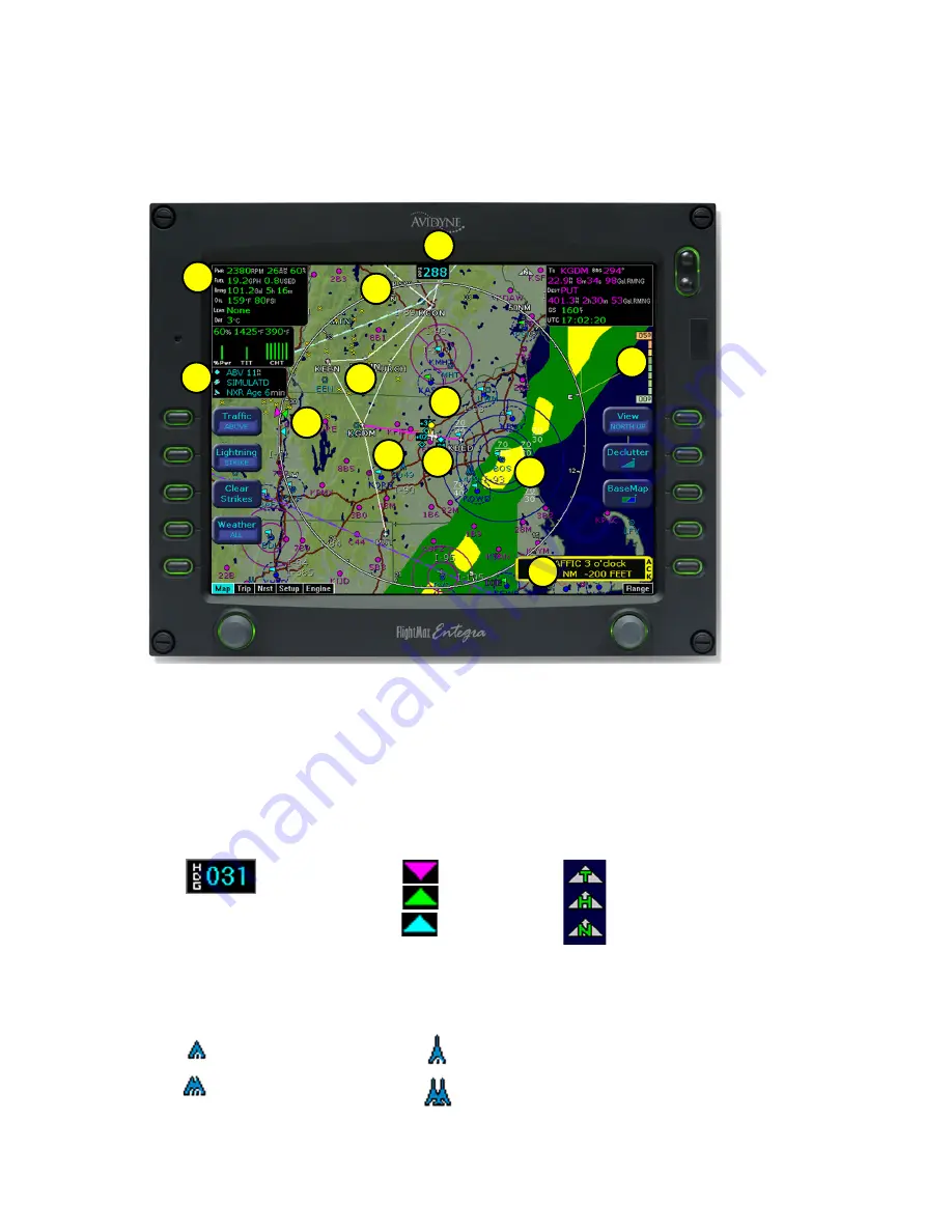
Map Page - Symbology
Heading Up
Track Up
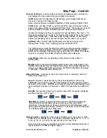
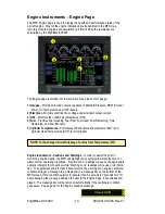
1) Data Blocks (Left & Right) -
View navigation and engine data in data blocks in the
upper corners of the display. See Data Block Edit (page 27) for options.
2) Sensor Status Box -
Displays Nexrad data status and age, and the status of traffic
and lightning sensors, if installed.
3) Heading/Track Indicator -
Three triangles around the compass rose provide actual
track, desired track, and heading indications. The H/T Block provides digital readout of
the current heading, or actual track. Map orientation is indicated in the triangle to the
right of the H/T Block.
Desired Track
H/T Block
Actual Track
Heading
North Up
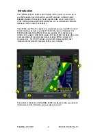
The MFD’s map presentation depicts your aircraft’s position in relation to flight plan,
nearby airports, terrain, traffic, lightning, weather, special use airspace, and other
navaids.
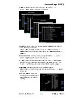
1
2
3
4
5
6
7
8
9
10
11
12
4) Obstacles -
The MFD’s database contains towers and other obstacles greater than
200 feet AGL. Obstacles can be displayed with MSL altitude label. Symbols for
Obstacles: