


IFD500 Series Pilot Guide
FMS Subsystem 3-35
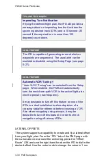
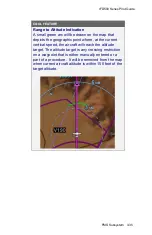
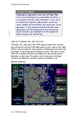
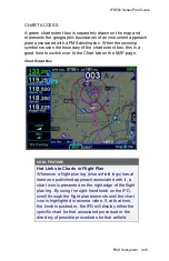
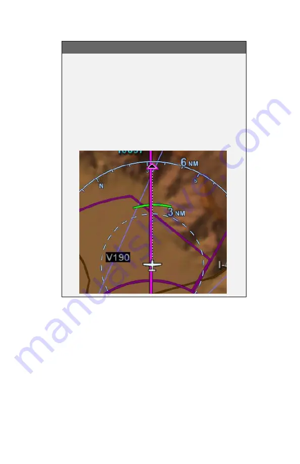
COOL FEATURE
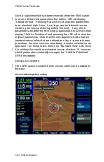
Range to Altitude Indication
A small green arc will be drawn on the map that
depicts the geographic point where, at the current
vertical speed, the aircraft will reach the altitude
target. The altitude target is any crossing restriction
on a waypoint that is either manually entered or a
part of a procedure. It will be removed from the map
when current aircraft altitude is within 150 feet of the
target altitude.
Summary of Contents for IFD510
Page 1: ......
Page 140: ...IFD500 Series Pilot Guide 3 50 FMS Subsystem Weather Data on Info Tab Info Tab Nearby Navaids ...
Page 150: ...IFD500 Series Pilot Guide 3 60 FMS Subsystem User Waypoint Airfield Naming Example ...
Page 156: ......
Page 180: ...IFD500 Series Pilot Guide 4 24 Map Subsystem ADS B Lightning Coverage Area Shadow ...
Page 252: ...IFD500 Series Pilot Guide 5 16 Aux Subsystem Trip Statistics Calculator ...
Page 460: ...IFD500 Series Pilot Guide 7 82 General Bluetooth pairing pairing code ...