


IFD500 Series Pilot Guide
4-32 Map Subsystem
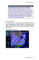
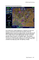
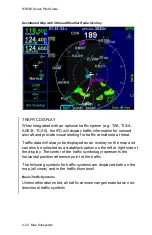
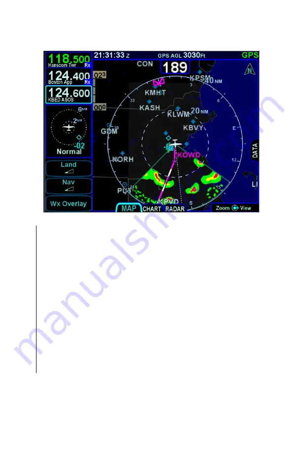
Decluttered Map with Onboard Weather Radar Overlay
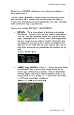
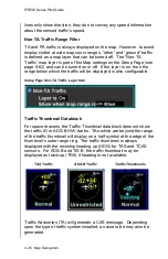
TRAFFIC DISPLAY
When integrated with an optional traffic system (e.g. TAS, TIS-A,
ADS-B, TCAS), the IFD will display traffic information for sensed
aircraft and provide visual alerting for traffic considered a threat.
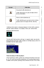
Traffic data will always be displayed as an overlay on the map and
can also be selected as a datablock option on the left or right side of
the display. The center of the traffic symbology represents the
horizontal position reference point of the traffic.
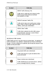
The following symbols for traffic systems are displayed both on the
map (all views) and in the traffic thumbnail
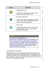
Basic Traffic Symbols
Unless otherwise noted, all traffic sensors can generate basic non-
directional traffic symbols
Summary of Contents for IFD510
Page 1: ......
Page 140: ...IFD500 Series Pilot Guide 3 50 FMS Subsystem Weather Data on Info Tab Info Tab Nearby Navaids ...
Page 150: ...IFD500 Series Pilot Guide 3 60 FMS Subsystem User Waypoint Airfield Naming Example ...
Page 156: ......
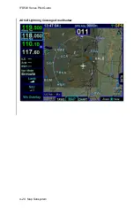
Page 180: ...IFD500 Series Pilot Guide 4 24 Map Subsystem ADS B Lightning Coverage Area Shadow ...
Page 252: ...IFD500 Series Pilot Guide 5 16 Aux Subsystem Trip Statistics Calculator ...
Page 460: ...IFD500 Series Pilot Guide 7 82 General Bluetooth pairing pairing code ...