IFD500 Series Pilot Guide
4-42 Map Subsystem
TERRAIN AWARENESS
Terrain Awareness is a graphical representation of aircraft height
above surrounding terrain and obstacles, shown as colored overlays
on the map. It is for general situational awareness purposes and is
not intended to be the sole means of terrain or obstacle avoidance.
Terrain awareness is often abbreviated as “TA”, but that is avoided in
this document in order to prevent confusion with the same acronym
being used for “Traffic Alert”. Terrain Awareness is based on GPS
altitude, not baro corrected or radar altitude, and will not generate a
CAS message or aural alert.
Terrain Awareness
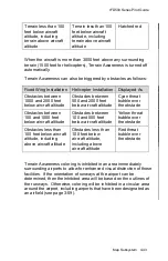
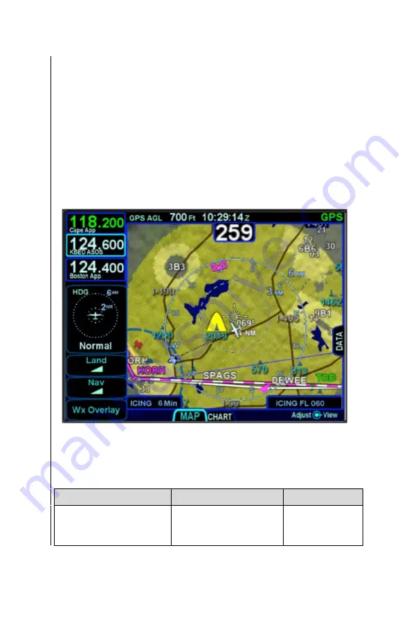
Terrain Awareness coloring can be triggered by terrain within a 10nm
radius of the aircraft and is displayed as follows, depending upon the
installation:
Fixed Wing Installation
Helicopter Installation
Displayed As
Terrain between 100
and 1000 feet below
aircraft altitude
Terrain between 100
and 500 feet below
aircraft altitude
Hatched
yellow
Summary of Contents for IFD510
Page 1: ......
Page 140: ...IFD500 Series Pilot Guide 3 50 FMS Subsystem Weather Data on Info Tab Info Tab Nearby Navaids ...
Page 150: ...IFD500 Series Pilot Guide 3 60 FMS Subsystem User Waypoint Airfield Naming Example ...
Page 156: ......
Page 180: ...IFD500 Series Pilot Guide 4 24 Map Subsystem ADS B Lightning Coverage Area Shadow ...
Page 252: ...IFD500 Series Pilot Guide 5 16 Aux Subsystem Trip Statistics Calculator ...
Page 460: ...IFD500 Series Pilot Guide 7 82 General Bluetooth pairing pairing code ...

