IFD500 Series Pilot Guide
4-60 Map Subsystem
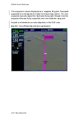
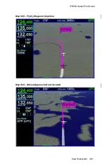
The waypoint is shown displayed as a magenta flag pole. Downpath
waypoints are not depicted in order to reduce map clutter. Fly-over
waypoints typically depict the flight plan flying right through/over the
waypoint whereas fly-by waypoints can turn inside the waypoint.
Airports and obstacles are also depicted on the SVS view.
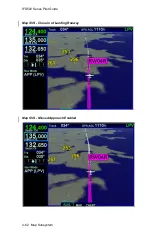
Map SVS - Curved Flight Path with Next Leg Depiction
Summary of Contents for IFD510
Page 1: ......
Page 140: ...IFD500 Series Pilot Guide 3 50 FMS Subsystem Weather Data on Info Tab Info Tab Nearby Navaids ...
Page 150: ...IFD500 Series Pilot Guide 3 60 FMS Subsystem User Waypoint Airfield Naming Example ...
Page 156: ......
Page 180: ...IFD500 Series Pilot Guide 4 24 Map Subsystem ADS B Lightning Coverage Area Shadow ...
Page 252: ...IFD500 Series Pilot Guide 5 16 Aux Subsystem Trip Statistics Calculator ...
Page 460: ...IFD500 Series Pilot Guide 7 82 General Bluetooth pairing pairing code ...

