

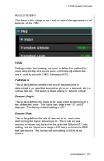


IFD500 Series Pilot Guide
5-50 Aux Subsystem
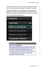
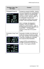
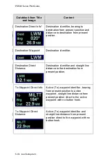
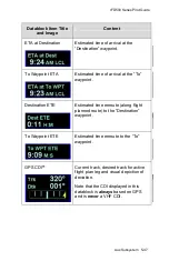
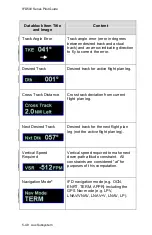
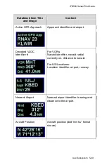
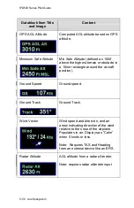
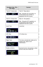
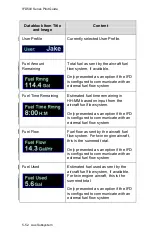
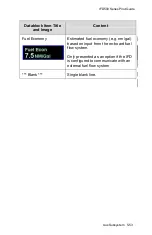
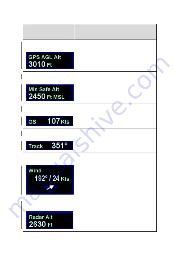
Datablock Item Title
and Image
Content
GPS AGL Altitude
Computed AGL altitude based on GPS
altitude.
Minimum Safe Altitude
Min Safe Altitude (defined as
1000’
above the highest terrain or obstacle in
a 10nm rectangle around the aircraft
position).
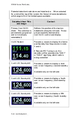
Ground Speed
Ground speed.
Ground Track
Ground Track.
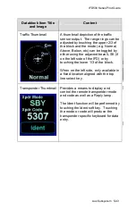
Wind Vector
Wind speed and direction, and an
arrow indicating direction of the wind
relative to the nose of the airplane.
Populates in air. Displays as “Calm”
when 5 knots or less.
Note: Requires TAS and Heading
from an external device like an EFIS.
Radar Altitude
AGL altitude from a radar altimeter.
Note: requires radar altimeter input
Summary of Contents for IFD510
Page 1: ......
Page 140: ...IFD500 Series Pilot Guide 3 50 FMS Subsystem Weather Data on Info Tab Info Tab Nearby Navaids ...
Page 150: ...IFD500 Series Pilot Guide 3 60 FMS Subsystem User Waypoint Airfield Naming Example ...
Page 156: ......
Page 180: ...IFD500 Series Pilot Guide 4 24 Map Subsystem ADS B Lightning Coverage Area Shadow ...
Page 252: ...IFD500 Series Pilot Guide 5 16 Aux Subsystem Trip Statistics Calculator ...
Page 460: ...IFD500 Series Pilot Guide 7 82 General Bluetooth pairing pairing code ...