AvMap - 17
Farmnavigator
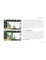
A button. The starting point is shown on the map as an
orange square with an ‘A’ on it. Once the point A is set,
the B button will appear. When you reach the headlands
set the point B by pressing the B button. The point B is
displayed on the Map just like Point A. These two points
are used to draw the reference straight line and the
corresponding parallel lines at a distance previously set
as working width.
3.5.2 Contour guide lines
Contour guide lines are used for fields with curved
boundaries. Drive the first reference line setting the
point A, and then, just before you reach the headlands,
setting the point B. The Farmnavigator will record
each position and draw the exact driven line and the
corresponding parallel lines at the distance previously
set as working width or virtual spray boom width.
3.5.3 Tram lines
Summary of Contents for G6 Farmnavigator
Page 1: ...Corresponding to Software Version 2 5 xx FARM NAVIGATION User Manual ...
Page 31: ......
Page 32: ...www farmnavigator com ...


