BARTINGTON INSTRUMENTS
Page 23 of 61 OM1800/26
12.2. Capturing Data in NMEA Mode
Whilst in NMEA Mode, the DL601 Data Logger can be connected to any external data logger that
is capable of receiving NMEA messages. An NMEA GPS device can then be plugged into the same
logger and the data can be correlated. Any Windows-based system can be used as an external
logger, including the Archer and Allegro field PCs, or any laptop/tablet PC.
See
Downloading Survey Data to a PC
for recommended software to use with the NMEA data
logger.
13. Gradiometer Range and Resolution
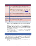
The Grad-01-1000L sensor has two linear operating ranges:
Range
Details
±
100nT
Values are recorded with a resolution of 0.01nT, but the actual resolution
achieved will be limited to about 0.03nT due to the internal noise of the
instrument.
±
1000nT
Values are recorded with a resolution of 0.1nT. The values will be clipped at
the full scale values with no over-range.
In Survey Mode (i.e. after selecting
Start survey
in Grid Mode), the result is displayed with a
resolution of 1nT regardless of the range selected, but the result is saved to memory with the
resolution appropriate for the range selected.
Each measured value is the average of many samples. In Survey Mode the sampling time is
adjusted to produce an average value over the sampling distance at the pace selected. The
measurement time is further modified to integrate the signal over a discrete number of mains
cycles. This enhances the high 50/60Hz rejection of the sensors.
Note:
The background noise can be further reduced by integration, walking more slowly, or
by using fewer samples per metre.
Note:
Integrating the readings over the measurement interval reduces the noise level, but
also effectively limits the bandwidth. If the sampling interval is set at e.g. 4 samples/m, the
minimum spatial resolution will be 0.25m and any anomaly smaller than this will be diluted
by the averaging process. The sampling interval should therefore be set to allow the
smallest anomaly expected to be recognised, with 4 samples/m being a good compromise.
Note:
Under optimum ground conditions the best survey results are obtained with the
lower sensor around 20cm above the surface. This produces the highest sensitivity to
buried features whilst minimising surface noise. The height of the gradient sensors can
easily be adjusted to avoid vegetation.


