background image

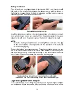
bottom of the unit and insert the other connector as shown in the following 
image. A small clip on the connector should hold the connector in place. 


Attach external power cable to Atlas. 

WARNING: 

Do not remove the cigarette lighter adapter and splice the ex-
posed wires directly to a 12-volt power system. The cigarette 
lighter adapter contains in the plug
 a protective fuse and a 
voltage regulator to convert 12 volts down to about 3 volts. 
Without this regulator, connecting your unit to a 12-volt power 
source will destroy the unit. This damage will not be covered 
by your warranty. 

The Atlas can use two other optional external cables to supply a 
NMEA/serial data connection or a combination of power and data. These 
cables are discussed in the following segment on NMEA connections. 

NMEA Cable Connections 

NMEA is a standard communications format for marine electronic equipment. 
For example, an autopilot can connect to the NMEA interface on this unit and 
receive positioning information. The unit can exchange information with any 
device that transmits or receives NMEA 0183 data. 

To exchange NMEA data, Brunton offers an optional data only cable and a 
power/data combo cable: 

The AMNS-DC is a NMEA/serial communications cable. It has a standard 
female DB-9 connector on one end to attach your unit to a computer's se-
rial communications port. 

11 

The AMNS-PCDC combines a cigarette lighter power adapter with a DB-9 
plug for a NMEA/serial com port connection to a laptop computer or other 
device. This is our favorite cable for connecting the Atlas MNS to a laptop 
computer in an RV or other vehicle. By transmitting NMEA data to the 
computer, you can get live position data for GPS-compatible mapping soft-

Summary of Contents for Atlas MNS

Page 1: ...ATLASMNS Handheld Mapping GPS Receiver Operation Instructions Copyright 2005 Brunton All rights reserved ...

Page 2: ...ion Energizer and e2 are registered trademarks of Energizer Holdings Inc Points of Interest Data in this unit are by infoUSA copyright 2001 2004 All Rights Reserved infoUSA is a trademark of infoUSA Inc eXitSource Database copyright 2001 2003 Zenrin Co Ltd Exit Authority and eXitSource are trademarks of Zenrin Co Ltd Brunton may find it necessary to change or end our policies regulations and speci...

Page 3: ... To remove an MMC 12 To add an MMC or SDC 13 InfoCards 14 External Antenna 14 R A M Bracket Mounting System 15 Other Accessories 16 Section 3 Easy Mode Operation 17 Keypad 17 Power lights on and off 18 Main Menu 18 Pages 19 Satellite Status Page 19 Navigation Page 20 Calibrate Compass 22 Compass Menu 24 Map Page 24 Atlas MNS Easy Mode Quick Reference 28 Find Your Current Position 29 Moving Around ...

Page 4: ...iagion Page 46 Compass Menu 48 Map Page 48 Map Menu 49 Moving Around the Map Zoom Cursor Arrow Keys 49 Find Distance From Current Position To Another Location 50 Find Distance From Point to Point 50 Find Your Current Position 50 Icons 51 Create Icon on Map 51 Create Icon at Current Position 51 Delete an Icon 52 Load GPS Data Files from an MMC 52 Navigate 53 Navigate Back Home 53 Navigate Back to H...

Page 5: ...Sun Moon Rise Set Calculator 62 Trip Calculator 62 Trip Down Timer 62 Trip Up Timer 62 Waypoints 62 Create a Waypoint 62 Create Waypoint on Map 62 Create Waypoint at Current Position 63 Create a Home Waypoint 63 Create a Waypoint by Average Position 63 Create a Waypoint by Projecting a Position 63 Select a Waypoint 64 Delete a Waypoint 64 Edit a Waypoint 64 Waypoint Name 64 Waypoint Symbol 64 Wayp...

Page 6: ...8 To display a Navionics chart 78 Port Information 79 To view Port Services information 79 Tidal Current Information 80 To view Tidal Current information 81 Tide Information 82 To view tide information 82 Pop up Help 83 Reset Options 84 In Advanced Mode 84 In Easy Mode 84 Screen Contrast and Brightness 84 Once in the Screen menu 85 Set Language 86 Set Local Time 86 Once in the Time Settings menu 8...

Page 7: ... Trail Options 93 Units of Measure 93 Section 6 Searching 95 Find Addresses 95 Find Any Item Selected by Map Cursor 97 Find Home Waypoint 98 Find Interstate Highway Exits 99 Find Map Places or Points of Interest POI 100 Find Streets or Intersections 102 Find Waypoints Advanced Mode only 104 Section 7 Supplemental Material 107 ...

Page 8: ...ling to a waypoint but will also visually check to make sure a clear safe path to the waypoint is always avail able WARNING When a GPS unit is used in a vehicle the vehicle operator is solely responsible for operating the vehicle in a safe manner Vehicle operators must maintain full surveillance of all pertinent driving boating or flying conditions at all times An accident or collision resulting i...

Page 9: ...know to find your way in the wilderness quickly Easy Mode operation will meet the navigation needs of many users But after you ve learned the basics or if you already have some GPS experi ence you may want to try out some of Atlas s many advanced navigation features That brings us to Section 4 Advanced Mode Operation After we introduce the Advanced Mode menus and submenus this section contains the...

Page 10: ...ixels Backlighting White LED screen backlighting for night and low light viewing Input power 3 volts DC two 1 5v AA batteries operates up to 12 hours on batteries when using one second position updates longer update rates further ex tend battery life but will reduce GPS accuracy Case size 5 6 H x 2 5 W x 0 9 D 142 x 65 x 25 mm water resistant to IPX 2 standards Weight 8 48 ounces 242 grams with al...

Page 11: ...Position updates Every one second Position points 2 000 waypoints 1 000 event marker icons Graphic symbols for waypoints or event marker icons 42 Routes 100 up to 100 waypoints per route Plot Trails 99 savable up to 9 999 points per trail Scout Plots 100 savable scout plots Home HOME feature precisely marks Home location with special icon then automatically displays navigation data to that positio...

Page 12: ...ion in relation to those satellites Once Atlas figures its latitude and longitude it plots that posi tion on the moving map shown on the screen While the screen is updated once a second your Atlas is making these internal calculations and determin ing its position several times a second The performance doesn t stop there Stored in the permanent memory of each Atlas is a basic background map of the...

Page 13: ...om Map Files directly from the MMC or SD Card To use a custom map all you need to do is slide an MMC containing a map into the unit Introduction to GPS and WAAS Well now you know the basics of how Atlas does its work You might be ready to jump ahead to Section 2 Installation Accessories on page 9 so you can install the batteries Or you might want to see how our text for matting makes the manual tu...

Page 14: ... clear view of the satellites in order to re ceive their signals Unlike radio or television signals GPS works at very high frequencies These signals can be easily blocked by trees buildings an autoHomeile roof even your body Unlike most GPS receivers the Atlas MNS has a digital compass built in side This aids in navigation drastically as you will not need to be in motion to determine direction of ...

Page 15: ...en you and your des tination for example It s up to you to safely navigate around obstacles no matter how you re using this product How to use this manual typographical conventions Many instructions are listed as numbered steps The keypad and arrow keystrokes appear as boldface type So if you re in a real hurry or just need a reminder you can skim the instructions and pick out what menu command to...

Page 16: ...ensed manner for quick and easy reading For example instructions for backtracking a trail in Easy Mode would look like this 1 Press MENU to NAVIGATE TRAIL ENT 2 Now begin moving and follow your Atlas Translated into complete English step 1 means Press the Menu key Next press the down arrow key to scroll down the menu and select highlight the Navigate Trail menu command Finally press the Enter key ...

Page 17: ... You can also use rechargeable AA alkaline batteries such as those made by RAYOVAC or rechargeable AA nickel metal hydride NiMH batteries We do not recommend nickel cadmium NiCd rechargeable batteries be cause we tend to get poor battery life from them Rechargeable alkaline batteries will not last as long as standard alkaline batteries However rechargeable NiMH batteries should give you suitable b...

Page 18: ...he battery compartment is a rotating MMC card lock The grip on this lock must be turned parallel with the direction of the batteries for them to fit properly Replace the battery compartment cover First align the latch tabs at the bot tom of the cover with the slots at the case s base Press the cover into place and then firmly push up on the clip at the top of the cover until it latches in place Th...

Page 19: ...ing segment on NMEA connections NMEA Cable Connections NMEA is a standard communications format for marine electronic equipment For example an autopilot can connect to the NMEA interface on this unit and receive positioning information The unit can exchange information with any device that transmits or receives NMEA 0183 data To exchange NMEA data Brunton offers an optional data only cable and a p...

Page 20: ...memory devices are about the size of a postage stamp An SD card is slightly thicker than an MMC As this manual went to press MMCs were available in storage capacities of 8 MB 16 MB 32 MB 64 MB and 128 MB SD cards were available in capacities of 8 MB 16 MB 32 MB 64 MB 128 MB 256 MB and up We have successfully tested SD cards up to 512 MB Additional MMC cards are available from Brunton see ordering ...

Page 21: ...ment cover 2 Remove batteries if present 3 Hold unit facedown in right hand Drop the MMC card into the slot label up with the notched edge toward the right 4 Press down on the center of the label and slide the card to the right Add an MMC Card 5 Turn the plastic rotating card lock until it holds the card firmly in place with the grip parallel to the direction of the batteries 6 Replace the batteri...

Page 22: ...re available through Brunton To order a card or for a list of the areas available see the ordering information in the back of this manual External Antenna A GPS antenna requires a clear view of the sky for optimum operation Inside a vehicle your Atlas can sometimes maintain satellite lock while sitting on the seat beside you but we don t recommend this for optimum performance Since the view is res...

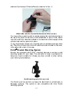
Page 23: ...cation with an unobstructed view of the sky Plug the connector into the unit s antenna socket located on the back in the upper left corner of the case R A M Bracket Mounting System Brunton has partnered with R A M mounting brackets to provide a solid mounting system for your Atlas This will work to make a permanent or temporary mount suitable for virtually any boat aircraft or other vehicle even m...

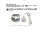
Page 24: ...rs and Map Create 6 custom mapping software for your computer If these accessories are not available from your dealer see the accessory ordering information on the inside back cover of this manual or check www brunton com MapCreate CD ROM and MMC card reader for USB ports 16 ...

Page 25: ...Keypad 2 7 4 3 6 1 5 9 8 Atlas MNS keypad 1 PWR LIGHT Power Light The PWR key turns the unit on and off and activates the backlight 2 PAGES Pressing this key switches the unit between the three different page screens in Easy Mode Satellite Navigation and Map Each page represents one of the unit s major operation modes Also use this key to directly access the compass when in sleep mode 3 MENU Press...

Page 26: ... and holding the PWR key for 3 seconds Main Menu Easy Mode has a single Main Menu which contains some function com mands and some setup option commands The tutorial lessons in this section will deal only with functions the basic commands that make Atlas do some thing Atlas will work fine for these lessons right out of the box with the factory default settings But if you want to learn about the var...

Page 27: ... command shows the product name and software version of the unit s operating system software as well as copyright notices Pages Easy Mode has three Page displays that represent the three major operat ing modes They are the Satellite Status Page the Navigation Page and the Map Page They are accessed by pressing the PAGES key Pressing PAGES repeatedly scrolls among the three screens in an endless ci...

Page 28: ...phs one for each satellite in view Since the unit has twelve channels it can dedicate one channel per visible satellite The taller the bar on the graph the better the unit is receiv ing the signals from the satellite The Estimated Position Error horizontal position error shown in the up per right corner of the screen is the expected error from a benchmark loca tion In other words if the EPE shows ...

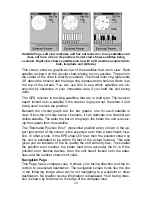
Page 29: ...ps the direction to your destination at the top of the screen while your heading indicator swings around the compass rose That way all you have to do to navigate to your destination is keep turning so that your arrow points closer and closer to the top of the screen Track or compass heading indicator showing facing direction Compass rose Navigation information data boxes Battery power indicator Na...

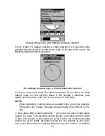
Page 30: ...4 you can still quickly check your compass bearing by pressing and holding the PAGES key This activates the screen and shows the current Compass display including your current heading and any information you are displaying in the custom izable data boxes As soon as you release the PAGES key the Atlas MNS will return to SLEEP MODE Calibrate Compass To find your heading the Atlas uses a sensor that ...

Page 31: ...ut choose a reference point nearby such as a tree your car or even use your own body NOTE While calibrating hold the Atlas as parallel to the ground as possible Tilting the Atlas makes compass measurements more difficult for the unit 23 3 Now press ENT to start calibration You ll notice the line moving slowly around the circle Turn the Atlas so that the line is pointing from the center of the circ...

Page 32: ...estination NOTE When our text says navigating to a waypoint we really mean naviga tion to any selected item whether it is a waypoint you made a map feature or an item like a restaurant from the POI database Using the map is as simple as pressing the PAGES key A screen similar to those in following images appears The arrow flashing in the center of the screen is your present position It points in t...

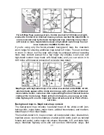
Page 33: ...accurate map detail Map Pages with high detail map of an urban area loaded on the MMC At left arterial streets appear at the 4 mile zoom range with a few Point of Interest icons visible Center numerous dots representing Points of Interest become visible at the 3 mile range Right at the 0 4 mile zoom you can see an inter state highway with an exit major and minor streets as well as Point of Inter e...

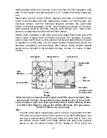
Page 34: ...gher detail in MapCreate shows the shoreline completely and accurately finer detail Many smaller islands would not be included in the background map but are of course in Map Create Interstate Major Street Cursor line Restaurant POI POI Markers POI Pop up School POI Position distance and bearing data When the map is zoomed out far enough most POIs appear as square dots As you zoom in closer the sym...

Page 35: ...on Even though their display is turned off you can still search for POIs and their icons will pop up when your unit finds them for you The following page contains a 12 step quick reference for Easy Mode op eration If you don t want to carry the manual with you as you practice with Atlas you might consider photocopying this quick reference page and tucking it into your pocket ...

Page 36: ...AGES key to display Map Page which shows a bird s eye view of the earth You can move around the map by Zoom in closer to see greater detail press ZIN zoom in key Zoom out to see more area less detail press ZOUT zoom out key Scroll map north south east or west using arrow keys To stop scrolling and return to current position on map press EXIT key 6 Set Home waypoint at your current position so you ...

Page 37: ...om a bird s eye view perspective The current zoom range shows in the lower left corner of the screen 1 Press the ZIN key zoom in to move in closer and see greater detail in a smaller geographic area 2 Press the ZOUT key zoom out to move farther away and see less map detail but a larger geographic area When you are walking or riding in a vehicle the map will automatically move as you move This keep...

Page 38: ...LECTED ITEM Press ENT to see the Way point Information screen for the selected item Searching Now that you ve seen how Atlas can find where you are let s search for something somewhere else Searching is one of the most powerful fea tures in the Brunton GPS product line In this example we ll look for the nearest fast food restaurant For more in formation on different types of searches refer to Sec ...

Page 39: ...creen shows name street address phone number latitude longitude distance to the restaurant and its compass bearing Figure at left shows Go To com mand right figure shows Find On Map command 6 Atlas s map appears with the cross hair cursor highlighting the restau rant s POI symbol A pop up name box identifies the POI A data box at the bottom of the screen continues to display the location s latitud...

Page 40: ... shows waypoint set at the cursor location If cursor was not active the point would be placed at the current position Caution Saving a new Home waypoint will overwrite and erase the previ ous Home waypoint Find your way back to the Home with the Navigation Page or Map Page When Home is stored andactivated the Navigation Page automatically shows the compass rose with its bearing arrow pointing towa...

Page 41: ... around the map until you find a location you want to go to 2 Center the cursor over the location to select it See the example below Many map items such as waypoints Points of Interest towns etc can be selected and appear highlighted with a pop up box Other features such as a river or a street intersection will not appear highlighted but the cursor will take you to those locations just the same Na...

Page 42: ...that are in view on the map you can easily use the Navigate to Cursor command above just use the cursor to select the POI Another method involves searching for POIs with the Find Map Places command launched with the FIND key See the searching example earlier in this section or turn to Sec 6 Searching for detailed instructions on POI searches After you have looked up an item with the Find Map Place...

Page 43: ...d starts creation of a new trail NOTE Atlas can record up to 9 999 points per trail which can be adjusted in Advanced Mode The default setting is a maximum of 2 000 points When trail length exceeds the maximum setting the unit begins re cording the trail over itself In Advanced Mode you can save and recall up to 10 different plot trails which can also be copied to your MMC for archiving Caution Yo...

Page 44: ... Begin moving and watch the Map Page or Navigation Page if you pre fer Simply walk or steer so that your current position arrow traces along the trail you have just made Navigate a Back Trail 1 Press MENU to NAVIGATE TRAIL ENT 2 Now begin moving and follow your Atlas Navigate Trail menu NOTE If you are already located at or near the beginning of your back trail the arrival alarm will go off as soo...

Page 45: ...nt 6 and must turn east to follow trail Steer arrow swings around to say turn left east toward the next trail waypoint arrival alarm message turned off for clarity Track or compass heading indicator 37 Bearing arrow Trail waypoint symbol Compass rose Cross track error range off course indicator Navigate trail navigation page compass rose views at left driver is east bound heading straight toward t...

Page 46: ...itch to Advanced Mode and use the instructions in Sec 4 for Creating and Saving a Trail 1 Press MENU to CLEAR TRAIL ENT Atlas asks if you re sure press ENT 2 Return to the page by pressing EXIT Transfer Custom Maps and GPS Data Files Custom Maps Custom maps work only from the MMC card or SD card When a card con taining a Custom Map File is loaded into the unit Atlas automatically loads the map int...

Page 47: ...C must be copied from the card to the Atlas s internal memory before the unit can read them Here s how 1 Insert the MMC into your unit Press MENU to TRANSFER MY DATA ENT and the screen below appears The Transfer My Data submenu asks if you want to save data to the MMC or load data from the MMC into Atlas s memory 2 The Transfer My Data menu includes a message which tells you if an MMC is present o...

Page 48: ...turn to the Page view press EXIT EXIT From left to right these figures show the menu sequence for naming and saving a GPS Data File from an MMC into Atlas s memory 4 Loading There may be more than one GPS Data File USR on the card To select a file press ENT to activate the selection box use or to highlight the file then press ENT to accept the selection Next press to LOAD ENT The unit will display...

Page 49: ... you sure you want to enter Advanced Mode 3 Press ENT and the unit switches to Advanced Mode Switch Back to Easy Mode from Advanced Mode To leave Advanced Mode and switch back to Easy Mode 1 Press MENU MENU to EASY MODE ENT 2 Unit asks Are you sure you want to turn on Easy Mode 3 Press ENT and the unit switches to Easy Mode ...

Page 50: ...eature from a list 4 ARROW KEYS These keys are used to navigate through the menus make menu selections move the chart cursor and enter data 5 ENT SAVE Enter Save This key allows you to save data accept values or execute menu commands 6 EXIT The Exit key lets you return to the previous screen clear data or erase a menu 7 FIND The Find key launches the Atlas search menus and some navi gation functio...

Page 51: ... press MENU MENU To clear the menu screen and return to the page display press EXIT Main Menu Advanced Mode Pages Land Mode has five Page displays that represent the Four major operating modes They are the Satellite Status Page the Position Page the Naviga tion Page and the Map Page They are accessed by pressing the PAGES key Pressing PAGES repeatedly scrolls among the five screens in an end less ...

Page 52: ...llite Status Menu right Status Menu The Satellite Status Menu allows you to set your own GPS options such as track smoothing and whether you want the GPS engine to stop searching a power saving function for use indoors Position Page This page provides detailed information on your Barometric pressure or altitude It also shows graphically the last 24 hours of Barometric or Alti tude History It also ...

Page 53: ...llows you to calibrate the Altitude to a specific altitude or current GPS altitude here or you can customize the Units of Measure used IMPORTANT NOTE Show Digital Data The Digital Data display provides detailed information about your environ ment including your ground speed bearing and current compass head ing Some of the most useful information on this display though are the pressure history and ...

Page 54: ...essing PWR You can also use the Instant On Compass feature to briefly display the compass reading without reactivating the entire unit Instant On Compass When the Atlas MNS is in Sleep Mode you can still quickly check your compass bearing by pressing and holding the PAGES key This activates the screen and shows the current Compass display including your current heading and any information you are ...

Page 55: ...vigate to your destination is keep turning so that your arrow points closer and closer to the top of the screen Track or compass heading indicator showing facing direction Compass rose Navigation information data boxes Battery power indicator Navigation Page recording a trail traveling east Page looks like this when Atlas is not navigating to a waypoint following a route or backtracking a trail Wh...

Page 56: ...earing by pressing and holding the PAGES key This activates the screen and shows the current Compass display including your current heading and any information you are displaying in the customizable data boxes As soon as you release the PAGES key the Atlas MNS will return to SLEEP MODE Compass Menu The Compass Menu allows you to set the compass orientation as well as calibrating the compass descri...

Page 57: ...The map menu allows you to find dis tances change the orientation of your map view map data and other helpful map functions Moving Around the Map Zoom Cursor Arrow Keys The map is presented from a bird s eye view perspective The current zoom range shows in the lower left corner of the screen If the zoom range says 4 mi the map shows an area 4 miles wide from the left edge of the screen to the righ...

Page 58: ...ng your current position to the cursor s location Press ENT to set the first point and the rubber band line disappears 3 Move the cursor to the second position The rubber band line reappears connecting the first point you set to the cursor The distance along that line will appear in the lower left hand corner of the screen 4 Press EXIT to clear the command and return to the page screen Find Your C...

Page 59: ...u can pick from when creating an icon Icons are similar to waypoints but they do not store as much information like names as waypoints do You can t use a menu to navigate to icons as you can with waypoints But you can use the map cursor and navigate to any icon on the map You can create an icon at the cursor position on the map or at your cur rent position while you are navigating Create Icon on M...

Page 60: ...o DELETE ALL ICONS DELETE BY SYMBOL or DELETE FROM MAP and press ENT Delete icons menu Load GPS Data Files from an MMC GPS Data files containing waypoints routes trails and event marker icons must be copied from an MMC to Atlas s internal memory before At las can read them Here s how 1 Press MENU MENU to SYSTEM SETUP ENT to TRANSFER MY DATA ENT and the screen below appears The Transfer My Data sub...

Page 61: ...e the entry later in this section on Navigate to a Waypoint Navigate Back to Home Waypoint This unit has a Straight Home feature that shows navigation data to the location where the feature was activated To activate it press the ZOUT and ZIN keys at the same time Your position at the time these keys are pressed is used as the Home position The unit automatically begins navi gating to the Home wayp...

Page 62: ...or then use the Navigate to Cursor command However you can avoid scrolling the map to pick your waypoint if you use the Find commands 1 Press FIND ENT To look up the nearest waypoint press ENT or to look by name and scroll through the entire waypoint list press ENT For this example look by name 2 If your waypoint list is a long one you can spell out the waypoint name in the FIND BY NAME box to sea...

Page 63: ...l go off as soon as navigation begins because of your proximity to the trail s first point Just press EXIT to clear the alarm 6 Upon arrival at your destination cancel navigation press MENU MENU to CANCEL NAVIGATION ENT to YES ENT Backtrack a Trail See the tip paragraph in the previous entry Navigate a Trail Routes A route is a series of waypoints linked together in an ordered sequence that s used...

Page 64: ...ey In this example we ll create a route from the map 1 From the NAVIGATION PAGE press MENU ENT or from the MAP PAGE press MENU MENU to ROUTE PLANNING ENT 2 Press ENT to ROUTE END ENT to ADD FROM MAP ENT The Map Page appears with the cursor showing 3 Use the Zoom keys and arrow keys to move the map and cursor until the cursor is centered on the spot where you want your route to begin If you are sta...

Page 65: ...first character then press to move the cursor to the next character and re peat until the name is correct then press ENT 9 You can execute other route commands such as NAVIGATE With the command box active just press to highlight a different command then press ENT 10 If you are finished with the route for now you can return to the last page displayed by pressing EXIT EXIT EXIT Delete a Route 1 From...

Page 66: ...te After Atlas has acquired a position 1 Press FIND to MAP PLACES ENT to POI LODGING 2 You could search the entire lodging category but in this example we will narrow our search Press to HOTELS MOTELS ENT ENT 3 Atlas says it is calculating and then a list of hotels and motels appears with the closest at the top of the list and the farthest at the bottom of the list The nearest is highlighted Find ...

Page 67: ... display the location s latitude and longi tude distance and bearing Map screen showing Finding Waypoint the result of a lodging search 7 To clear the search and return to the last page displayed press EXIT EXIT EXIT Press EXIT one more time if you want to clear the cursor and let the map return to the current or last known position Before you completely exited out of the Search menus you could ha...

Page 68: ...he number of MMCs you can carry in your pockets For various trail options see the Trail Options entry in Sec 5 Create and Save a Trail Atlas is set at the factory to automatically create and record a trail while the unit is turned on It will continue recording the trail until the length reaches the maximum trail point setting default is 2 000 but the unit can record trails 9 999 points long When t...

Page 69: ...lly recorded in the unit s internal memory must be saved to the MMC as a GPS Data File in order to store it on your per sonal computer GPS Data Files stored on an MMC must be copied from the card to the Atlas s internal memory before the unit can read them Here s how 1 Insert the MMC into your unit Press MENU MENU to SYSTEM SETUP ENT to TRANSFER MY DATA ENT 2 The Transfer My Data menu includes a m...

Page 70: ...NU to UTILITIES ENT to DOWN TIMER ENT Trip Up Timer To get to the Up Timer menu press MENU MENU to UTILITIES ENT to UP TIMER ENT Waypoints A waypoint is simply an electronic address based on the latitude and longitude of a position on the earth A waypoint represents a location spot or destination that can be stored in memory then be recalled and used later on for navigation purposes Simply think o...

Page 71: ...nit takes points to average for the position The greater the number of points the greater the accuracy When the desired number of points accumulates press ENT to create and save the waypoint 3 The Edit Waypoint menu appears You can simply save the waypoint by pressing EXIT EXIT or you can edit the waypoint Create a Waypoint by Projecting a Position This feature sets a waypoint at a point located a...

Page 72: ...to way point name ENT to EDIT SYMBOL ENT 2 Use arrow keys to select desired symbol and press ENT To return to the previous page press EXIT EXIT EXIT Waypoint Position To edit waypoint position 1 Press FIND ENT to NAME ENT ENT to way point name ENT to EDIT POSITION ENT 2 Latitude press ENT then press or to change the first character then press to the next character and repeat until the latitude is ...

Page 73: ...or more to the right or left of the line to the waypoint The anchor alarm is triggered when you drift outside of a preset radius Again using the 0 1 mile as an example if you re anchored and your boat moves more than 0 1 mile the alarm will flash a message and sound a tone You can only adjust alarm distance settings or turn alarms off or on in Ad vanced Mode Switch from Easy to Advanced MENU to AD...

Page 74: ...ata so that it can calculate which satellites should be in view It then searches for only those satellites When your GPS receiver is turned on for the first time it doesn t know what your position or elevation altitude is The unit begins searching for the satellites using data that it acquired the last time it was turned on This was probably at the factory Since it s almost certain that you re not...

Page 75: ...Configuration Atlas has one NMEA 0183 version 2 0 compatible communication port or com port for short The Com Port Menu which is accessed from the Sys tem Setup Menu in Advanced Mode allows you to configure the communi cations port to send data to another electronic device such as an autopilot Menus for changing Com Port settings For connectors and wiring information for another device consult the...

Page 76: ...e names of the NMEA sentences are abbreviated in this menu These are the functions of the various selectable prefixes GLL transmits latitude and longitude of present position time of posi tion fix and status RMC and RMB transmits navigation information messages APB transmits autopilot information GGA transmits time position and fix related data GSA and GSV transmits fix mode DOP values and satelli...

Page 77: ...and Greek grid systems are the national coordinate system used only in their respective countries In order to use these grid systems you must be in the respective country This unit will pick the matching datum for you when you select the grid See the entry on Map Datum Selection for more infor mation The military grid reference system MGRS uses two grid lettering schemes which are referred to as s...

Page 78: ...r First take your map of the area and determine a reference latitude longitude Note in order for this system to work the latitude longitude lines must be parallel with the edge of the map USGS maps are parallel others may not be Also this works better with smaller scale maps The reference position can be any where on the map but the closer it is to your location the smaller the num bers will be th...

Page 79: ... Position Page This page has seven boxes you can customize While on the Position Page press MENU to CUSTOMIZE ENT The topmost data box begins flash ing Use the arrow keys to select the box you want to change With the display box highlighted and flashing press ENT to open a list of options Scroll or to select a different data option then press ENT You can repeat these steps to change the display in...

Page 80: ...his command activated and are not using an external passive antenna the unit will not be able to accu rately lock on To switch back to using the Atlas s internal an tenna or to use an optional external active antenna be sure to turn off this command From the Status page press MENU to EXT PASSIVE ANT Press ENT to uncheck the box next to the com mand GPS Simulator The GPS simulator lets you use the ...

Page 81: ...e your unit can automatically follow a trail or route with out manual steering if you use these steps 1 From the Map Page go to the simulator menu Pick a STARTING POSITION at or near the beginning of your trail route Enter an approximate TRACK shown in compass degrees that will point you toward the start of the trail route 2 Set SPEED to zero Select STEER WITH ARROWS command and press ENT which tu...

Page 82: ...the map off if desired which turns the map screen into a GPS plotter turn off or on the pop up map info boxes draw the map boundaries or boxes around the areas of detail or fill land areas with gray You can also turn on or off Map Overlays which display latitude and longi tude grid lines or range rings on the map This menu lets you select Navi onics Maps for instructions see the Navionics Charts e...

Page 83: ... distance from your current position to the smaller ring the ring s ra dius is 25 miles always 1 4 the zoom range With the arrow keys and map cursor you can scroll the map to see the third and fourth rings In this example the distance to the third ring is 75 miles and distance to the fourth ring is 100 miles from your current position To set range rings Press MENU to MAP DATA ENT Press to RANGE RI...

Page 84: ... Datum Menu right Map Detail Category Selection This menu determines which of the mapping features are shown on the screen This includes waypoints trails icons cities highways etc You can selectively turn on or off any of these items customizing the map to your needs Map Detail Categories can be turned off and on only in Ad vanced Mode Switch from Easy to Advanced MENU to ADVANCED MODE ENT ENT To ...

Page 85: ...right side of the map and so on How ever if you travel any other direction the map doesn t line up with your view of the world To correct this problem a track up mode rotates the map as you turn Thus what you see on the left side of the screen should always be to your left and so on Another option is course up mode which keeps the map at the same ori entation as the initial bearing to the waypoint...

Page 86: ...our unit can display Navionics electronic charts on MMCs Both the GOLD and CLASSIC format charts are accepted They work just like a MapCreate custom map on an MMC Left entrance to Aransas Pass in a MapCreate custom map 4 mile zoom Remaining images from left to right same position on Navionics GOLD chart at 8 mile 4 mile and 1 mile zoom ranges WARNING You should never format the MMC containing your...

Page 87: ...n the map display These icons appear at the 2 nautical mile zoom range An example is displayed in the following figures To view Port Services information 1 Use the arrow keys to move the cursor over a Port Services icon When selected a pop up name box appears 2 Press FIND FIND to display the Port Services Information screen Port Services icon Pop up name box Cursor lines Navionics chart showing Po...

Page 88: ...y To scroll through the Detailed Services window from SERVICE CATEGORIES press to DETAILED SERVICES ENT then use or to read the list of available services To re turn to the Map Page press EXIT EXIT To return to the top service cate gory window press ENT Tidal Current Information Navionics charts contain Tidal Current information represented at large zoom ranges by a box icon with the letter C The ...

Page 89: ...s chart showing Tidal Current Station icon selected by cursor Right the icon animates automatically without selecting it at the 1 2 mile zoom range The tidal current is flowing toward the northwest at a velocity of 0 8 mph Line indicates current status Current Information screen The Tidal Current Information screen displays daily tidal current data for this station on this date at the present time...

Page 90: ...ently small zoom range 1 2 nautical mile the icon itself becomes an animated gauge showing a rising or falling tidal height for the selected station at the present time At larger zoom ranges you can select the boxed T icon and it becomes an animated gauge with a pop up name box Examples are displayed in the following figures To view tide information 1 Select a Tide Station icon use the arrow keys ...

Page 91: ...dal data for other dates by changing the month day and year selection boxes To select another date 1 Use and to highlight month day or year then press ENT 2 Use and to select the desired month day or year then press ENT To clear the information screen press EXIT Pop up Help Help is available for virtually all of the menu labels on this unit By high lighting a menu item and leaving it highlighted f...

Page 92: ...ode Hold down the PAGES key while you press PWR to turn the unit on NOTE Reset Options does not erase any waypoints routes icons or plot trails Advanced Mode s Reset Options command left and the Reset Options Menu right Screen Contrast and Brightness The adjustments work the same in both Easy and Advanced Mode but you access the SCREEN command differently in each mode In Easy Mode you first press ...

Page 93: ... is maxi mum contrast Screen Command left and Contrast bar right To adjust the display s brightness 1 Press to BRIGHTNESS Press or to move the bar The left end of the scale is minimum contrast the right end is maximum contrast Screen Command left and Contrast bar right To adjust the screen s display mode 1 Press to DISPLAY MODE ENT then press or to select mode EXIT Display Mode menu 85 ...

Page 94: ...n Danish Swedish Russian Dutch and Finnish To select a different language 1 Press MENU MENU to SYSTEM SETUP ENT 2 Press to SET LANGUAGE ENT 3 Use or to select a different language and press ENT All menus now appear in the language you selected Set Local Time The local time and date are saved when a waypoint is created The ad justments work the same in both Easy and Advanced Mode but you ac cess th...

Page 95: ...hen press ENT To set the Year Press to YEAR ENT Press or to select the year then press ENT Adjusting the time left Adjusting the month right The last field in this menu is CONFIG DST This feature allows your unit to automatically adjust with the time change caused by Daylight Saving Time you should only have to set it once You may select which set of rules matches DST in your region or simply acce...

Page 96: ... the screen 3 To return to the previous page press EXIT EXIT In Advanced Mode you 1 Press MENU MENU to SYSTEM SETUP ENT to SOFTWARE INFO ENT 2 Read the information displayed on the screen 3 To return to the previous page press EXIT EXIT Sounds and Alarm Sound Styles Sounds triggered by key strokes and alarms can be adjusted The unit has an internal speaker controlled using the Pizeo Volume slider ...

Page 97: ... display To set Alarm Sounds Press to ALARM SOUNDS With the option high lighted press ENT to check it turn on and uncheck it turn off After the option is set press EXIT EXIT to return to the page display To set Alarm Style Press to ALARM STYLE ENT Press or to change the style then press ENT After the option is set press EXIT EXIT to return to the page display Track Smoothing This is a factory sett...

Page 98: ...These options are only available in Advanced Mode but option changes made in Advanced will affect the appearance of trails in Easy Mode General Trail Options To access the Trails Menu 1 Press MENU MENU to MY TRAILS ENT ENT Main Menu left Trails Menu center Trail Options right Delete All Trails To remove all of the trails from memory from the Trails Menu press to DELETE ALL ENT to YES ENT Flash Tra...

Page 99: ...RAILS With the option highlighted press ENT to check it turn on and uncheck it turn off Update Trail Criteria Auto Time Distance The options are automatic time or distance When it s in the default auto matic mode the unit doesn t update the plot trail while you re traveling in a straight line Once you deviate from a straight line the unit drops a plot point trail waypoint onto the trail This conse...

Page 100: ... or distance data entry boxes and press ENT Press or to change the first character then press to the next character and repeat until the entry is correct Press EXIT EXIT to return to the Trail Options Menu Trail Options menu Specific Trail Options Delete Trail To delete a specific trail From the Trails menu press to trail name ENT The Edit Trail menu appears as seen in the following figure Press t...

Page 101: ...our changes then press EXIT to erase this menu You can also change the trail line color and pattern For instructions see the entries on Edit a Trail Color and Edit a Trail Pattern in Sec 4 Ad vanced GPS Operations Units of Measure This menu shown below sets the speed and distance statute or nautical miles meters depth feet fathoms or meters temperature degrees Fahrenheit or Celsius and heading tru...

Page 102: ...ng Press to HEADING ENT Press or to change the heading then press ENT After the option is set press EXIT EXIT to return to the page display To set Time Format Press to TIME FORMAT ENT Press or to change the time format then press ENT After the option is set press EXIT EXIT to return to the page display To set Date Format Press to DATE FORMAT ENT Press or to change the date format then press ENT Af...

Page 103: ... work the same in each mode However the Go Home command works only in Easy Mode and the Find Waypoints command works only in Advanced Mode You can still find a Home waypoint in Advanced mode you just search for it using the Find Waypoints command Easy Mode Find menu left Advanced Mode Find menu right NOTE You can search for items even if Atlas hasn t acquired a position yet or start from a positio...

Page 104: ...ssing ENT then press or to select a street name from the list then press ENT The street name you selected is now in the street field To return to the previous page press EXIT Tip When entering a street name do not enter the street s compass direction N S E or W in the street name field Just enter the number or name If the example below had been a search for 324 E 9th St you would en ter 9th and pr...

Page 105: ...d left Search in particular city only option center Find City by name right 6 When the necessary search fields are filled in press to FIND AD DRESS ENT Your unit asks you to wait while it searches for the address If an address is not in the database a message appears saying the address could not be found 7 The unit will display a list of addresses If the address you are looking for is highlighted ...

Page 106: ...y the Atlas To search for the Home Waypoint in Easy Mode simply press FIND to GO HOME ENT The Easy Mode Find Menu In Advanced Mode you still have access to a Home Waypoint created in Easy Mode It will simply show up in your waypoints list under the name Home You can search for the Home Waypoint navigate to it add it to a route or otherwise use it exactly like any other waypoint Details on searchin...

Page 107: ...ighway name in the top selection box Press or to change the first letter then press to move the cursor to the next letter and repeat until the name is correct then press ENT ENT B Jump down to the lower selection list by pressing ENT then press or to select a highway from the list then press ENT Find Exit using the Highway Name 3 Once you have selected a highway name you can then select an exit Pr...

Page 108: ...exit on the map Go To option left Find On Map option right Tip You can also look up some additional information on the Exit Services located near this exit Press to SERVICES or to select service name ENT Find Map Places or Points of Interest POI 1 Press FIND to MAP PLACES ENT Easy Mode Find menu left Advanced Mode Find menu right 100 ...

Page 109: ...ct the POI you want and press ENT to call up the POI s Waypoint Information screen Find by nearest option left Calculating screen center POI list right 4 Search by name of POI At the Find By menu press ENT There are two options A You can spell out the POI in the top selection box Press or to change the first letter then press to move the cursor to the next letter and repeat until the name is corre...

Page 110: ...or Intersections Find a Street 1 Press FIND to STREETS ENT and the Find Streets menu appears Easy Mode Find menu left Advanced Mode Find menu right 102 2 You must first fill in a screet name in the First Street dialog box Press ENT to display the Find By Name menu There are two options A You can spell out the street in the top selection box Press or to change the first letter then press to move th...

Page 111: ...t street left Street found right If you want to navigate to the found street at the cursor location just press MENU ENT EXIT Find an Intersection You must enter one street in the First Street dialog box and enter the next street in the Second Street dialog box 1 Press FIND to STREETS ENT and the Find Streets menu appears 2 You must first fill in a screet name in the First Street dialog box Press E...

Page 112: ...ar techniques to select a city or Zip Code but your search will probably be faster if you leave those boxes blank You can spec ify a city and or Zip Code later on to narrow the search if the resulting list is too long Find intersection left and Working menu center Intersection list right 6 To search for the intersection of the two streets press to FIND INTERSEC TION ENT A message appears asking yo...

Page 113: ...the waypoint press press ENT The Go To Way point command is already highlighted The unit will show navigation information to the waypoint B To find the waypoint press to FIND ON MAP ENT The Map Page appears with the cursor highlighting the found waypoint To clear these menus and return to the previous page press EXIT repeatedly 5 If you re looking by name there are two options A You can spell out ...

Page 114: ... command is already highlighted The unit will show navigation information to the waypoint B To find the waypoint press to FIND ON MAP ENT The Map Page appears with the cursor highlighting the found waypoint To clear these menus and return to the previous page press EXIT repeatedly 106 ...

Page 115: ...0 Zambia Arc 1950 Zimbabwe Arc 1960 Mean for Kenya Tanzania Ascension Island 1958 Ascension Island Astro Beacon E 1945 Iwo Jima Astro DOS 71 4 St Helena Island Astro Tern Island FRIG 1961 Tern Island Astronomical Station 1952 Marcus Island Australian Geodetic 1966 Australia Tasmania Australian Geodetic 1984 Australia Tasmania Ayabelle Lighthouse Djibouti Bellevue IGN Efate Erromango Islands Bermud...

Page 116: ...pean 1950 Finland Norway European 1950 Greece European 1950 Iran European 1950 Italy Sardinia European 1950 Sicily European 1950 Malta Ireland 1965 Ireland ISTS 061 Astro 1968 South Georgia Is lands ISTS 073 Astro 1969 Diego Garcia Johnston Island 1961 Johnston Island Kandawala Sri Lanka Kerguelen Island 1949 Kerguelen Island Kertau 1948 West Malaysia Singapore Kusaie Astro 1951 Caroline Islands L...

Page 117: ... 1927 Canada New Brunswick New foundland Nova Sco tia Quebec North American 1927 Canada Northwest Territories Sas katchewan North American 1927 Canada Yukon North American 1927 Canal Zone North American 1927 Cuba North American 1927 Greenland Hayes Peninsula North American 1927 Mexico North American 1983 Alaska Canada CONUS North American 1983 Central America Mexico Observaorio Metereo 1939 Azores...

Page 118: ...ican 1969 Chile South American 1969 Colombia South American 1969 Ecuador South American 1969 Ecuador Baltra Ga lapagos South American 1969 Guyana South American 1969 Paraguay South American 1969 Peru South American 1969 Trinidad Tobago South American 1969 Venezuela South Asia Singapore Tananarive Observa tory 1925 Madagas car Timbalai 1948 Brunei East Malaysia Sabah Sarawak Tokyo Mean for Japan Ko...

Page 119: ...111 Notes ...

Page 120: ...112 Notes ...

Page 121: ...113 Notes ...

Page 122: ... against harmful interference in a residential installation This equipment generates uses and can radiate radio frequency energy and if not installed and used in accordance with the instructions may cause harmful interference to radio communications However there is no guarantee that interference will not occur in a particular installation If this equipment does cause harmful interference to radio...

Page 123: ...nonexclusive nonassignable right to use these Da tabases for supplemental navigation reference purposes but only as long as you comply with the terms and conditions of this License Agreement We reserve the right to terminate this license if you violate any aspect of this License Agreement You are responsible for using of ficial government charts and prudent navigation for safe travel 3 The Databas...

Page 124: ...ABLE TO ANYONE FOR ANY SPECIAL CONSEQUENTIAL INCIDENTAL OR OTHER INDIRECT DAMAGE OF ANY KIND Some states do not allow the exclusion or limitation of incidental or consequential damages so the above limitations or exclusions may not apply to you This warranty does NOT apply in the following circumstances 1 when the product has been serviced or repaired by anyone other than us 2 when the product has...

Page 125: ...EFUND AS JUST DESCRIBED IS THE EXCLUSIVE REMEDY AVAILABLE TO YOU AGAINST US FOR ANY DEFECT MALFUNCTION OR NON CONFORMITY CONCERNING THE PRODUCT OR FOR ANY LOSS OR DAMAGE RESULTING FROM ANY OTHER CAUSE WHATSOEVER WE WILL NOT UNDER ANY CIRCUMSTANCES BE LIABLE TO ANYONE FOR ANY SPE CIAL CONSEQUENTIAL INCIDENTAL OR OTHER INDIRECT DAMAGE OF ANY KIND Some states do not allow the exclusion or limitation ...

Page 126: ...y Many times customer service can resolve your problem over the phone without sending your product to the factory To call us use the following toll free number 307 856 6559 8 a m to 5 p m Mountain Standard Time M F Brunton may find it necessary to change or end our shipping policies regu lations and special offers at any time We reserve the right to do so with out notice outside the USA If you hav...

Page 127: ...n WY 82501 USA Phone 307 856 6559 Fax 307 856 1840 Orders 800 443 4871 info brunton com Shipping Information If it becomes necessary to send a product for repair or replacement you must first receive a return authorization number from Customer Service Products shipped without a return authorization will not be accepted When shipping we recommend you do the following 1 Always use the original shipp...

Page 128: ...visit our web site www brunton com 620 East Monroe Riverton WY 82501 307 856 6559 Brunton Pub 043005 Copyright 2005 All Rights Reserved Printed in USA Brunton ...

Reviews: