


ENGLISH
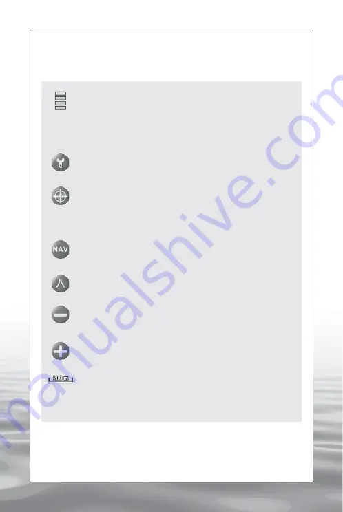
Intensity of GPS signal
This bar shows the intensity of the GPS signal.
One bar
indicates the minimum intensity (3 satellites received),
Four bars indicate the maximum intensity (6 or more
satellites received).
Settings
Opens the settings menu to set up the software.
Home
Centres the map on the boat
(when GPS signal is received).
Navigation Data
Visualizes the navigation data.
Caliper
Activates the A to B measuring function.
Zoom Out
Reduces the map.
Zoom In
Magnifies the map.
Map scale
Indicates the map scale, the unit of measure can be
choosen in the settings menu.
3. Getting started
3.1 The bar Menu
offered by www.Busse-Yachtshop.de email: info@busse-yachtshop.de


