21
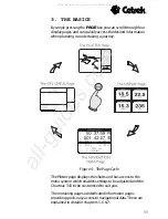
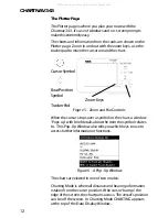
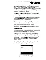
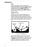
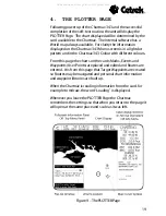
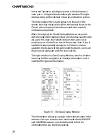
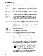
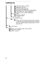
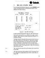
These windows give status and detailed information relating
to the electronic charts and the Chartnavs various functions.
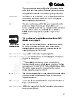
An explanation of the information displayed is given below:
CHARTING
This is the status, CHARTING or C is displayed when you
are planning your route. NAVIGATE or N is displayed
when navigating a planned route.
FIX
*
This tells you the status of the FIX (your position) from the
positioning device. The message tells you if the Local
Correction facility is switched ON, using the CHART DATUM or
WGS84. NOT GOOD, NOT RECEIVED or WRONG
FORMAT will be displayed if a suitable fix signal is not
received.
Wrong Format may be displayed until your GPS
obtains an accurate fix.
50 41.00 N
This is the vessels current position, calculated from the FIX.
001 56.00 W
If a Fix has never been received, a set of dashes will be
displayed instead of the vessels co-ordinates and the Fix
status will display NOT RECEIVED.
SOG: 10.2 kts
*
SOG Speed Over Ground may be displayed.
COG: 168.0
mag
*COG Course Over Ground may be displayed, 168 degrees
magnetic in this example.
* If the positioning instrument is not connected or its
message is badly received, a dash appears in place of the last
number in the FIX, SOG, SPEED, COG or HEADING data fields.
They will all appear as dashes on power up if a position
finding device has never been fitted.
SHIP TO ..........
This indicates that the distance and bearing information below
is from the vessels position to the Target or, if there is no
Target, to the cursor.
DST: 13.5 nm
DST is the distance from the ships-position to the cursor or
target, as stated above.
BRG: 052.0 mag
BRG is the bearing from the ships-position to the cursor or
target, as stated above.
All manuals and user guides at all-guides.com
all-guides.com

