51
12. USING ROUTES
A Route is a collection of Waypoints joined by straight lines.
The straight lines are tracks that your Chartnav can follow
automatically. Up to six routes can be held in the Chartnavs
memory which can be recalled and used at any time. The
Chartnav can follow a route from any of its Waypoints, to
either end, by entering a Target.
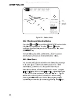
If a Waypoint is placed over a Mark or Event, the Chartnav use
the Multiple User Point symbol and both identification
numbers will be displayed.
Waypoints in a route are numbered so that the first number is
always the route number. For example Waypoints in Route 3
will be numbered 3.01, 3.02, 3.03 etc.
A Route may be plotted in either Charting or
Navigate Mode. However, Charting Mode allows
greater movement around the chart as the map
cursor controls the section of the chart that is viewed.
In Navigate Mode, although you may zoom in and
out, the region of the chart that is displayed is
controlled by the position of the vessel.
To make plotting and editing routes at sea easier, the Chartnav
343 has an Autolocate feature, when cursor is positioned near
the User Point.
12.1 Routes MENU
To make your route as accurate as possible, there are several
edit function available on the Chartnav 343.
From the PLOTTER Page use the
MENU
key to call up the Top
Menu Panel. The PLOTTER option will already be highlighted,
simply press the
SELECT
key and new menu options will be
displayed. ROUTES, the first option, is already selected so
press the
SELECT
key again to access the Routes Menu.
The six available Routes will be listed across the top of the
screen, ensure that the Route you wish to edit is highlighted.
Having selected the appropriate Route the first set of edit
options can be found in the Side Menu.
All manuals and user guides at all-guides.com
all-guides.com

