l
Postprocessing:
Also known as baseline processing. Refine the GNSS data collected during the flight to
achieve highly accurate image positions, using postprocessing software such as Trimble Business
Center software. The output is called a trajectory.
l
Image processing:
Use the postprocessed data to create high absolute accuracy deliverables such as
orthophotos and point clouds, using image processing software such as Trimble Business Center
software.
Software overview
l
l
l
l
l
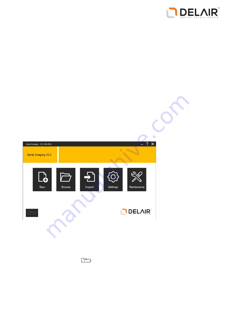
The Home screen
When you open the Aerial Imaging software, the
Home
screen appears.
The
Home
screen is shown below:
From this screen you can:
l
Create a new project or import a project. Alternatively, browse to the
Projects
screen to view available
projects. See
.
l
Change system settings. See
Changing the system settings, page 16
.
l
Access the
Maintenance
screen. See
Performing maintenance, page 17
To return to the current job, click
.
13
Delair-Tech
|
676, Rue Max Planck – 31670 Toulouse-Labège, France
|
Tel: +33 (0) 5 82 95 44 06
|
Capital: 238 110,30 € - APE: 3030Z – Intra-Community VAT number: FR90 53 09 69 781 – 530 969 781 R.C.S. Toulouse
This document is the sole property of Delair-Tech and cannot be used or reproduced without the written authorization of Delair-Tech
.


