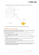
Unlike a normal landing, you are not prompted to confirm landing before the final leg of the landing.
If communication resumes during this automatic failsafe, the rover continues the landing sequence.
Overspeed protection
If the rover detects a steep and fast decline, it will maximize drag to minimize the impact on the ground. The
aircraft will descend in a "flat-spin"-like flight trajectory.
Geofence
If the rover reaches a geofence boundary, it activates the HERE pattern (see
) and returns to the vicinity of the GCS location.
The use of a geofence boundary is optional and can be set in the
Flight Settings
screen. For more
information, see
Managing flight settings, page 38
Emergency software commands
The
Dashboard
tab of the Aerial Imaging software provides several buttons for taking emergency action
when the rover is in flight.
Note –
l
Tapping any button in this screen overrides any previous command, including any previous button
press in this screen. If you initiate an emergency command and then initiate a second emergency
command before the first command is completed, the rover immediately terminates the first
command without completing it and begins the second command.
l
The only button available when the rover is below 50 m (164 ft) during takeoff is
.
Land
Use the
button when the flight must be terminated and there is time and space for a pre-planned
landing.
When you tap
, the rover immediately terminates its flight plan and initiates a normal landing sequence.
It flies at the desired flight height to the entry point which is located 300 m (984 ft) from the landing
location. If the
Land
command is initiated during the transition between blocks which are at different
heights, the
desired flight height
is the height of the next block. If the flight height of the next block is:
l
lower
than the previous block, the aircraft flies to the landing entry point while
descending
.
l
higher
than the previous block, the aircraft flies to the landing entry point while
ascending
.
When the aircraft has reached the landing entry point but is not yet at a height of 75 m (246 ft) + the landing
offset, it starts circling downward in 200 m (656 ft) diameter circles until it reaches a height of 75 m (246 ft) +
the landing offset. The aircraft then orbits until you do one of the following:
l
To complete the landing, tap
in the message box on the map. The aircraft finishes circling when all
landing conditions are met and then it starts the final leg of the landing.
l
To release the
Land
command, tap the
button again. The aircraft returns to the start of the flight
line it was on when the flight plan was interrupted, and resumes mapping when it reaches the point
that mapping paused.
88
Delair-Tech
|
676, Rue Max Planck – 31670 Toulouse-Labège, France
|
Tel: +33 (0) 5 82 95 44 06
|
Capital: 238 110,30 € - APE: 3030Z – Intra-Community VAT number: FR90 53 09 69 781 – 530 969 781 R.C.S. Toulouse
This document is the sole property of Delair-Tech and cannot be used or reproduced without the written authorization of Delair-Tech
.


