1
Getting Started
Welcome to Topo USA
These are just some of the many features that you can enjoy with Topo USA®.
•
Try our data downloads for free! Included with your purchase is a download
certificate for $40 worth of data and imagery using the NetLink tab
(registration required). You can also subscribe to the DeLorme Map Library for
unlimited downloads.
•
Send map downloads directly to your Earthmate PN-Series GPS through the
Exchange dialog.
•
Map Library subscriptions allow you to download unlimited data and imagery
for just $29.95 a year.
•
Exchange maps, tracks, routes, and waypoints with an Earthmate PN-Series
GPS.
•
Search for trails, state parks, mountain peaks, unique natural features, points
of interest, and more.
•
View your maps in 3-D and fly over the terrain with shaded relief, detailed
land use/land cover features, and elevation contours.
•
Use the Handheld Export tab to create custom maps to send to your
Earthmate PN-Series GPS.
•
Use the split-screen functionality to view two types of data for the same
location at the same time.
•
Create trail, road, or direct routes by adding start and finish points on your
map. Customize your route by adding stops and vias.
•
Use the toolbar to share maps, add data and images to the map,
open/create/save projects, start/stop GPS, edit your preferences, and more.
•
Profile map items and objects you draw/add to the map to determine
coordinate information, linear distance, elevation, grade, and so on.
•
Print high quality, detailed, 2-D or 3-D single-page maps, and/or mural maps
as large as 3 x 3 pages. You can even print routes, route directions, and
profiles.
•
Import .loc or .gpx files from www.geocaching.com that you can then transfer
to an Earthmate PN-Series GPS.
•
Create custom keyboard shortcuts or select a DeLorme shortcut scheme, such
as 3-D Navigation, to navigate the program more easily than ever.
•
Connect your GPS device to the program and track your progress on a laptop
as you travel.
•
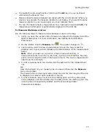
Use the Measure tool to measure linear distance or the area and perimeter of
a polygon measurement object on the map.
•
And much more!
What's New in Topo USA
•
PN-Series features
•
Automatically add a NetLink Map Library map package to the Exchange
dialog for immediate transfer to your device—no map cutting required
Summary of Contents for Topo USA 8.0
Page 1: ...Topo USA 8 0 User Guide ...
Page 2: ......
Page 32: ......
Page 44: ......
Page 76: ......
Page 90: ......
Page 162: ......
Page 204: ......
Page 240: ......
Page 250: ......
Page 274: ......
Page 280: ...Topo USA User Guide 270 Z ZIP Postal Codes 36 Zone 234 Zoom Tools 10 20 Zooming In and Out 10 ...


