Copyright © 2022 DJI All Rights Reserved.
40
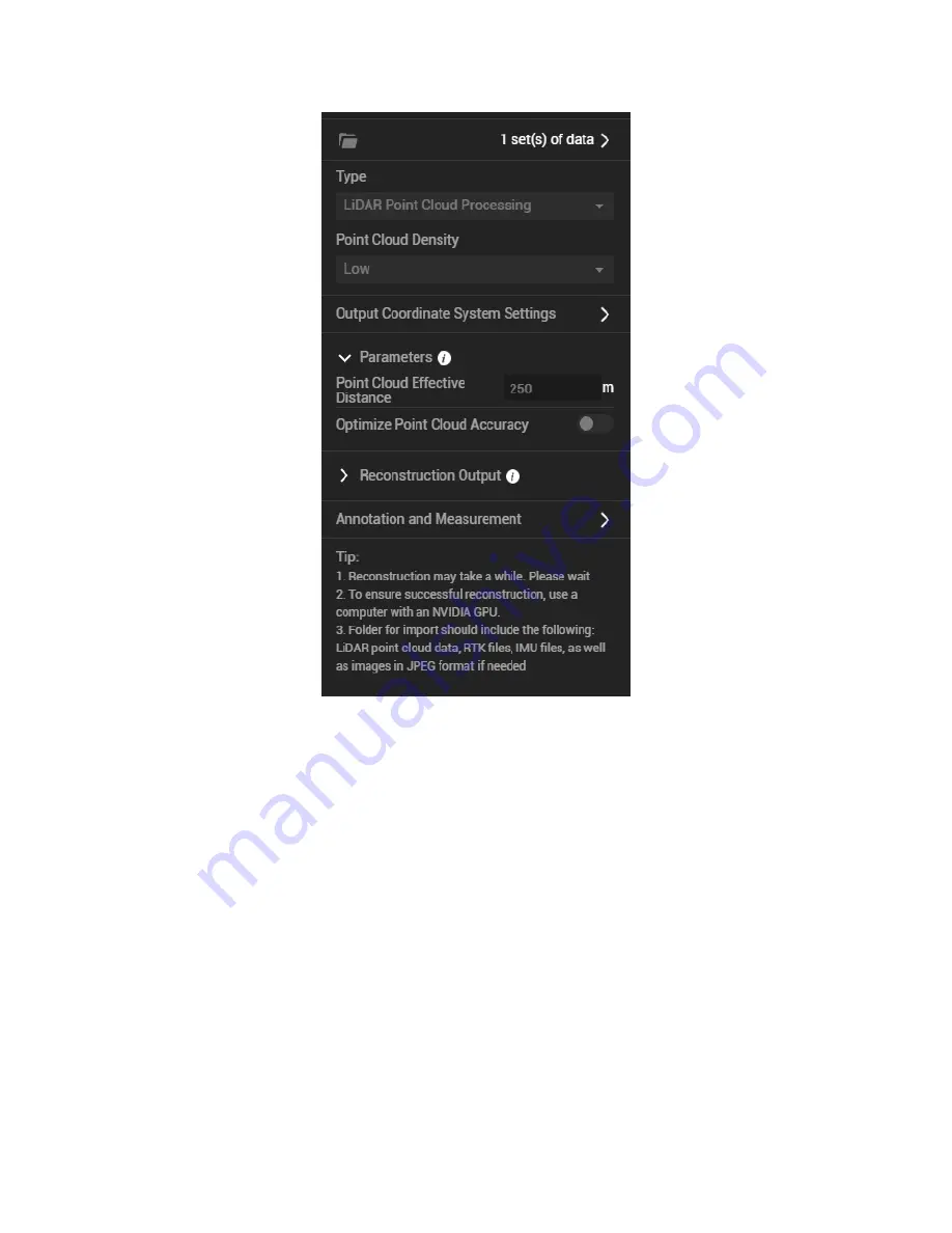
Figure: Reconstruction parameter settings
(6)
Select the Reconstruction Output Format
3D point clouds in PNTS (the format used for display in DJI Terra) and LAS format (the standard
format of airborne LiDAR output) will be selected by default. You can also choose to output the point
cloud in PLY (for MeshLab), PCD (for CloudCompare), or S3MB (for SuperMap) format.
(7)
Start Processing
Click "Start Processing" to start reconstruction. During processing, you can click "Stop" to pause the
process, and the software will save the current progress. If you resume the process, the software will
continue data processing from the breakpoint.

