Copyright © 2022 DJI All Rights Reserved.
43
4.3 Result Files
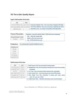
The result files output by DJI Terra include a LAS point cloud result and an OUT trajectory file.
Figure: Result files output by DJI Terra
*.las: The LAS point cloud output by DJI Terra is the standard result of airborne LiDAR. The LAS
version is V1.2 and the file can be directly imported to most analysis software. The LAS result records
information such as the 3D point coordinates, RGB color information, reflectivity, time, number of
echoes, the echo that each 3D point belongs to, the total number of points in each echo, and the scan
angle.
*_sbet.out: The post-processing trajectory file of the mission, which records the trajectory information
after adjustment and solution. The file can be imported into third-party software for trajectory display.
During DJI Terra's data processing, the point cloud accuracy optimization function is an adjustment
process. For this reason, you don't need to perform a second adjustment using third-party software.
The file is stored in binary format, and its data items, units, and types are as follows:
Item
Unit
Type
Size
GPS Time (seconds of week)
seconds
double
8 bytes
Latitude
radians
double
8 bytes
Longitude
radians
double
8 bytes
Altitude
meters
double
8 bytes
x body velocity
meters/second
double
8 bytes

