Ignis Operations Manual
Drone Amplified
Touching the boxed drone icon in the Ignis menu opens the Geofencing Menu, shown in
Figure 7.14.1. While this menu is open, touching spots on the map will mark that location as
a corner of the area constraining Ignis to. Touch each corner of the burn area in a clockwise
or counter-clockwise order to specify the burn area. You can use the Undo and Clear
buttons to remove corners that have been added. You can drag corners of the geofence to
move them.
Ignis will not be allowed to drop if the drone is flying outside the geofenced area, or if
the drone is flying and no geofenced area has been defined. If the drone leaves the
geofenced area, Ignis will automatically stop dropping.
Touch the boxed drone icon again to close this menu.
7.15 Waypoints
On DJI Drones, the remote controller must be in mode F in order for the drone to fly
waypoint missions.
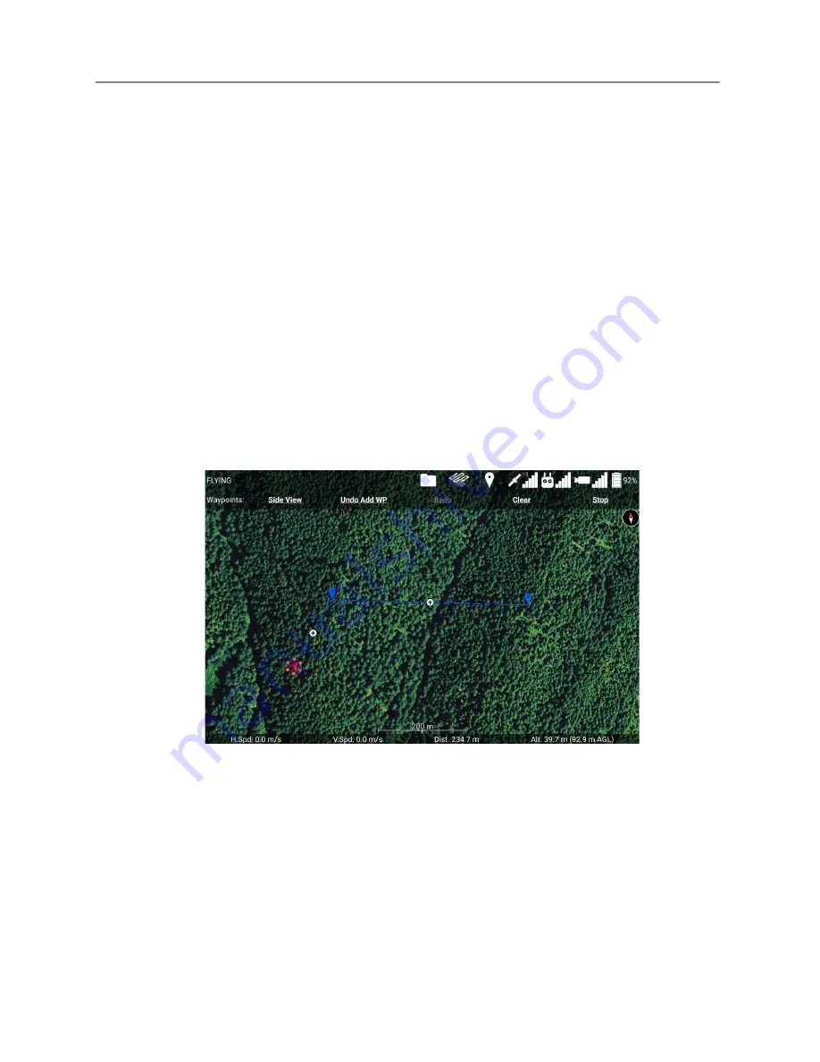
Figure 7.15a: Waypoints Menu.
Touch the balloon-shaped Waypoint icon at the top of the screen to open the Waypoint
Menu.
While the Waypoint Menu is open, touching the map will place a waypoint at the
touched location. The figure above shows a sequence of 2 waypoints that have been placed.
You can drag waypoints to move them around. You can touch the + button between two
Last Updated
Page 123
Apr 13, 2022


