

HSI Operation
EFIS-D10A Pilot’s User Guide
6-9
source. If you wait more than 5 seconds without adjusting anything or pressing any buttons, the selection self-
clears.
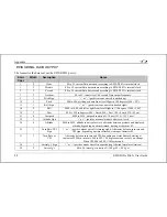
6.
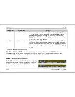
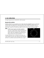
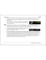
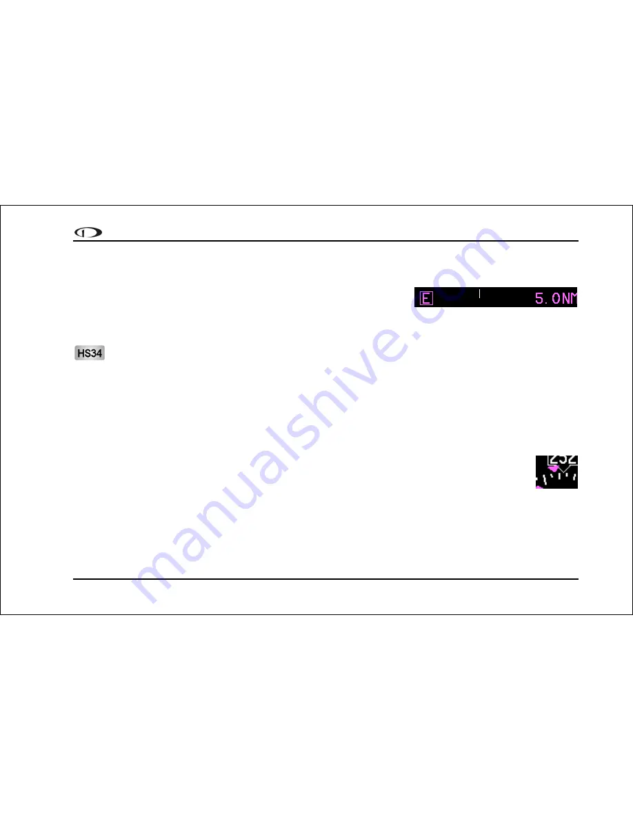
Scale indicator. This shows you what scale the CDI is using. Since
serial GPS streams do not indicate the correct scaling mode, this must
be configured manually with the "scale" button under the HSI menu.
The three options are "E" for enroute (5 n.m. full scale), "T" for terminal (1 n.m. full scale), and "A" for
approach (0.3 n.m. full scale). The current scale name and full scale range is indicated on the screen.
When the HS34 is hooked to a GPS unit via ARINC-429, the system can read the scaling from the ARINC-429
connection. When connected this way, the scaling auto-updates and follows the GPS. The indication on the
screen for mode and range should match the mode and range of the GPS at all times. When in this mode, the
range is not limited to just 5/1/0.3nm, as the GPS may slide between scales, so it would not be unexpected to
see a number such as 0.8 on the screen. Because of this behavior, on the final phases of an approach, a GPS
hooked to the HS34 via ARINC-429 acts much like a VOR receiver would with the CDI acting as angular
deflection, not linear distance. There are still only three master modes of Enroute, Terminal, and Approach,
which are annunciated on the screen.
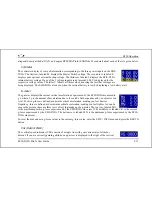
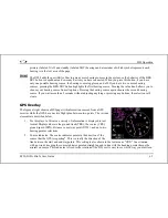
7.
Track indicator. This indicates your direction over the ground as reported by the GPS. This is
different than your magnetic heading when there are crosswinds present. Since this is your actual
ground track, keeping this directly above your course pointer keeps you on course, even if your
magnetic heading is different. As long as a valid GPS source is detected by the system, the ground
track indicator can be displayed. This is not dependent on the currently set nav source.
Summary of Contents for EFIS-D10A
Page 2: ......
Page 8: ...Table of Contents viii EFIS D10A Pilot s User Guide Appendix D EFIS D10A Specifications 8 8...
Page 34: ......
Page 60: ......