


Page | 32
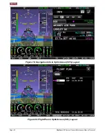
SkyView
HDX System
General Maintenance Manual, Revision F
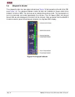
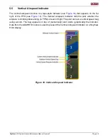
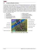
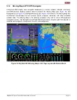
5.11
Synthetic Vision
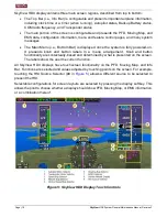
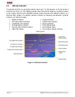
A SkyView HDX display provides a synthetic vision representation of the local terrain and
obstacles. This display is for advisory purposes only and must not be used as the sole means
of terrain and obstacle avoidance.
When enabled, terrain clearance advisories are provided based on the predicted path of the
airplane relative to the terrain database and the proximity of the aircraft to terrain.
The synthetic vision advisory is based both on altitude and on flight path. Terrain shown in Red
is an immediate threat to the airplane. The map advisory is based solely on GPS altitude.
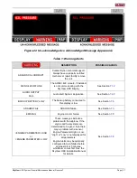
•
YELLOW terrain is between 100 and 1000 feet below airplane GPS altitude.
•
RED terrain is above the airplane, or 100 feet or less below the airplane.
NOTE:
Terrain advisories are provided any time they are enabled, even if topographical relief is
not shown on the map.
When enabled, terrain advisories are suppressed prior to takeoff and are enabled approximately
200 feet above the takeoff altitude.