
SV-MAP-270 Navigation Mapping Software
SkyView Pilot’s User Guide - Revision M
7-45
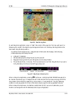
Using User Waypoints
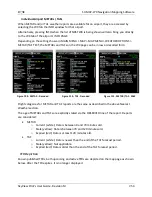
User Waypoints are searchable via the “USER” tab on the “Nearest” window. The “USER” tab
only appears if there are User Waypoints stored in SkyView.
User Waypoints can also be found like any other airport or navaid by searching on identifier or
name in the Info Window.
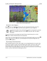
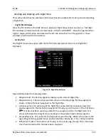
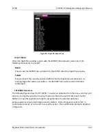
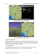
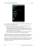
Map Preferences
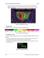
Go to MAIN MENU > MAP > MAP MENU> to adjust the following map preferences and options:
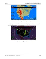
Weather Options–(if equipped) Adjusts the display of weather-related options. See the
Weather section of this chapter for further information about the options in this menu.
Map Mode–Use these settings to specify when the map is displayed in “Track Up” vs.
“North Up” orientations. Additionally, you can choose whether VOR directions are
shown as “bearings” (the direction the VOR is relative to the aircraft position) or
“radials” (what radial the aircraft is on relative to the VOR, with the published deviation
of the VOR station correctly taken into account, like would be seen on a sectional) when
listed on the NRST page.
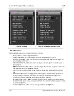
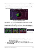
Map Items–Use these settings to specify the largest zoom level that the various features
are displayed.
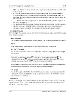
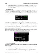
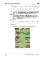
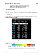
Info Items–Use these settings to display up to 10 informational items along the left and
right sides of the Map Page Items available for display include:
o
Bearing to Waypoint
o
Cross Track
This is the shortest possible distance that can possibly be traveled that
will put you back on course. Essentially, it is the perpendicular distance
from the current location to the course line.
o
Current Location
o
Destination Waypoint
Identifier of the final waypoint in your flight plan.
o
Distance to Go
The total distance remaining along the flight plan.
o
Distance to Waypoint
Distance to the currently active waypoint.
o
ETA (Final)
The estimated time of arrival at the final waypoint in the flight plan. This
time does not account for time zone changes. If GPS ground speed is <25
knots, your Vno speed setting is used for so that you can see approximate
travel times while on the ground.
o
ETA (Next)
The estimated time of arrival at the next waypoint in the flight plan. This
time does not account for time zone changes. If GPS ground speed is <25
knots, your Vno speed setting is used for so that you can see approximate
travel times while on the ground.