SV-MAP-270 Navigation Mapping Software
7-52
SkyView Pilot’s User Guide - Revision M
o
Current (green) – Data is between 0 and 60 minutes old.
o
Stale (yellow) – Data is between 60 and 75 minutes old.
o
Expired (red) – Data is at least 75 minutes old.
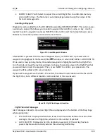
METAR/TAF Information
Textual METARs and TAFs are can be viewed for individual airports on their INFO pages.
Additionally, a summary of the nearest METAR weather reports for airports that report METAR
information can be found in the NRST list.
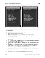
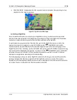
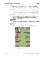
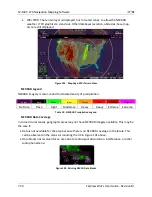
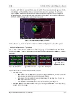
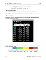
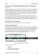
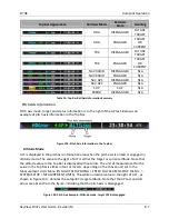
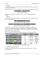
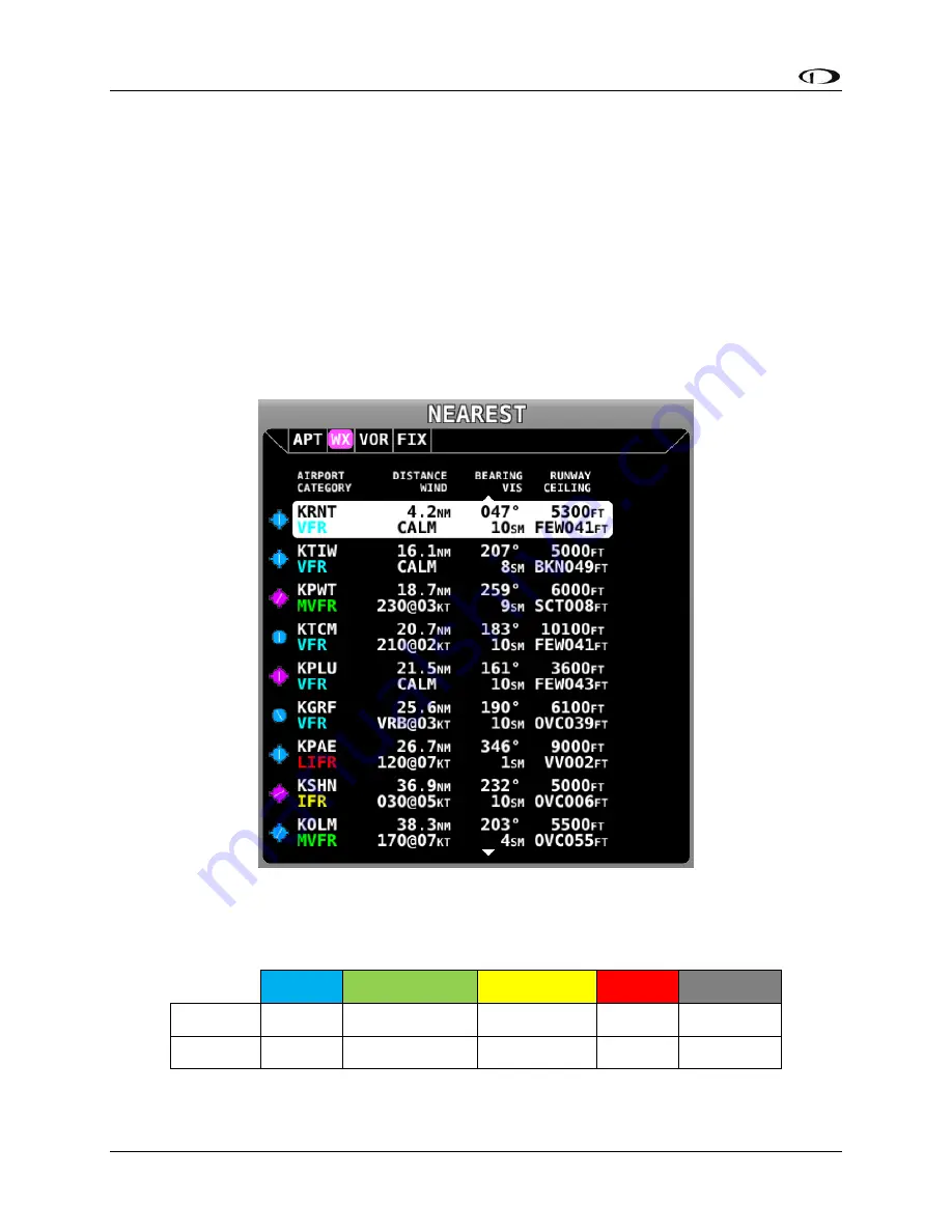
Nearest Weather
The MAIN MENU > MAP > NRST window will contain a WX (weather) tab whenever weather
information is available to SkyView:
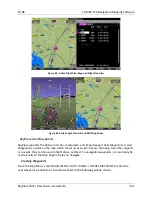
Figure 108 - Nearest WX
The flight category below the airport identifier indicates the weather conditions at the airport.
Possible flight categories are:
VFR
MVFR
IFR
LIFR
UNKNOWN
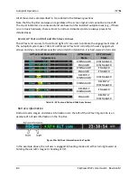
Visibility
> 5 NM
3-5 NM
1-3 NM
< 1 NM
Unknown
Ceiling
> 3000’
1,000’ - 3,000’
500’ – 1000’
< 500’
Unknown