SV-MAP-270 Navigation Mapping Software
SkyView Pilot’s User Guide - Revision M
7-53
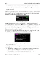
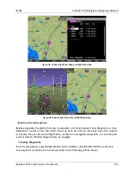
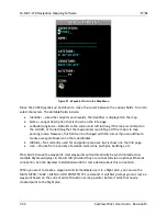
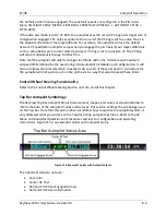
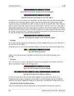
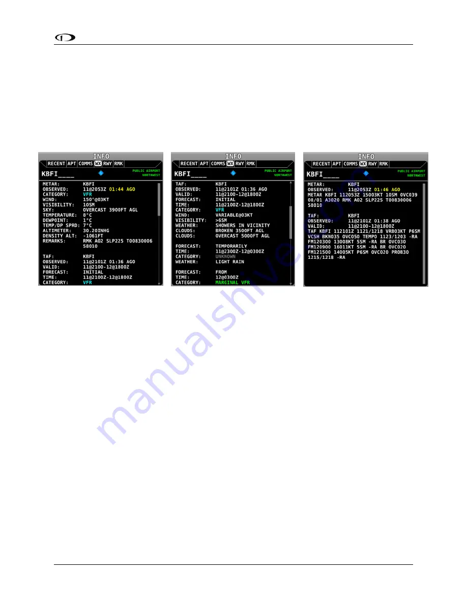
Individual Airport METARs / TAFs
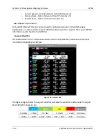
When METAR and/or TAF weather reports are available for an airport, they are accessed by
selecting the WX tab the INFO window for that airport.
Alternatively, pressing INFO when the list of NRST WX is being shown will also bring you directly
to the WX tab of the airport’s INFO PAGE.
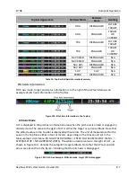
Depending on the setting chosen in MAIN MENU > MAP > MAP MENU > WEATHER OPTIONS >
METAR/TAF TEXT, the METARs and TAFs on the WX page can be in raw or decoded form:
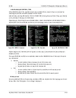
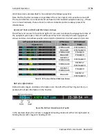
Figure 109 - METAR - Decoded
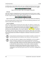
Figure 110 - TAF - Decoded
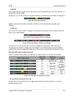
Figure 111 - METAR/TAF - RAW
Flight categories for METAR and TAF reports are the same as described in the above Nearest
Weather section.
The age of METARs and TAFs are explicitly stated via the OBSERVED line of the report. Reports
are considered:
METAR
o
Current (white): Data is between 0 and 70 minutes old.
o
Stale (yellow): Data is between 70 and 120 minutes old.
o
Expired (red): Data is at least 120 minutes old.
TAF
o
Current (white): Data is newer than the end of the TAF forecast period.
o
Stale (yellow): Not applicable.
o
Expired (red): Data is older than the end of the TAF forecast period.
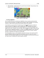
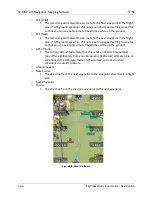
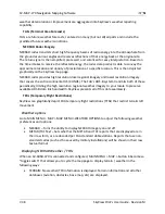
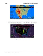
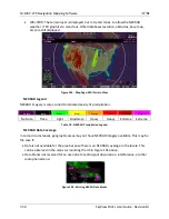
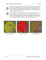
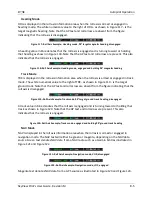
TFR Depiction
Known published TFRs, both upcoming and active TFRs are depicted on the map page as shown
below. After the TFR expires, it is no longer displayed.