SV-MAP-270 Navigation Mapping Software
7-18
SkyView Pilot’s User Guide - Revision M
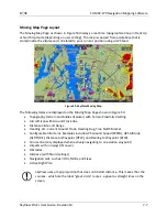
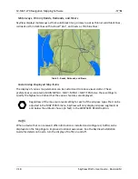
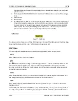
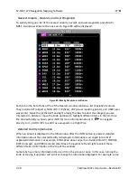
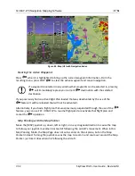
Motorways, Primary Roads, Railroads, and Rivers
SkyView displays motorways as thick solid black lines, primary roads as thinner solid black lines,
railroads as thin dark lines with railroad “ties”, and rivers as thin blue lines:
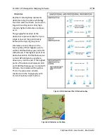
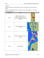
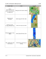
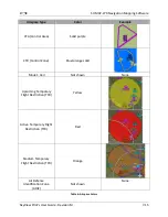
Table 9 - Roads, Railroads, and Rivers
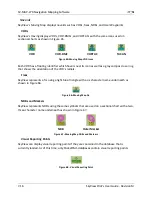
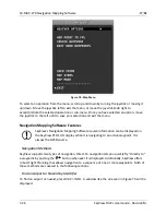
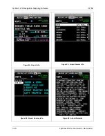
Customizing Displayed Map Items
The display of various map elements can be customized to reduce visual clutter. These
preferences are located in MAIN MENU > MAP > MENU > MAP ITEMS. Use these settings to
specify the highest zoom level that the various features are displayed.
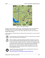
Regardless of the max zoom level setting for each of the airspace types that can be
adjusted in the MAP ITEMS menu, SkyView will only display airspace segments at
and below the altitude chosen (in feet) in the AIRSPACES BELOW option.
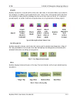
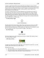
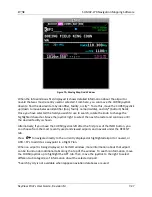
Traffic
When a device that can receive traffic information is installed and configured, traffic can be
displayed on the Map Page to improve situational awareness. See the SkyView Installation
Guide for details on how to turn the display of traffic on and off.