SHANGHAI ESURVEY GNSS CO., LTD.
63
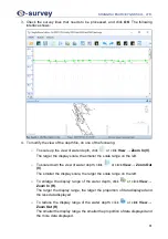
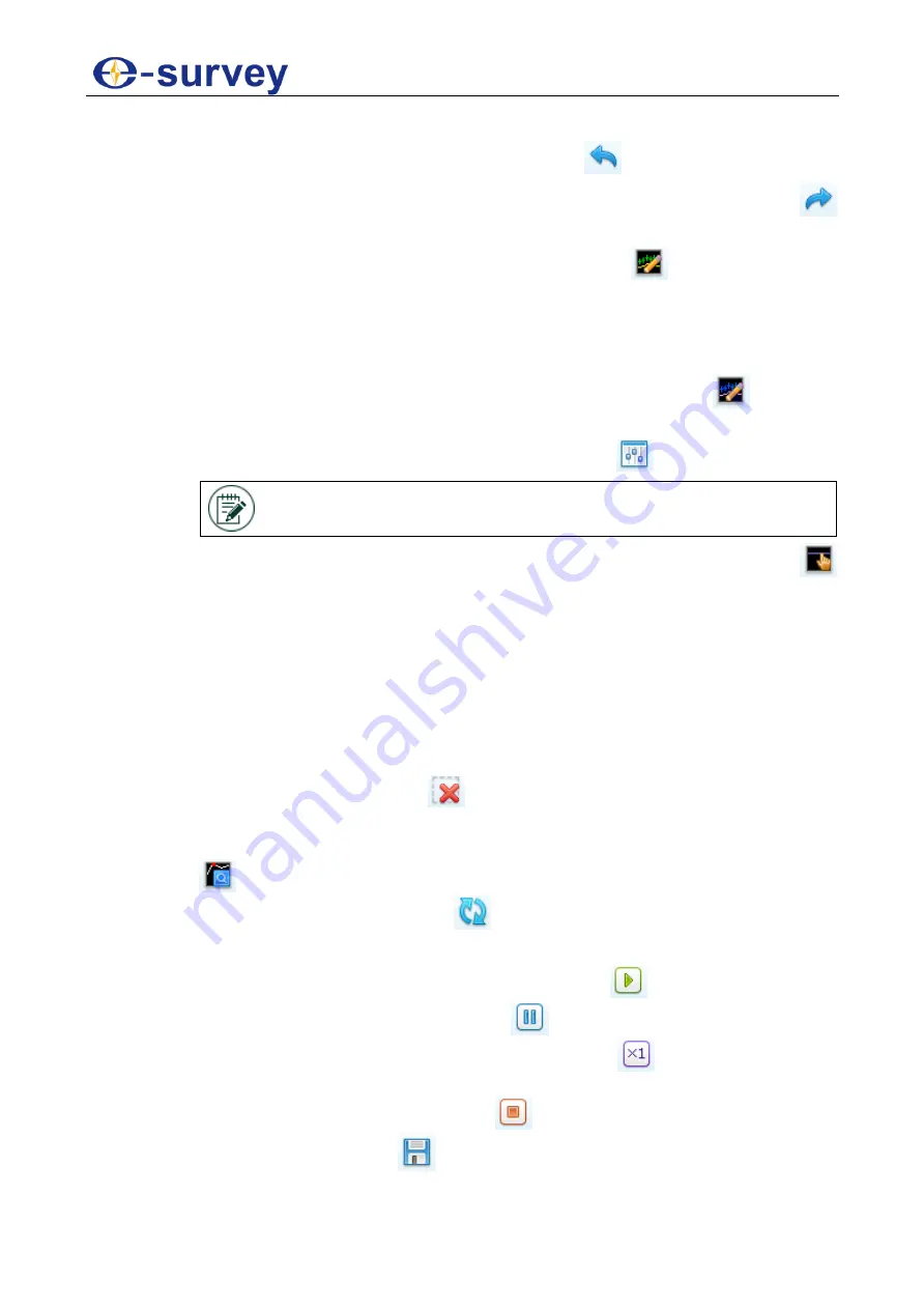
6. To modify the depth line, do the following:
o
To reverse the action of an earlier action, click
or click
Tool
→
Undo
.
o
To restore any actions that were previously undone using an undo, click
or click
Tool
→
Redo
.
o
To manually smooth the abnormal water depth, click
or click
Tool
→
Edit
Depth H
, hold down the left mouse button, and draw the track to be modified
on the abnormal line segment. The abnormal segment turns to be the target
track.
If your vessel is equipped with the dual frequency single beam echosounder,
please modify the abnormal depth at low frequency by clicking
or clicking
Tool
→
Edit Depth L
.
o
To automatically smooth the abnormal depth, click
or click
Tool
→
Auto
.
NOTE:
After automatically smooth the abnormal water, please
check if there are missing depth points and manually smooth them.
o
To move the elevation line of water surface (the purple dotted line), click
or click
Tool
→
Moving Surface Line
, hold down the left mouse button, and
drag the elevation line to the target position.
When the elevation of water surface is between 0 m and 9.9 m, the
scale where the elevation line is located is the elevation value.
When the elevation of water surface is greater than 9.9 m, the scale
where the elevation line is located is the digit and decimal of the
elevation value.
o
To delete the problematic depth points and use the surrounding depth to
interpolate the region, click
or click
Tool
→
Delete Data
, select a region
on the depth line, and click
OK
in the confirmation popup.
o
To jump to the point with zero depth so as to conveniently process data, click
or click
Tool
→
Next 0 Depth Value
.
o
To refresh all depth data, click
or click
Tool
→
Refresh
.
7. To play the depth line, do the following:
o
To automatically start playing the depth line, click
.
o
To pause playing the depth line, click
.
o
To speed up or slow down the playing speed, click
and modify the speed
among 1, 2 times, 4 times and 8 times.
o
To stop playing the depth line, click
.
8. To save the modification, click
, click
OK
in the confirmation popup.
Summary of Contents for VE115
Page 1: ...Shanghai eSurvey GNSS Co Ltd 1st Edition V1 0 Unmanned Vessel Control System USER GUIDE VE115...
Page 2: ......
Page 4: ...SHANGHAI ESURVEY GNSS CO LTD...
Page 6: ...SHANGHAI ESURVEY GNSS CO LTD II...
Page 16: ...SHANGHAI ESURVEY GNSS CO LTD 10 2 Select English and click Next 3 Click Next...
Page 26: ...SHANGHAI ESURVEY GNSS CO LTD 20 2 2 2 2 2 Setting Page The Setting page is as shown as follows...
Page 53: ...SHANGHAI ESURVEY GNSS CO LTD 47 5 In Device page do the following...
Page 73: ......

