60
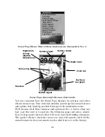
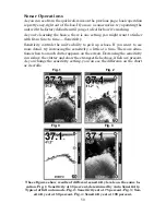
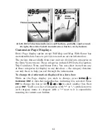
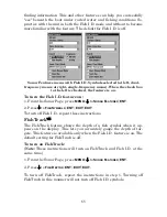
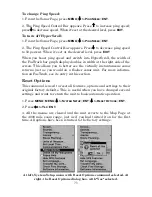
At left, little ColorLine indicates a soft bottom, probably sand or mud.
At right, the wider ColorLine indicates a harder, rocky bottom.
Customize Page Displays
Every Page display option except Full Map and Map With Sonar has
customizable data boxes to provide constant on-screen information.
The various data available from your unit are divided into categories in
the Data Viewer menu. These categories include GPS Data, Navigation,
Trip Calculator, Time, and Sonar Data. You can select items from any
of these categories for display in any data box — the category divisions
are only there to help you sort through the information.
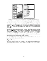
To change the information displayed in a data box:
While on the Page display you wish to change, press
MENU
|
↓
to
C
USTOMIZE
|
ENT
. A data box name flashes, indicating it is selected. Press
ENT
to change the box or hit
↑
,
↓
,
→
or
←
to select another box, then
press
ENT
. You'll see a list of categories with "+" or "–" symbols next to
each category name. A category with a "+" next to it is
expandable
,
meaning its contents are hidden.
Wider
ColorLine
Thin or no ColorLine
Summary of Contents for FishElite 500C
Page 22: ...14 Notes ...
Page 98: ...90 Notes ...
Page 132: ...124 Notes ...
Page 176: ...168 Notes ...
Page 198: ...190 Notes ...

