CHAPTER 5
REFERENCE GUIDE
EFD1000/500 MAX MFD Pilot’s Guide
Page 5-2
091-00006-002 ()
EFD1000/500 MAX MFD Pilot’s Guide
Page 5-3
091-00006-002 ()
Figure 5-2
Navigation Map VIEW,
VFR Style Map, Showing
Hot Key Menu, Page 2/2
5.1 Navigation Map
The Navigation Map VIEW is a pilot configurable, moving map. The Navigation Map
VIEW’s default map style is a VFR map, oriented North-Up with the Ownship symbol
located at the center of rotation of the map displaying a 360° range ring. The pilot
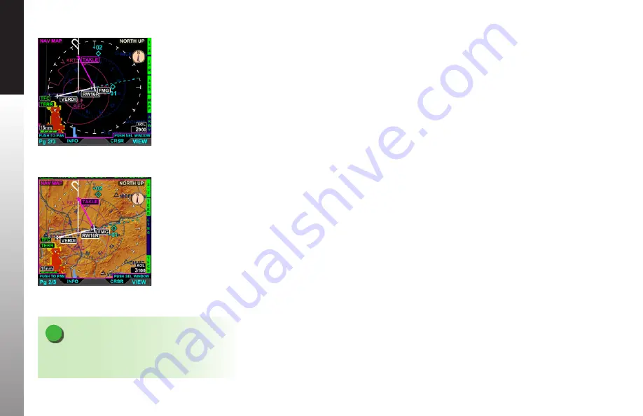
can select either an IFR (
Figure 5-1
) or VFR (
Figure 5-2
) style map via a Hot Key. The
remaining Hot Keys provide the pilot options to select the range ring type, change the
map declutter settings, and will display airways, terrain, traffic, and weather overlays.
When climbing or descending toward the Altitude selected on the PFD, the Nav
Map will display an altitude intercept arc that show the location the aircraft will reach
the selected altitude at the current instantaneous vertical speed. This feature can be
disabled in the main menu.
The current height above ground (AGL), as computed from ownship altitude and
terrain height directly below the aircraft, is shown in the AGL box in the lower right
of the display. The AGL values are rounded down to the next hundreds of feet (i.e., 899’
is rounded to 800’).
The Navigation Map VIEW has either eight or twelve Hot Keys, organized into two or
three menus depending upon what optional equipment is configured. The first Hot
Key is labeled 1/X , 2/X, or 3/3 (depending on the menu you are viewing) as outlined in
Table 5-1
. If the feature controlled by the Hot Key is not configured, the associated Hot
key Legend is blank. .
Figure 5-1
Navigation Map VIEW,
IFR Style Map, Showing
Hot Key Menu 1/2
NOTE
Depending upon the installation settings, some Hot
Key labels may be blank.


