C
ONFIGURATION
C
OMMAND
S
ET
- F
IRMWARE
R
EVISION
2.4.0_
BETA
-
V
ERSION
1.0.0
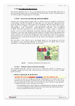
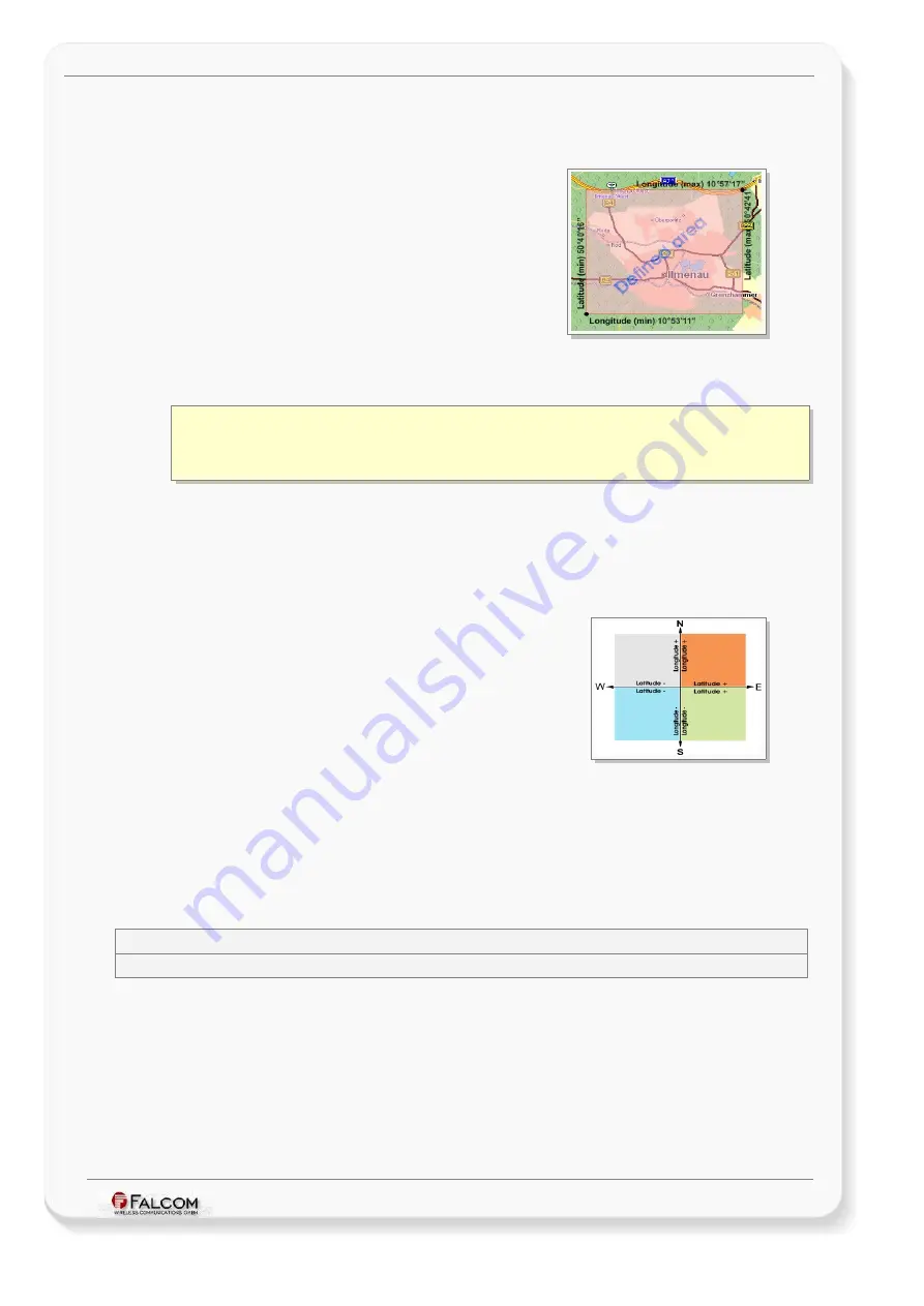
Locate the zone you want to define on the map, and note down the
min
longitude/Latitude and the
max
longitude/Latitude coordinates of a rectangle that
defines the zone/GeoFence, as shown in figure below.
Figure 6:
Determine the Zone’s Grid Coordinates
In our example
(in degrees, minutes, seconds)
:
Longitude (min)
= 10°53’11”
E
Latitude (min)
= 50°40’16” N
Longitude (max) = 10
°
57’17” E
Latitude (max)
= 50°42’41” N
In order to convert coordinates from degrees, minutes, seconds format to decimal
format, refer to chapter
, “How to convert the coordinates”
,
You have now determined the grid coordinates for your rectangular zone/GeoFence.
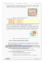
One last step before setting up the configuration, is to determine the sign of the
coordinate values. Please remember that, Latitude North and Longitude East are
positive and Latitude South and Longitude West are negative (see also figure below):
Figure 7:
Determining the sign of the coordinate values
3.2.24.2 Set up the Geofencing zones and areas
Set up the configuration as normal based on the parameter syntax, and enter the
parameters as indicated in chapter
. The set values are
$PFAL,Cnf.Set,GF3= area<
flag
>,"
name
",R,<
La_Min>
,<
Lo_Min
>,<
La_Max
>,<
Lo_Max
>
$PFAL,Cnf.Set,GF3= area<
flag
>,"Ilmenau",R,50.6711,10.8863,50.7113,10.9547
An established GeoFence supports two different events:
1. when the vehicle enters the pre-defined GeoFence boundaries.
2. when the vehicle leaves into the pre-defined GeoFence boundaries.
An area supports also two different events:
1.
when the vehicle enters into the area boundaries
*
.
2.
when the vehicle leaves the area boundaries
*
.
*
geographic boundaries are set automatically from a collection of set Geofences
This confidential document is a property of FALCOM and may not be copied or circulated without previous permission.
Page 199 of 271


