Navigator Menu
7
Navigation Photo
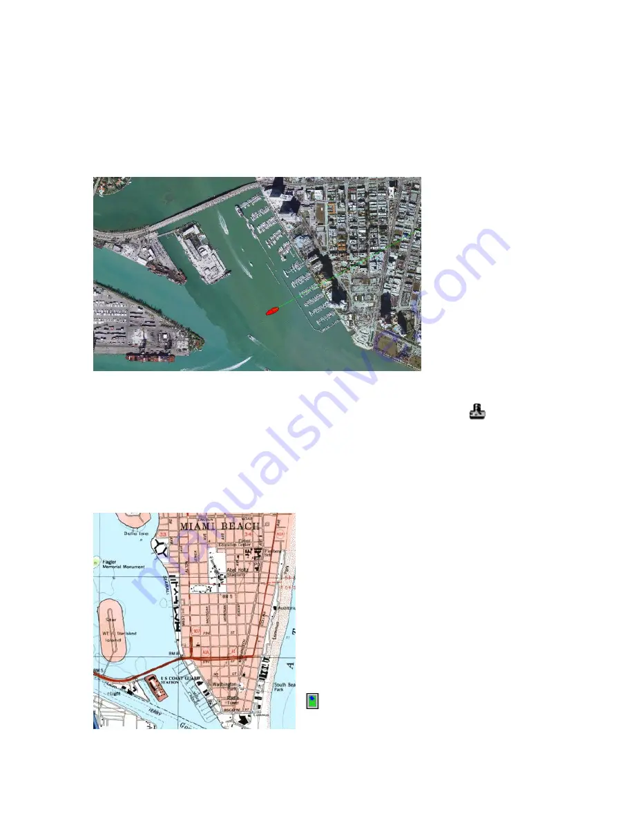
Navigation photos are created from satellite or aerial images, and are available for many
coastal areas.
Navigation photos provide some inland coverage, showing buildings, roadways, etc. in
greater detail than nautical charts. Bodies of water are sometimes darkened or
otherwise edited to remove glare, making it easy to see your vessel icon.
To open a navigation
photo, you must first
be viewing a nautical
chart. To switch to a
navigation photo for
the area you’re
viewing, touch
Mode
,
Navigation Photo
.
When no navigation photo is available for the area, the “Navigation Photo” menu option
is displayed with darkened print and cannot be selected, as pictured above.
In the chart list, Navigation Photo Charts are indicated with a camera icon
Topo Map
Some of Faria’s digital chart packages include USGS topographic maps covering up to
five miles inshore from coastal areas. If you have installed these Topo Maps, you can
use them to get a more detailed look at coastal terrain.
When you are cruising close to shore in an
area where you have Topo Map coverage,
touch
Mode, Topo Map
to open a map of your
area.
You can also select Topo Map titles directly
from the chart list, which can be handy if
you’re planning a visit to a specific harbor or
town: press
View, Chart
and select a Topo
Map title.
In the chart list, Topo Maps are indicated with
a green map icon.
Summary of Contents for Maestro
Page 1: ...User s Manual TM IS0270 rev A ecr 8171 3 2010 ...
Page 2: ......
Page 8: ......
Page 50: ......
Page 68: ......
Page 86: ...Maestro Navigator 3 5 3 doc 82 ...
Page 90: ......
Page 94: ...Maestro Navigator 3 5 3 doc 90 ...
Page 122: ......
Page 140: ......
Page 142: ......


