427-0101-01-12 Revision 100
September 2020
33
This document does not contain any export-controlled information.
Configuration
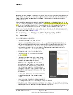
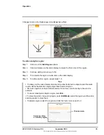
To upload a reference map image and calibrate the radar to the map:
Step 1
Using an online map or GPS service such as Google Maps, download a reference map
image.
For example, if you use Google Maps or another online map, you can take a screenshot of
a satellite view of the radar’s detection range. In Windows 10, you can use the default
keyboard shortcut (Windows logo key + Shift + S) to take the screenshot, paste the
screenshot into an image editor (for example, Paint), and then save the image in JPG or
PNG format. The size of JPG files are optimized better.
Tips
Step 2
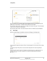
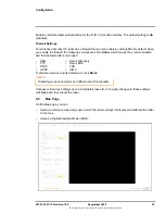
Identify two calibration points for which you can obtain accurate and exact latitude and
longitude coordinates. For example, intersections of two roads or highways.
For optimal calibration, the two calibration points should be as far apart as possible and on
opposite sides of the map image. For example, at top-right and at lower-left.
Step 3
Under Map Display, click
Find file
, and then click
Upload
.
If the map successfully uploads, a confirmation message appears.
Click
Accept
.
If a map does not successfully upload, try again. Try changing the quality or compression
of the map image. Higher quality or lower compression increases the map file size.
When you take the screenshot, make sure that north is straight up in the map image and
that the map is flat (2D).
Use a large, high-resolution screen or display in its native resolution with no zoom. You
might get better results taking the screenshot with the map source in full screen (in
Google Chrome, press F11). Also, in Google Maps, for example, it might help to turn off
labels.
Keep in mind where the radar is or will be mounted and oriented and take a screenshot
that covers an area a little larger than the radar’s range (for the US model, 800 meters).
The quality and resolution of the map image should be high enough so that the
reference map is useful when you zoom in on the radar display.
It might take a few attempts at different settings to achieve the best result.


