3. TARGET TRACKING (TT)
3-33
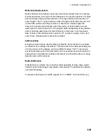
This land outline is used to inhibit further acquisition and tracking of ship-sized
echoes beyond the closest coast outline. Five consecutive scans of coastal
outline are retained in memory to allow for signal variation. All smaller echoes
are declared to be ship sized and the middle of the leading edge is used to
provide precise range and bearing coordinates of each echo on every scan. This
range/bearing data is matched to previous data and analyzed from scan-to-scan
for consistency. When it is determined to be as consistent as a real target,
automatic acquisition occurs and tracking is initiated. Continued tracking and
subsequent calculation develop the relative course and speed of the target.
The true course and speed of own ship are computed from own ship's gyro and
speed inputs, and the resulting course and speed of each tracked target is easily
computed by vector summing of the relative motion with own ship’s course and
speed. The resulting true or relative vector is displayed for each of the tracked
targets. This process is updated continually for each target on every scan of the
radar.
Qualitative description of tracking error
The FURUNO TT's accuracy complies with or exceed IMO standards.
Own ship maneuvers
For slow turns there is no effect. For very high turning rates (greater than
150°/minute, depending on gyro), there is some influence on all tracked targets
that lasts for a minute or two then all tracked targets revert to full accuracy.
Other ship maneuvers
Target ship courses, lag 15 to 30 seconds at high relative speed, or 3 to 6
seconds at low (near 0) relative speed. It is less accurate during a turn due to lag,
but accuracy recovers quickly.


