7-1
7.
DISPLAYS
There are five display modes: PLOTTER, INTEGRITY, HIGHWAY, COURSE and DA-
TA. This chapter describes the display modes except for PLOTTER.
7.1
Integrity Display
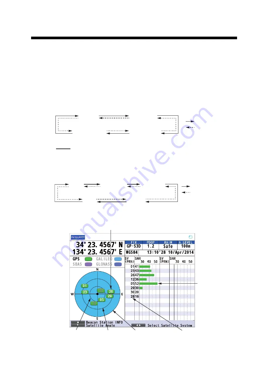
The integrity display provides information about GPS satellite position, beacon station
information and signal quality. There are four integrity displays: GNSS, beacon, graph
for signal noise ratio and graph for satellite angle.
Use the cursorpad (
S
or
T
) to change the displays, in the following sequence.
GNSS
The GNSS display shows the condition of satellite positioning system. Number, azi-
muth and elevation angle of all satellites (if applicable) in view of your receiver appear.
Use the cursorpad (
W
or
X
) to change the satellite positioning system in the following
sequence.
The following illustration is an example integrity display for GPS.
GNSS
Beacon
Graph: signal
noise ratio
Graph:
satellite angle
: Press the ▲ key.
: Press the ▼ key.
GPS
GLONASS*
GALILEO*
SBAS
ALL
: Press the ► key.
: Press the ◄ key.
*: Reserved for future use.
Elevation 60°
Elevation 30°
Elevation 0°
Receiver
signal level
(Bars show
signal level.)
Satellites used for positioning (Satellite numbers used for positioning
are displayed in white, or black if not used for positioning.)
Satellite numbers


