2. INSTALLATION
2-20
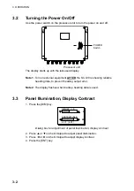
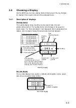
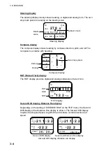
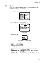
When the system is turned on for the first time it is in the “cold start” state, which
means there is no satellite data (almanac data) stored. In this condition it takes
about 20 minutes to find heading, indicated by displaying “OK.” (Once almanac
data is stored it takes about five minutes to find heading.) The timer at the top
left corner of the screen shows time since power on. If OK is not displayed within
30 minutes after turning on the power, the antenna mounting location may not be
suitable. It is suspected that the number of
satellites in view is less than five due to
signal blockage. Clear the problem and
then check status on the status display.
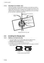
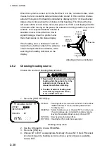
If the heading error is between 5° and 10°,
loosen the nut at the center of the antenna
unit and adjust antenna orientation, while
watching the heading indication on the
display.
Adjusting antenna orientation
2.6.2 Choosing
heading
source
Choose the source of heading data as below:
CAUTION
1. Never switch from internal to external
heading while the autopilot is in the
automatic mode. Change to the
manual mode before switching.
2. The data of external heading must
come from type-approved sensor,
in case of SOLAS vessel.
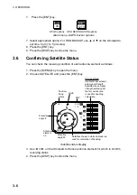
1. Press the [HDG SETUP] key.
HEADING SETUP
OFFSET :
+000.0
(SERVICE ONLY)
HEADING
: INT
INT HDG
- - - . -
°
EXT HDG
- - - . -
°
OFFSET : Heading offset. See service manual for instructions.
"SERVICE ONLY" means heading offset shown
for display only.
HEADING : Select heading source. Choose INT for normal use.
If a gyrocomapss is connected for primary means,
leaving this equipment as backup, choose EXT.
INT HDG : Bow heading. Includes offset.
EXT HDG : Heading fed from external equipment.
Heading setup menu
2. Use the Omnipad to choose HEADING.
3. Press the [ENT] key.
4. Choose INT or EXT as appropriate. Normally choose INT. If the GPS sensor
is not working and a heading sensor such as a gyrocompass is available,
choose EXT.
BOW
PORT
Antenna
Element
1
Antenna
Element
2
Antenna
Element
3
+ Direction
- Direction
Summary of Contents for SC-120
Page 1: ...SATELLITE COMPASS SC 120...
Page 10: ...This page is intentionally left blank...
Page 14: ...This page is intentionally left blank...
Page 58: ...This page is intentionally left blank...
Page 71: ...APPENDIX A 5 NAV OUT1 Port Output drive capability Max 10 mA HDG4 NAV2 port RS 232C level...
Page 82: ......
Page 83: ......
Page 84: ......
Page 87: ...Takahashi T Takahashi T D 1...
Page 88: ...Takahashi T Y Hatai D 2...
Page 89: ...Takahashi T Y Hatai D 3...
Page 90: ...Takahashi T Y Hatai D 4...
Page 91: ...Takahashi T Y Hatai D 5...
Page 92: ...D 6...
Page 93: ......
Page 94: ......
Page 96: ......

