background image

Introduction

 WARNING

See the 

Important Safety and Product Information

 guide in the 

product box for product warnings and other important 

information.

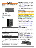
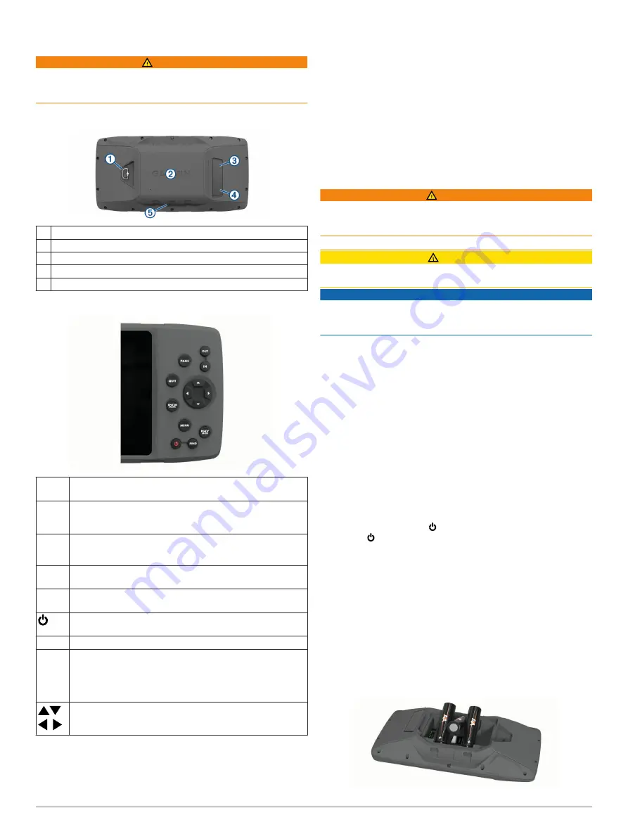
Device Overview

À

Battery cover D-ring

Á

microSD card slot (under battery door)

Â

MCX port for external GPS antenna (under weather cap)

Ã

Mini-USB port (under weather cap)

Ä

Power connector for accessory mounts

Keys

OUT
IN

Select to zoom in or zoom out of the map page.

PAGE

Select to scroll through the main pages in sequence and to 
return to the home page.
Hold to switch between automotive mode and marine mode.

QUIT

Select to scroll through the main pages in reverse sequence, 
revert to the previous value in the data entry field, or cancel a 
function.

ENTER
MARK

Select to acknowledge messages and select options.
Hold to mark a waypoint.

MENU Select to open the menu for the page.

Press twice to open the main menu.
Hold to turn on and turn off the device.
Select to adjust the backlight and external speaker volume.

FIND

Select to find a destination.

NAV
MOB

Select to open the navigation options.
In marine mode, hold to create a Man Overboard (MOB) and 
begin navigation to the MOB location.
In automotive mode, hold to open the next turn page and play 
the voice prompt for the next turn.


Select to scroll, highlight options, and move the cursor.

Main Pages

You can select PAGE to scroll through the main pages, and hold 

PAGE to switch between automotive mode and marine mode. 

The usage mode determines which main pages appear.

Marine mode

: By default, five main pages appear in marine 

mode: map, compass, highway, active route, and position 

data. You can turn on the altimeter page in the display 

settings (

Display Settings

, page 9

).

Automotive mode

: By default, two main pages appear in 

automotive mode: map and trip computer. You can turn on 

the highway, compass, and altimeter pages in the display 

settings (

Display Settings

, page 9

).

Viewing the Main Menu

From a main page, press 

MENU

 twice to open the main 

menu.

Battery Information

 WARNING

The temperature rating for the device may exceed the usable 

range of some batteries. Alkaline batteries can rupture at high 

temperatures.
Do not use a sharp object to remove batteries.

 CAUTION

Contact your local waste disposal department to properly 

recycle the batteries.

NOTICE

Alkaline batteries lose a significant amount of their capacity as 

the temperature decreases. Use lithium batteries when 

operating the device in below freezing conditions.

Maximizing Battery Life

You can do several things to extend the life of the batteries.
• Reduce the backlight brightness (

Adjusting the Backlight 

Brightness and Volume

, page 2

).

• Reduce the backlight timeout (

Display Settings

, page 9

).

• Use battery save mode (

Turning On Battery Save Mode

page 1

).

• Decrease the map drawing speed (

Map Settings

, page 8

).

• Turn off GLONASS (

Enabling GLONASS and WAAS

page 3

).

Turning On Battery Save Mode

You can use battery save mode to prolong the battery life.

Select 

Setup

 > 

Display

 > 

Battery Save

 > 

On

.

In battery save mode, the screen shuts off when the backlight 

times out. You can select   to turn on the screen, and you can 

double tap   to view the status page.

Long-Term Storage

When you do not plan to use the device for several months, 

remove the batteries. Stored data is not lost when batteries are 

removed.

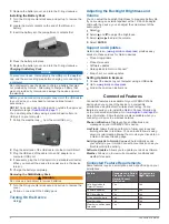
Installing AA Batteries

Instead of the battery pack (

Installing the Battery Pack

page 2

), you can use alkaline, NiMH, or lithium AA batteries. 

This is useful when you are on the trail and cannot charge the 

battery pack. Use NiMH or lithium batteries for best results.

1

Turn the D-ring counter-clockwise, and pull up to remove the 

cover.

2

Insert three AA batteries, observing polarity.

Introduction

1

Summary of Contents for 276Cx

Page 1: ...GPSMAP 276Cx Owner s Manual...

Page 2: ...o ANT GPSMAP and TracBack are trademarks of Garmin Ltd or its subsidiaries registered in the USA and other countries BaseCamp and Garmin Express are trademarks of Garmin Ltd or its subsidiaries These...

Page 3: ...a Destination 6 Stopping Navigation 6 Finding a Location by Name 6 Finding a Location Near Another Location 6 Navigating with the Compass 6 Calibrating the Compass 6 Course Pointer 6 Navigating with t...

Page 4: ...Index 13 ii Table of Contents...

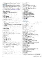
Page 5: ...tomotive mode map and trip computer You can turn on the highway compass and altimeter pages in the display settings Display Settings page 9 Viewing the Main Menu From a main page press MENU twice to o...

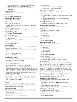
Page 6: ...12 24 Volt adapter cable with the device you can adjust the volume level of the audio output 1 Select 2 Select and to adjust the brightness 3 Select and to adjust the volume 4 Select ENTER Support and...

Page 7: ...r you turn on the device it automatically begins searching for satellites The GPS page appears while the unit is gathering satellite signals and acquiring a fix which should take only a few minutes Ac...

Page 8: ...t Points 2 Select a waypoint 3 Select MENU Average Location 4 Move to the waypoint location 5 Select Start 6 Follow the on screen instructions 7 When the confidence status bar reaches 100 select Save...

Page 9: ...n and receiving a GPS signal You can pause and start track recording manually 1 Begin moving to record a track 2 From the main menu select Track Active 3 Select an option To pause track recording sele...

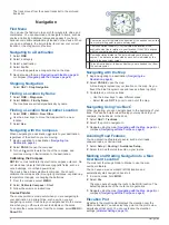
Page 10: ...hazards To enable the course pointer from the compass select MENU Show CDI Course line pointer Indicates the direction of the desired course line from your starting point to your next waypoint Course...

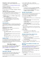
Page 11: ...and moon and hunting and fishing 1 From the main menu select Celestial 2 Select Day View Week View or Month View 3 If necessary select the arrows at the top of the screen to view different dates 4 Se...

Page 12: ...blue triangle which represents your position on the map onto the nearest road This is most useful when driving or navigating on roads Orientation Adjusts how the map is shown on the page The North Up...

Page 13: ...velocity information RTCM Allows the device to accept Differential Global Positioning System DGPS information from a device supplying Radio Technical Commission for Maritime Services RTCM data in an...

Page 14: ...GPS position Changing the Units of Measure You can customize units of measure for distance and speed elevation depth temperature pressure and vertical speed 1 Select Setup Units 2 Select a measuremen...

Page 15: ...ICE To prevent corrosion thoroughly dry the USB port the weather cap and the surrounding area before charging or connecting to a computer 1 Pull up the weather cap from the USB port 2 Plug the small e...

Page 16: ...2 to 113 F Radio frequency protocol 2 4 GHz ANT wireless communications protocol Bluetooth and Wi Fi enabled device Compass safe distance 30 cm 11 8 in The device withstands incidental exposure to wat...

Page 17: ...8 navigating 6 settings 8 updating 2 marine 1 settings 8 memory card 11 microSD card 1 11 See memory card MOB 6 N navigation 6 7 compass 6 course pointer 6 stopping 5 6 notifications 3 P page layout...

Page 18: ...31 55 69 33 99 39 02 36 699699 52 001 855 792 7671 0800 427 652 0800 0233937 47 815 69 555 00800 4412 454 44 2380 662 915 35 1214 447 460 386 4 27 92 500 0861 GARMIN 427 646 27 0 11 251 9800 34 93 275...

Reviews: