Navigating with Sight 'N Go
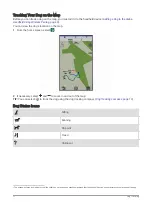
You can point the device at an object in the distance, lock in the direction, and navigate to the object.
1 Select Navigation > Compass >
> Sight 'N Go.
2 Point the device at an object.
3 Select Lock Direction > Set Course.
Elevation Plot
By default, the elevation plot displays the elevation for an elapsed time.
To open the elevation plot, select Track Manager > My Track >
.
Calibrating the Barometric Altimeter
You can calibrate the barometric altimeter manually if you know the correct elevation or the correct barometric
pressure.
1 Go to a location where the elevation or barometric pressure is known.
2 Select Track Manager > My Track >
>
> Altimeter Setup > Calibrate Altimeter.
3 Follow the on-screen instructions.
Navigating to a Point on the Plot
1 Select Track Manager > My Track >
.
2 Select an individual point on the plot.
3 Select
> View Map.
4 Select Go.
Changing the Plot Type
You can change the elevation plot to display pressure and elevation over time or distance.
1 Select Track Manager > My Track >
>
> Altimeter Setup > Plot Type.
2 Select an option.
Resetting the Elevation Plot
Select Track Manager > My Track >
>
> Reset.
Trip Computer
The trip computer displays your current speed, average speed, maximum speed, trip odometer, and other
helpful statistics. You can customize the trip computer layout, dashboard, and data fields (
).
To open the trip computer, select Trip Computer.
Customizing the Trip Computer Data Fields
1 Select Navigation > Trip Computer.
2 Select a data field to customize.
3 Select a category or select All Categories.
4 Select the new data field.
For data field descriptions, see
.
Resetting the Trip Computer
For more accurate trip information, reset the trip computer before beginning a trip.
Select Navigation > Trip Computer >
> Reset Trip.
26
Navigation

