94
Basic Operation
Procedures
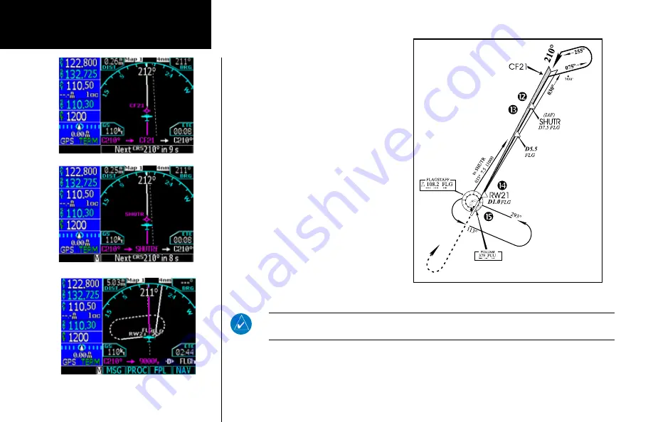
11. Also as you approach SHUTR, a waypoint
message (“NEXT TO TRK 210°”) appears on
the bottom of the screen.
12. As you cross SHUTR, the destination
sequences to the MAP (“RW21”, the runway
threshold). With the needle on the external
CDI (or HSI) centered, fly toward the MAP,
observing the altitude minimums dictated by
the approach plate.
When viewing the Map Page, you’ll note
that the final course segment is displayed
in magenta (the active leg of the flight plan
always appears in magenta).
13. As you approach the MAP, a waypoint
message (“NEXT CRS 210°”) appears on the
bottom of the screen.
14. At the DH/DA, initiate the missed approach,
if necessary. Once the GNS 480 crosses the
MAP (Defined as the runway end waypoint),
the GNS 480 will autoswitch back to GPS
data.
NOTE
: If you have turned autoswitch off, press the
CDI
key to manually switch external CDI
output to the GPS receiver. “GPS” is indicated next to the
CDI
key.
15. The first missed approach leg is a course of 210° to 9000 ft. Track this outbound course.
DO NOT USE FOR
NAVIGATION
Summary of Contents for Apollo CNX80
Page 1: ...DRAFT GNS 480TM color GPS WAAS NAV COM pilot s guide...
Page 16: ...8 Getting Started...
Page 17: ...9 Getting Started...
Page 18: ...10 Getting Started...
Page 24: ...16 Getting Started Nav Terms Diagram Flight Plan Terms Diagram...
Page 160: ...This page intentionally left blank...
Page 161: ......


