


190-00820-08 Rev. A
Cirrus Perspective
™
by Garmin – Pilot’s Guide for the SR20/SR22/SR22T
187
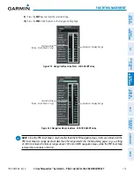
FLIGHT MANAGEMENT
SY
STEM
O
VER
VIEW
FLIGHT
INSTRUMENTS
EIS
AUDIO P
ANEL
& CNS
FLIGHT
MANA
GEMENT
HAZARD
AV
OID
ANCE
AFCS
ADDITIONAL
FEA
TURES
APPENDICES
INDEX
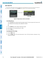
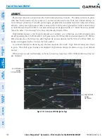
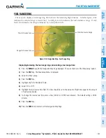
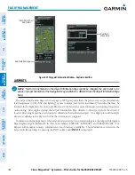
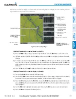
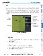
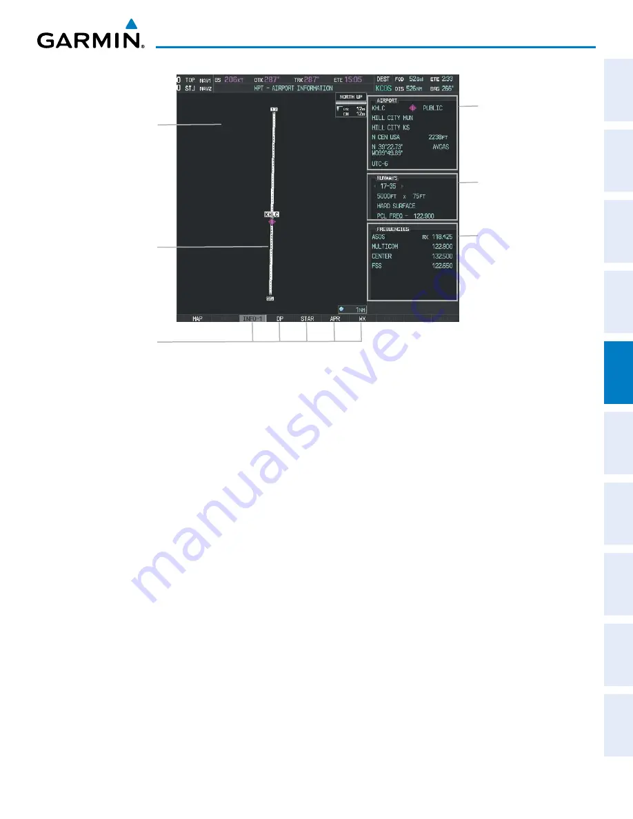
Figure 5-34 Airport Information Page
Airport/Runway
Diagram
Navigation Map
Showing Selected
Airport
Runway Information
- Designation
- Length/Width/Surface
- Lighting Available
Airport Information
- ID/Facility/City
- Usage Type/Region
- Lat/Long/Elev
- Fuel Available
- Time Zone (UTC Offset)
COM/NAV Freq. Info.
- Identification
- Frequency
- Availability
- Additional Information
Softkeys
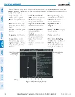
The following descriptions and abbreviations are used on the Airport Information Page:
• Usage type: Public, Military, Private, or Heliport
• Runway surface type: Hard, Turf, Sealed, Gravel, Dirt, Soft, Unknown, or Water
• Runway lighting type: No Lights, Part Time, Full Time, Unknown, or PCL Freq (for pilot-controlled
lighting)
• COM Availability: TX (transmit only), RX (receive only), PT (part time), i (additional information available)
Summary of Contents for Cirrus Perspective SR20
Page 1: ... Cirrus SR20 SR22 SR22T Integrated Avionics System Pilot s Guide ...
Page 2: ......
Page 655: ......