


Cirrus Perspective
™
by Garmin – Pilot’s Guide for the SR20/SR22SR22T
190-00820-08 Rev. A
316
HAZARD AVOIDANCE
SY
STEM
O
VER
VIEW
FLIGHT
INSTRUMENTS
EIS
AUDIO P
ANEL
& CNS
FLIGHT
MANA
GEMENT
HAZARD
AV
OID
ANCE
AFCS
ADDITIONAL FEA
TURES
APPENDICES
INDEX
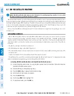
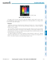
neXrAd l
iMitAtionS
NEXRAD radar images may have certain limitations:
• NEXRAD base reflectivity does not provide sufficient information to determine cloud layers or precipitation
characteristics (wet hail vs. rain). For example, it is not possible to distinguish between wet snow, wet
hail, and rain. Undetermined precipitation types may be displayed as mixed.
• NEXRAD base reflectivity is sampled at the minimum antenna elevation angle. An individual NEXRAD
site cannot depict high altitude storms at close ranges. It has no information about storms directly over
the site.
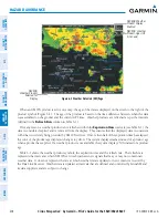
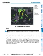
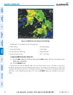
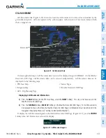
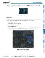
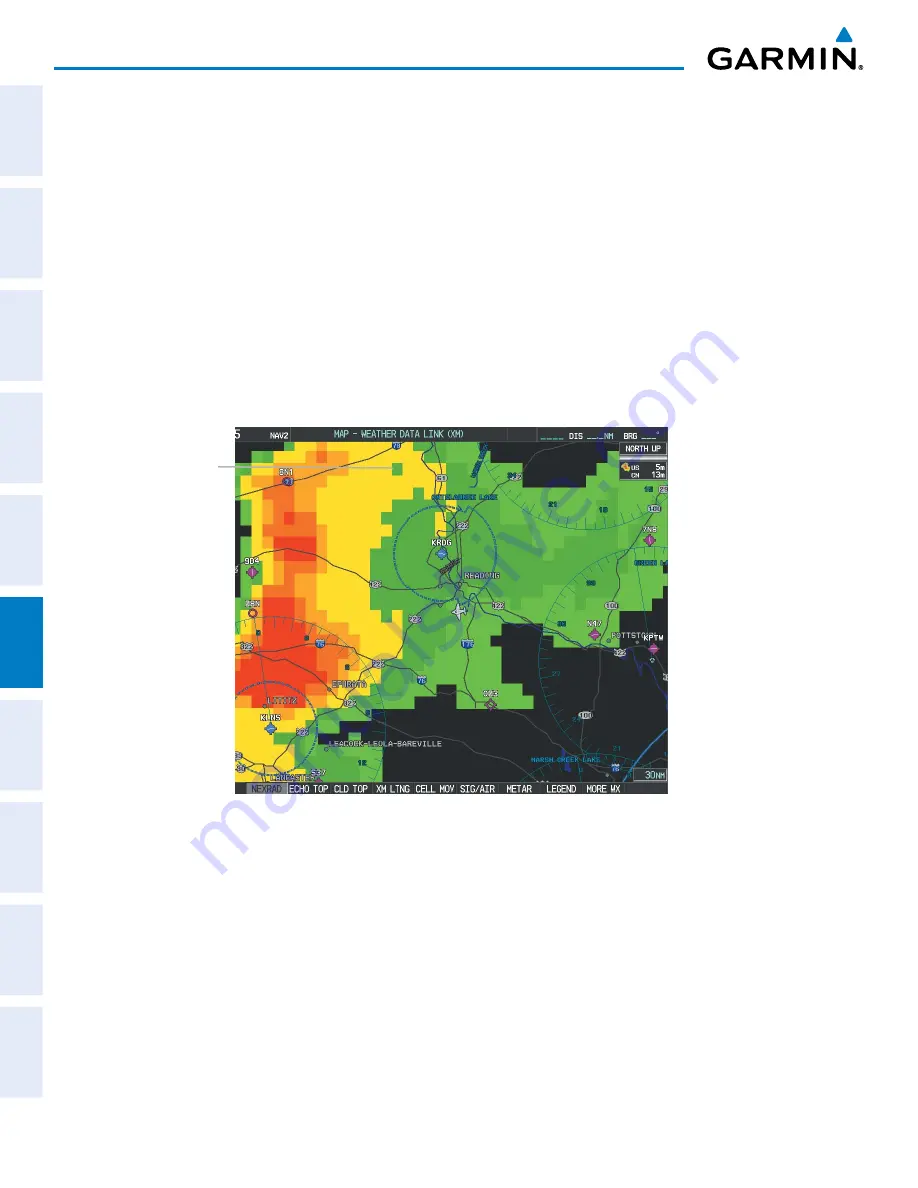
• When zoomed in to a range of 30 nm, each square block on the display represents an area of four square
kilometers. The intensity level reflected by each square represents the
highest
level of NEXRAD data
sampled within the area (Figure 6-12).
• Unknown precipitation below 52ºN is displayed as rain regardless of actual precipitation type.
Figure 6-12 NEXRAD Data - Zoomed
Block Area is 4 km
2
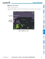
The following may cause abnormalities in displayed NEXRAD radar images:
• Ground clutter
• Strobes and spurious radar data
• Sun strobes (when the radar antenna points directly at the sun)
• Interference from buildings or mountains, which may cause shadows
• Metallic dust from military aircraft, which can cause alterations in radar scans
Summary of Contents for Cirrus Perspective SR20
Page 1: ... Cirrus SR20 SR22 SR22T Integrated Avionics System Pilot s Guide ...
Page 2: ......
Page 655: ......