


Cirrus Perspective
™
by Garmin – Pilot’s Guide for the SR20/SR22SR22T
190-00820-08 Rev. A
350
HAZARD AVOIDANCE
SY
STEM
O
VER
VIEW
FLIGHT
INSTRUMENTS
EIS
AUDIO P
ANEL
& CNS
FLIGHT
MANA
GEMENT
HAZARD
AV
OID
ANCE
AFCS
ADDITIONAL FEA
TURES
APPENDICES
INDEX
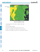
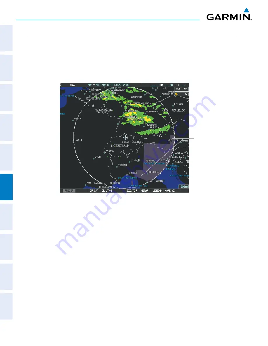
WORLDWIDE WEATHER PRODUCTS
PRECIPITATION
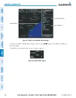
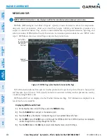
Precipitation (PRECIP) data is not real-time. The lapsed time between collection, processing, and
dissemination of radar images can be significant and may not reflect the current radar synopsis. Due to the
inherent delays and the relative age of the data, it should be used for long-range planning purposes only.
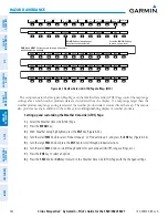
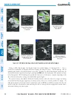
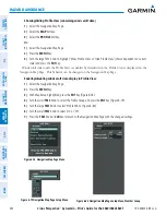
Figure 6-62 Precipitation Data on the Weather Data Link (GFDS) Page
No Radar Coverage
Boundary of
Precipitation data
request
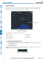
Precipitation data can be displayed on the following maps:
• PFD Inset Map
• Navigation Map Page
• Weather Data Link (GFDS) Page
• Airport Information Page
• Trip Planning Page
• Nearest Pages
• Flight Plan Pages
• AUX - Video Page
Displaying Precipitation weather information:
1)
Select the
MAP
Softkey (for the PFD Inset Map, select the
INSET
Softkey). This step is not necessary on the
Weather Data Link (GFDS) Page.
2)
Press the
PRECIP
Softkey.
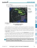
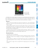
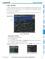
Radar data shown represents lowest level, base reflectivity, of radar returns. The display of the information
is color-coded to indicate the weather severity level. All weather product legends can be viewed on the
Weather Data Link (GFDS) Page. For the Precipitation legend (Figure 6-63), select the
LEGEND
Softkey when
Precipitation is selected for display.
Summary of Contents for Cirrus Perspective SR20
Page 1: ... Cirrus SR20 SR22 SR22T Integrated Avionics System Pilot s Guide ...
Page 2: ......
Page 655: ......