

Cirrus Perspective
™
by Garmin – Pilot’s Guide for the SR20/SR22SR22T
190-00820-08 Rev. A
374
HAZARD AVOIDANCE
SY
STEM
O
VER
VIEW
FLIGHT
INSTRUMENTS
EIS
AUDIO P
ANEL
& CNS
FLIGHT
MANA
GEMENT
HAZARD
AV
OID
ANCE
AFCS
ADDITIONAL FEA
TURES
APPENDICES
INDEX
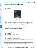
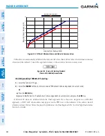
b)
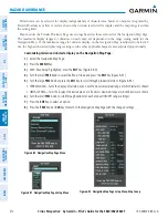
Select ‘View Arc’ or ‘View 360º’ (choice dependent on current state) and press the
ENT
Key to change the view.
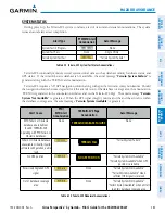
Showing/hiding aviation information on the Terrain Proximity Page:
1)
Press the
MENU
Key.
2)
Select ‘Show Aviation Data’ or ‘Hide Aviation Data’ (choice dependent on current state) and press the
ENT
Key.
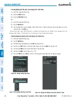
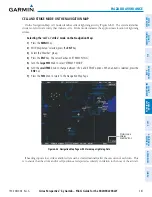
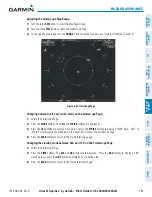
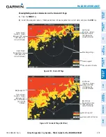
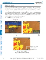
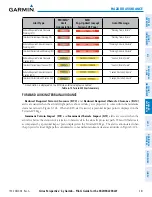
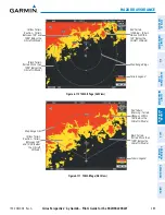
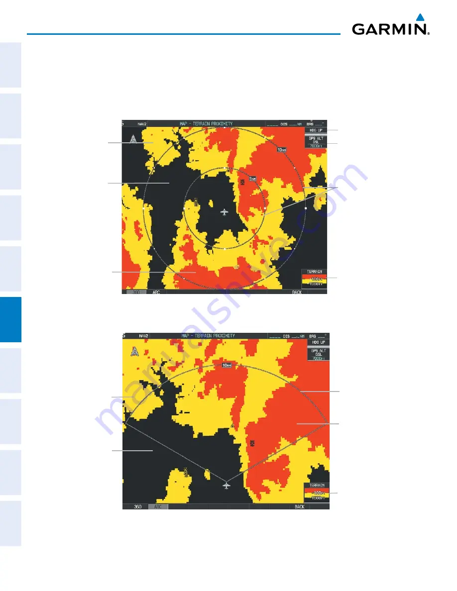
Red Terrain
(Above or Within
100’ Below the
Aircraft Altitude)
Black Terrain
(More than 1000’
Below the Aircraft
Altitude)
Terrain Legend
Map Range Rings
Map Orientation
Current Aircraft GPS-
derived GSL Altitude
Yellow Terrain
(Between 100’ and
1000’ Below the
Aircraft Altitude)
Figure 6-94 Terrain Proximity Page (360 View)
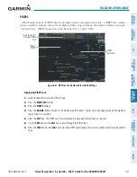
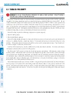
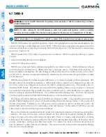
Figure 6-95 Terrain Proximity Page (ARC View)
Yellow Terrain
(Between 100’
and 1000’ Below
the Aircraft
Altitude)
Map Range Arc
Terrain Legend
Black Terrain
(Terrain More than
1000’ Below the
Aircraft Altitude)
Red Terrain
(Above or Within
100’ Below the
Aircraft Altitude)
Summary of Contents for Cirrus Perspective SR20
Page 1: ... Cirrus SR20 SR22 SR22T Integrated Avionics System Pilot s Guide ...
Page 2: ......
Page 655: ......