190-00820-11 Rev. A
Pilot’s Guide for the Cirrus SR2x with Cirrus Perspective by Garmin
409
HAZARD AVOIDANCE
SY
STEM
O
VER
VIEW
FLIGHT
INSTRUMENTS
EIS
AUDIO P
ANEL
& CNS
FLIGHT
MANA
GEMENT
HAZARD
AV
OID
ANCE
AFCS
ADDITIONAL
FEA
TURES
APPENDICES
INDEX
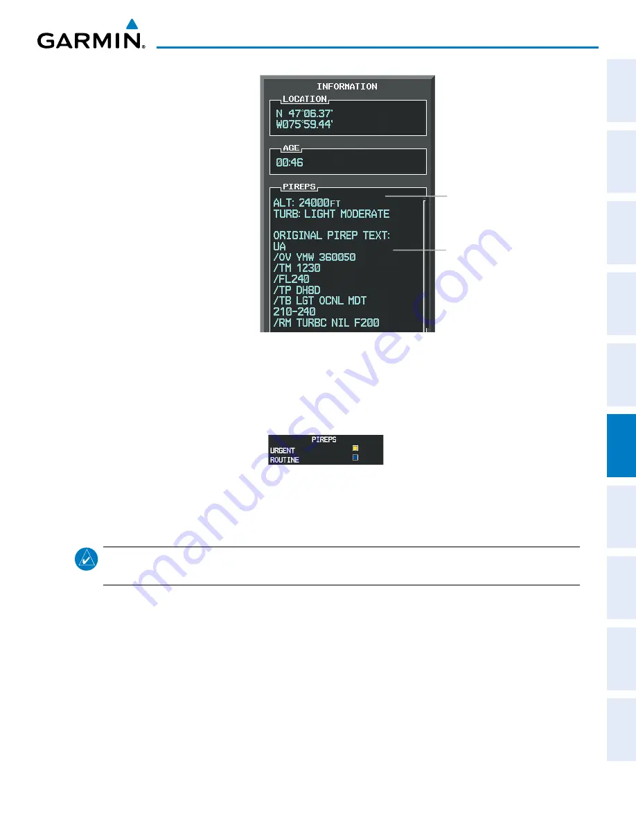
Figure 6-119 PIREP Text on the Weather Data Link (CNXT) Page
Decoded PIREP Text
Original PIREP
Text
To display the PIREP legend (Figure 6-120), press the
LEGEND
Softkey when PIREPs are selected for
display. The PIREP color is determined by the report type (routine or urgent).
Figure 6-120 AIREPs & PIREPs Legend
TFRS
NOTE:
Do not rely solely upon data link services to provide Temporary Flight Restriction (TFR) information.
Always confirm TFR information through official sources such as Flight Service Stations or Air Traffic Control.
In the United States, the Federal Aviation Administration (FAA) issues Temporary Flight Restrictions (TFRs)
to designate areas where flight is restricted. TFRs are issued to restrict flight for a variety of reasons including
national security, law enforcement, natural disasters, airshows, and large sporting events. TFRs may be issued
at any time, and TFR data displayed is only intended to supplement official TFR information obtained from
Flight Service Stations (FSS), and air traffic control.
The age of TFR data is not shown; however, if TFR data is not available or has expired, the system displays
‘TFR N/A’ in the upper-left corner of maps on which TFRs can be displayed.


