background image

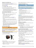
• For Mac computers, drag the volume icon to the trash.

2

Disconnect the cable from your computer.

Deleting Files

NOTICE

If you do not know the purpose of a file, do not delete it. Your 

device memory contains important system files that should not 

be deleted.

1

Open the 

Garmin

 drive or volume.

2

If necessary, open a folder or volume.

3

Select a file.

4

Press the 

Delete

 key on your keyboard.

Troubleshooting

Locking the Keys

You can lock the keys to prevent inadvertent key presses.

1

Select the data page you want to view while the keys are 

locked.

2

Hold 

 and   to lock the keys.

3

Hold 

 and   to unlock the keys.

Resetting Your Device

If the device stops responding, you may need to reset it.

1

Hold   for at least 25 seconds.

2

Hold   for one second to turn on the device.

Resetting the Device to Factory Settings

You can restore all of the device settings to the factory default 

values.

1

Select the action key.

2

Select 

Setup

 > 

Reset

 > 

All Settings

 > 

Yes

.

Clearing All Sensor Plot Data

1

Select the action key.

2

Select 

Setup

 > 

Reset

 > 

Clear Plots

 > 

Yes

.

Getting More Information

You can find more information about this product on the Garmin 

website.
• Go to 

www.garmin.com/outdoor

.

• Go to 

www.garmin.com/learningcenter

.

• Go to 

http://buy.garmin.com

, or contact your Garmin dealer 

for information about optional accessories and replacement 

parts.

Appendix

Data Fields

Some data fields require you to be navigating or require ANT+ 

accessories to display data.

ACCURACY (GPS)

: The margin of error for your exact location. 

For example, your GPS location is accurate to /- 

12 feet (3.65 m).

AMB PRESS (ambient pressure)

: The uncalibrated 

environmental pressure.

ASCENT (ascent total)

: The total elevation distance ascended 

since the last reset.

AVG ASCENT (average ascent)

: The average vertical distance 

of ascent since the last reset.

AVG CAD (average cadence)

: The average cadence for the 

current activity.

AVG DESCNT (average descent)

: The average vertical 

distance of descent since the last reset.

AVG HR (average heart rate)

: The average heart rate for the 

current activity.

AVG HR % (average heart rate percentage)

: The average 

percentage of maximum heart rate for the current activity.

AVG LAP (average lap)

: The average lap time for the current 

activity.

AVG PACE (average pace)

: The average pace for the current 

activity.

AVG SPEED (average speed overall)

: The average speed 

while moving and stopped since the last reset.

BAROMETER

: The calibrated current pressure.

BATTERY

: The remaining battery power.

BEARING

: The direction from your current location to a 

destination. You must be navigating for this data to appear.

CADENCE

: The revolutions of the crank arm or strides per 

minute. Your device must be connected to a cadence 

accessory.

CALORIES

: The amount of total calories burned.

CMP HDNG (compass heading)

: The direction you are moving 

based on the compass.

COMPASS

: A visual representation of the direction in which the 

device is pointing.

COURSE

: The direction from your starting location to a 

destination. Course can be viewed as a planned or set route. 

You must be navigating for this data to appear.

DATE

: The current day, month, and year.

DESCENT (descent total)

: The total elevation distance 

descended since the last reset.

DISTANCE (trip odometer)

: A running tally of the distance 

traveled since the last reset.

ELEVATION

: The altitude of your current location above or 

below sea level.

FINAL DEST (final destination)

: The last point on the route to 

the destination. You must be navigating for this data to 

appear.

FINAL DIST (distance to final destination)

: The remaining 

distance to the final destination. You must be navigating for 

this data to appear.

FINAL ETA (final estimated time of arrival)

: The estimated 

time of day you will reach the final destination (adjusted to 

the local time of the destination). You must be navigating for 

this data to appear.

FINAL ETE (final estimated time en route)

: The estimated 

time remaining before you reach the destination. You must 

be navigating for this data to appear.

FINAL LOC (final location)

: The last point on the route or 

course.

FINAL VDST (final vertical distance to destination)

: The 

elevation distance between your current position and the 

final destination. You must be navigating for this data to 

appear.

FINAL VSPD (final vertical speed to destination)

: The rate of 

ascent or descent to a predetermined altitude. You must be 

navigating for this data to appear.

GLIDE RATIO

: The ratio of horizontal distance traveled to the 

change in vertical distance.

GPS (signal strength)

: The strength of the GPS satellite signal.

GPS ELEVTN (GPS elevation)

: The altitude of your current 

location using GPS.

GPS HDNG (GPS heading)

: The direction you are moving 

based on GPS.

Appendix

15

Summary of Contents for D2 Pilot

Page 1: ...D2 Pilot Owner s Manual September 2013 190 01674 00_0A Printed in Taiwan ...

Page 2: ...Ltd or its subsidiaries registered in the USA and other countries ANT BaseCamp chirp D2 Garmin Connect GSC HomePort and tempe are trademarks of Garmin Ltd or its subsidiaries These trademarks may not be used without the express permission of Garmin The Bluetooth word mark and logos are owned by the Bluetooth SIG Inc and any use of such marks by Garmin is under license Mac is a registered trademark...

Page 3: ... 7 chirp 7 Finding a Geocache with a chirp Device 7 Applications 7 Jumpmaster 7 Planning a Jump 7 Jump Types 7 Entering Jump Information 7 Entering Wind Information for HAHO and HALO Jumps 8 Entering Wind Information for a Static Jump 8 Constant Settings 8 Clock 8 Setting the Alarm 8 Starting the Countdown Timer 8 Using the Stopwatch 8 Adding a Custom Time Zone 8 Editing a Custom Time Zone 8 Alert...

Page 4: ...Management 14 File Types 14 Disconnecting the USB Cable 14 Deleting Files 15 Troubleshooting 15 Locking the Keys 15 Resetting Your Device 15 Resetting the Device to Factory Settings 15 Clearing All Sensor Plot Data 15 Getting More Information 15 Appendix 15 Data Fields 15 Data Pages 17 Registering Your Device 17 Software License Agreement 17 Heart Rate Zone Calculations 17 Altimeter and Barometric...

Page 5: ... turn the backlight on and off Hold to turn the device on and off Á D2 Select to scroll through the data pages options and settings Hold to navigate to an airport by airport code page 5 Â NRST Select to scroll through the data pages options and settings Hold to navigate to the nearest airport page 5 Ã Select to return to the previous screen Hold to view the status page Ä Action key Select to open ...

Page 6: ...he airport Ä The instruments page displays your ground speed À altitude Á track over ground  and the vertical speed in feet per minute à The next waypoint page displays the waypoint name À bearing to the waypoint Á distance to the waypoint  track over ground à and the estimated time to the next waypoint Ä navigation mode only Setting the Altitude Alert You can set an alarm to vibrate when you re...

Page 7: ...reate New and select the new profile The profile you selected is now the active profile The previous profile was saved 4 If necessary select Edit and edit the name of the profile 5 Customize your settings page 9 and data fields for the active profile Any changes you make are saved to the active profile Deleting a Profile 1 Select the action key 2 Select Setup Profiles 3 Select a profile 4 Select D...

Page 8: ...our mobile device start the Garmin Pilot app The Garmin Pilot app detects your device and connects to it automatically Editing the Name of a Route 1 Select the action key 2 Select Routes 3 Select a route 4 Select Rename 5 Select the action key and to enter characters 6 Select _ Done Editing a Route 1 Select the action key 2 Select Routes 3 Select a route 4 Select Edit 5 Select a point 6 Select an ...

Page 9: ...the map the compass or the horizontal situation indicator to navigate to your destination To use some navigation options you may have to change to another profile page 3 or add options to the main menu page 9 Navigating to a Destination Before you can navigate to a destination you must enable GPS and acquire satellite signals page 3 1 Select the action key 2 Select an option NOTE Not all options a...

Page 10: ...e action key 3 Select an option To pan up or down select Pan and select or To pan right or left select Pan and select or To navigate to a saved location select Pan select the action key and select Select Pt To zoom in or out select Zoom and select or Navigating Using TracBack While navigating you can navigate back to the beginning of your track This can be helpful when finding your way back to cam...

Page 11: ...ed for experienced skydivers particularly those in the military The jumpmaster feature follows military guidelines for calculating the high altitude release point HARP The device detects automatically when you have jumped to begin navigating toward the desired impact point DIP using the barometer and electronic compass Planning a Jump WARNING Jumpmaster is for use by experienced skydivers only Jum...

Page 12: ...ing a static jump based on the parachute canopy rating Static only Each parachute should be labeled with a K value Clock Setting the Alarm 1 Select the action key 2 Select Clock Alarm Clock Add Alarm 3 Select the action key and to set the time 4 Select Tone Vibration or Tone Vib 5 Select Once Daily or Weekdays Starting the Countdown Timer 1 Select the action key 2 Select Clock Timer 3 Select the a...

Page 13: ...yourself with the settings for each feature If you customize your settings before your activity you will spend less time adjusting the watch during your activity To open the Setup menu select the action key and select Setup NOTE All changes you make are saved to the active profile page 3 Setup Item Available Settings and Information System You can customize GPS settings arrow keys and the device l...

Page 14: ... Setting the North Reference You can set the directional reference used in calculating heading information 1 Select the action key 2 Select Setup Sensors Compass North Ref 3 Select an option To set geographic north as the heading reference select True To set the magnetic declination for your location automatically select Magnetic To set grid north 000º as the heading reference select Grid To set t...

Page 15: ...tivity data to Garmin Connect Foot Pod Speed Sets the speed to Off Indoor and Always On page 13 Setting Your Fitness User Profile The device uses information that you enter about yourself to calculate accurate data You can modify the following user profile information gender age weight height and lifetime athlete page 11 1 Select the action key 2 Select Setup Fitness User 3 Modify the settings Abo...

Page 16: ...p or loop where it is exposed to ambient air and therefore provides a consistent source of accurate temperature data You must pair the tempe with your device to display temperature data from the tempe Putting On the Heart Rate Monitor NOTE If you do not have a heart rate monitor you can skip this task You should wear the heart rate monitor directly on your skin just below your breastplate It shoul...

Page 17: ... you may need to pair it with the device again Caring for the Heart Rate Monitor NOTICE You must unsnap and remove the module before cleaning the strap A build up of sweat and salt on the strap can decrease the ability of the heart rate monitor to report accurate data Go to www garmin com HRMcare for detailed washing instructions Rinse the strap after every use Machine wash the strap after every s...

Page 18: ...lvents and insect repellents that can damage plastic components and finishes Thoroughly rinse the device with fresh water after exposure to chlorine salt water sunscreen cosmetics alcohol or other harsh chemicals Prolonged exposure to these substances can damage the case Avoid pressing the keys under water Avoid extreme shock and harsh treatment because it can degrade the life of the product Do no...

Page 19: ...age pace The average pace for the current activity AVG SPEED average speed overall The average speed while moving and stopped since the last reset BAROMETER The calibrated current pressure BATTERY The remaining battery power BEARING The direction from your current location to a destination You must be navigating for this data to appear CADENCE The revolutions of the crank arm or strides per minute...

Page 20: ...reset MAX TEMP maximum temperature The maximum temperature recorded in the last 24 hours MIN ELEVTN minimum elevation The lowest elevation reached since the last reset MIN TEMP minimum temperature The minimum temperature recorded in the last 24 hours MOV N AVG moving average The average speed while moving since the last reset MOV N TIME moving time A running tally of the time spent moving since th...

Page 21: ... derivative works based on the Software You agree not to export or re export the Software to any country in violation of the export control laws of the United States of America or the export control laws of any other applicable country Heart Rate Zone Calculations Zone of Maximum Heart Rate Perceived Exertion Benefits 1 50 60 Relaxed easy pace rhythmic breathing Beginning level aerobic training re...

Page 22: ... language 10 lifetime athlete 11 locations 5 9 editing 3 saving 3 locking keys 15 M main menu customizing 9 man overboard MOB 6 maps 5 browsing 6 navigating 6 orientation 10 settings 10 viewing 12 zoom 6 menu 1 moon phase 9 N navigation 5 compass 5 horizontal situation indicator HSI 6 Sight N Go 5 stopping 5 nearest airport 5 north reference 10 P pairing ANT sensors 12 position format 11 product r...

Page 23: ......

Page 24: ...5 00800 4412 454 44 2380 662 915 35 1214 447 460 386 4 27 92 500 0861 GARMIN 427 646 27 0 11 251 9999 34 93 275 44 97 49 0 180 6 427646 20 ct Anruf a d deutschen Festnetz Mobilfunk max 60 ct Anruf 46 7744 52020 Garmin International Inc 1200 East 151st Street Olathe Kansas 66062 USA Garmin Europe Ltd Liberty House Hounsdown Business Park Southampton Hampshire SO40 9LR UK Garmin Corporation No 68 Zh...

Reviews: