Garmin G1000 Pilot’s Guide for the Diamond DA42NG
190-00-00962-02 Rev. A
338
HAZARD AVOIDANCE
SY
STEM
O
VER
VIEW
FLIGHT
INSTRUMENTS
EIS
AUDIO P
ANEL
& CNS
FLIGHT
MANA
GEMENT
HAZARD
AV
OID
ANCE
AFCS
ADDITIONAL FEA
TURES
APPENDICES
INDEX
national security, law enforcement, firefighting, natural disasters., airshows, and large sporting events. TFRs
may be issued at any time, and TFR data displayed on the G1000 is only intended to supplement official TFR
information obtained from Flight Service Stations (FSS), and air traffic control.
The age of TFR data is not shown; however, if TFR data is not available or has expired, the system displays
‘TFR N/A’ in the upper-left corner of maps on which TFRs can be displayed.
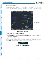
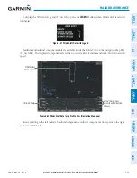
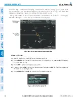
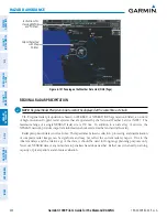
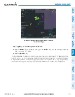
Figure 6-89 TFR Data on the Weather Data Link (XM) Page
TFR Selected
with Map
Pointer
TFR Summary
Information
Displaying TFR Data:
1)
Select the Weather Data Link (GFDS) Page or Navigation Map Page.
2)
Press the
RANGE
Knob and pan the map pointer over a TFR to highlight it. The system displays TFR summary
information above the map.
3)
Press the
ENT
Key. The system displays a pop-up menu.
4)
If necessary, turn the
FMS
Knob to select ‘Review Airspaces’ and press the
ENT
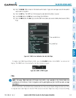
Key. The system displays the
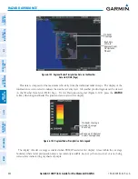
TFR Information window (Figure 6-90).
5)
Press the
FMS
Knob or the
CLR
Key to remove the TFR Information window.
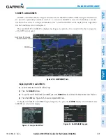
Figure 6-90 Full Text for Selected TFR

